
Easier access to scientific data

Brought to you by NOAA CoastWatch Great Lakes Node
|
ERDDAP
Easier access to scientific data |
|
Brought to you by NOAA CoastWatch Great Lakes Node |
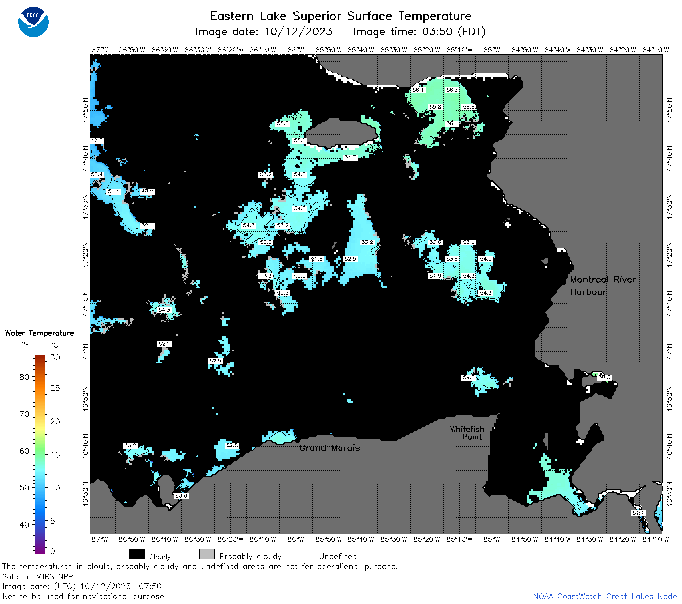
| Dataset Title: | Lake Superior Eastern Region Surface Temperature Contour Map (2022-present)


|
| Institution: | CoastWatch Great Lakes Node (Dataset ID: LS_NRT_TC_s3) |
| Information: | Summary
| License
| Metadata
| Background | Subset
| Data Access Form
| Make a graph
| Subset
| Data Access Form
| Make a graph
|
![[ICO]](https://apps.glerl.noaa.gov/erddap/images/fileIcons/blank.gif) | Name | Last modified | Size | Description |
|---|---|---|---|---|
![[DIR]](https://apps.glerl.noaa.gov/erddap/images/fileIcons/back.gif) | Parent Directory | - | - | |
![[IMG]](https://apps.glerl.noaa.gov/erddap/images/fileIcons/image2.gif)  | s3_2023_10_12_0150.png | 12-Oct-2023 05:27 | 41012 | |
 | s3_2023_10_12_0240.png | 12-Oct-2023 05:29 | 45868 | |
 | s3_2023_10_12_0330.png | 12-Oct-2023 06:25 | 40564 | |
 | s3_2023_10_12_0700.png | 12-Oct-2023 10:27 | 52877 | |
 | s3_2023_10_12_0750.png | 12-Oct-2023 11:25 | 61819 | |
 | s3_2023_10_12_0840.png | 12-Oct-2023 11:27 | 68654 | |
 | s3_2023_10_12_0930.png | 04-Nov-2023 04:51 | 29427 | |
 | s3_2023_10_12_1450.png | 04-Nov-2023 04:53 | 32272 | |
 | s3_2023_10_12_1500.png | 04-Nov-2023 04:56 | 70792 | |
 | s3_2023_10_12_1540.png | 12-Oct-2023 19:25 | 76804 | |
 | s3_2023_10_12_1640.png | 04-Nov-2023 04:58 | 88184 | |
 | s3_2023_10_12_1720.png | 04-Nov-2023 05:00 | 29408 | |
 | s3_2023_10_12_1730.png | 04-Nov-2023 05:02 | 85416 | |
 | s3_2023_10_12_1820.png | 04-Nov-2023 05:05 | 84034 | |
 | s3_2023_10_12_1830.png | 04-Nov-2023 05:07 | 29438 | |
 | s3_2023_10_12_1910.png | 04-Nov-2023 05:09 | 84326 | |
 | s3_2023_285.png | 13-Oct-2023 09:10 | 89411 | |