
Easier access to scientific data

Brought to you by NOAA CoastWatch Great Lakes Node
|
ERDDAP
Easier access to scientific data |
|
Brought to you by NOAA CoastWatch Great Lakes Node |
| Dataset Title: | Lake Superior Eastern Region Surface Temperature Contour Map (2022-present)


|
| Institution: | CoastWatch Great Lakes Node (Dataset ID: LS_NRT_TC_s3) |
| Information: | Summary
| License
| Metadata
| Background | Subset
| Data Access Form
| Make a graph
| Subset
| Data Access Form
| Make a graph
|
![[ICO]](https://apps.glerl.noaa.gov/erddap/images/fileIcons/blank.gif) | Name | Last modified | Size | Description |
|---|---|---|---|---|
![[DIR]](https://apps.glerl.noaa.gov/erddap/images/fileIcons/back.gif) | Parent Directory | - | - | |
![[IMG]](https://apps.glerl.noaa.gov/erddap/images/fileIcons/image2.gif) 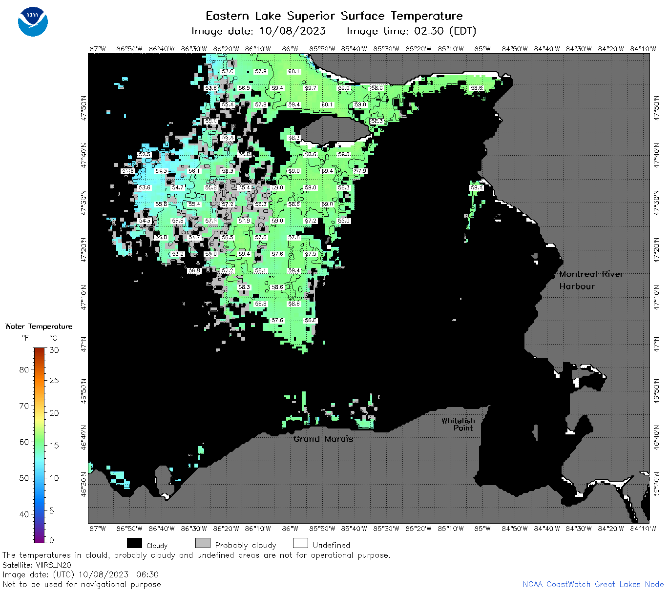 | s3_2023_10_08_0630.png | 08-Oct-2023 09:25 | 70259 | |
 | s3_2023_10_08_0720.png | 08-Oct-2023 11:25 | 58968 | |
 | s3_2023_10_08_0810.png | 08-Oct-2023 11:30 | 47172 | |
 | s3_2023_10_08_0900.png | 08-Oct-2023 12:25 | 41501 | |
 | s3_2023_10_08_1620.png | 08-Oct-2023 20:25 | 35325 | |
 | s3_2023_10_08_1710.png | 08-Oct-2023 21:25 | 38403 | |
 | s3_2023_281.png | 09-Oct-2023 09:10 | 68709 | |