
Easier access to scientific data

Brought to you by NOAA CoastWatch Great Lakes Node
|
ERDDAP
Easier access to scientific data |
|
Brought to you by NOAA CoastWatch Great Lakes Node |
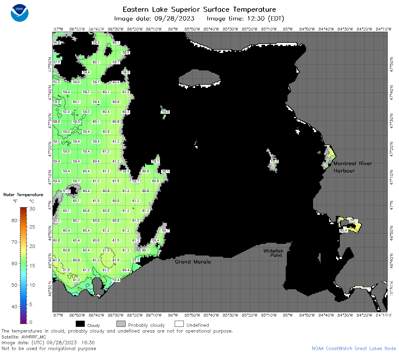
| Dataset Title: | Lake Superior Eastern Region Surface Temperature Contour Map (2022-present)


|
| Institution: | CoastWatch Great Lakes Node (Dataset ID: LS_NRT_TC_s3) |
| Information: | Summary
| License
| Metadata
| Background | Subset
| Data Access Form
| Make a graph
| Subset
| Data Access Form
| Make a graph
|
![[ICO]](https://apps.glerl.noaa.gov/erddap/images/fileIcons/blank.gif) | Name | Last modified | Size | Description |
|---|---|---|---|---|
![[DIR]](https://apps.glerl.noaa.gov/erddap/images/fileIcons/back.gif) | Parent Directory | - | - | |
![[IMG]](https://apps.glerl.noaa.gov/erddap/images/fileIcons/image2.gif)  | s3_2023_09_28_0140.png | 28-Sep-2023 05:25 | 61345 | |
 | s3_2023_09_28_0230.png | 28-Sep-2023 05:28 | 80505 | |
 | s3_2023_09_28_0320.png | 28-Sep-2023 06:25 | 65435 | |
 | s3_2023_09_28_0710.png | 28-Sep-2023 21:27 | 53851 | |
 | s3_2023_09_28_0800.png | 28-Sep-2023 21:30 | 45920 | |
 | s3_2023_09_28_0850.png | 28-Sep-2023 22:25 | 43057 | |
 | s3_2023_09_28_1450.png | 28-Sep-2023 21:35 | 35024 | |
 | s3_2023_09_28_1530.png | 28-Sep-2023 21:38 | 55208 | |
 | s3_2023_09_28_1630.png | 28-Sep-2023 21:43 | 60308 | |
 | s3_2023_09_28_1750.png | 28-Sep-2023 22:30 | 81437 | |
 | s3_2023_09_28_1840.png | 28-Sep-2023 22:32 | 84140 | |
 | s3_2023_09_28_1930.png | 28-Sep-2023 22:34 | 94416 | |
 | s3_2023_271.png | 29-Sep-2023 09:10 | 65501 | |