
Easier access to scientific data

Brought to you by NOAA CoastWatch Great Lakes Node
|
ERDDAP
Easier access to scientific data |
|
Brought to you by NOAA CoastWatch Great Lakes Node |
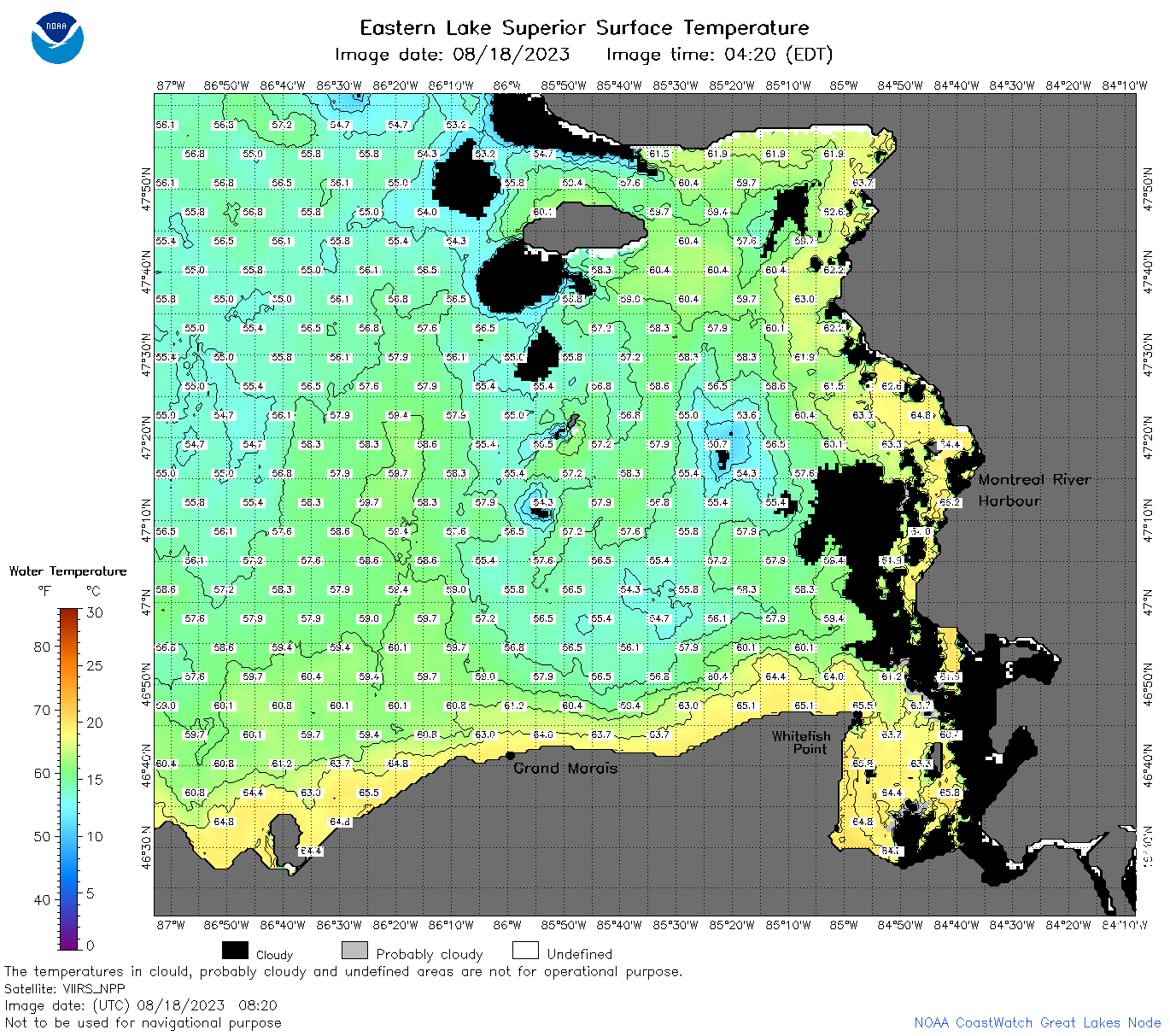
| Dataset Title: | Lake Superior Eastern Region Surface Temperature Contour Map (2022-present)


|
| Institution: | CoastWatch Great Lakes Node (Dataset ID: LS_NRT_TC_s3) |
| Information: | Summary
| License
| Metadata
| Background | Subset
| Data Access Form
| Make a graph
| Subset
| Data Access Form
| Make a graph
|
![[ICO]](https://apps.glerl.noaa.gov/erddap/images/fileIcons/blank.gif) | Name | Last modified | Size | Description |
|---|---|---|---|---|
![[DIR]](https://apps.glerl.noaa.gov/erddap/images/fileIcons/back.gif) | Parent Directory | - | - | |
![[IMG]](https://apps.glerl.noaa.gov/erddap/images/fileIcons/image2.gif)  | s3_2023_08_18_0320.png | 18-Aug-2023 06:26 | 41164 | |
 | s3_2023_08_18_0640.png | 18-Aug-2023 10:25 | 84936 | |
 | s3_2023_08_18_0730.png | 18-Aug-2023 10:28 | 102571 | |
 | s3_2023_08_18_0820.png | 18-Aug-2023 12:25 | 130337 | |
 | s3_2023_08_18_0910.png | 18-Aug-2023 12:28 | 68004 | |
 | s3_2023_08_18_1440.png | 18-Aug-2023 19:25 | 90895 | |
 | s3_2023_08_18_1530.png | 18-Aug-2023 19:28 | 111069 | |
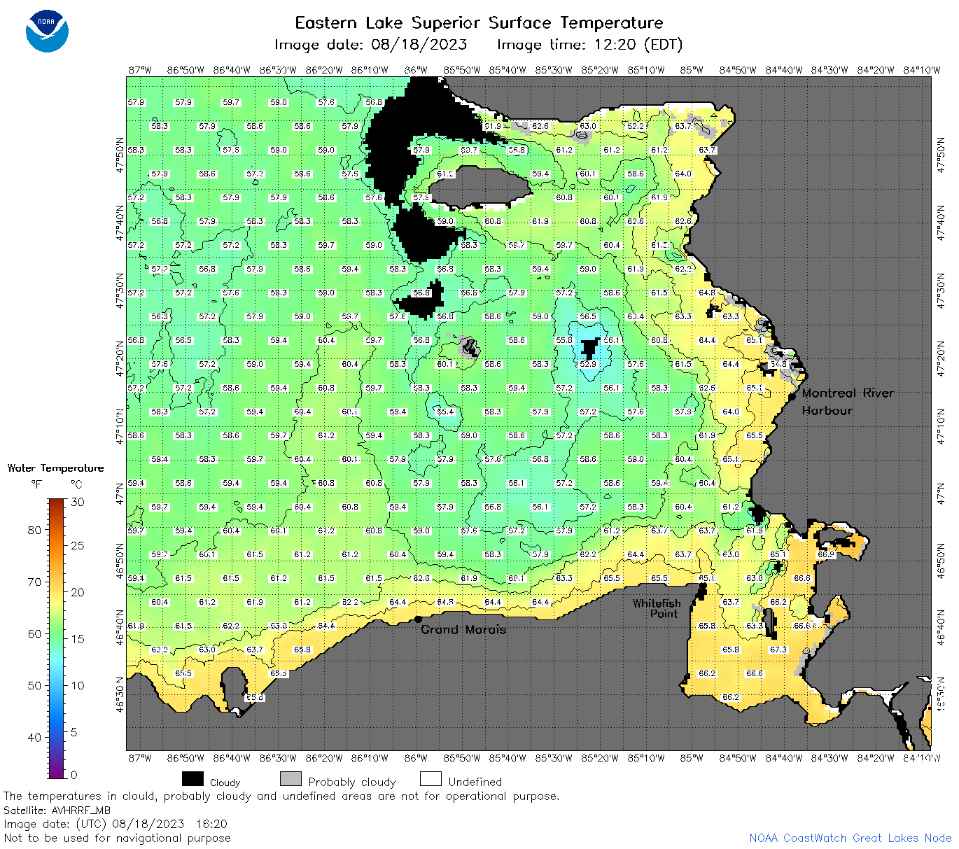 | s3_2023_08_18_1620.png | 18-Aug-2023 19:32 | 115642 | |
 | s3_2023_08_18_1720.png | 18-Aug-2023 19:35 | 123498 | |
 | s3_2023_08_18_1810.png | 18-Aug-2023 22:25 | 120819 | |
 | s3_2023_08_18_1900.png | 18-Aug-2023 21:29 | 118455 | |
 | s3_2023_230.png | 19-Aug-2023 09:10 | 79014 | |