
Easier access to scientific data

Brought to you by NOAA CoastWatch Great Lakes Node
|
ERDDAP
Easier access to scientific data |
|
Brought to you by NOAA CoastWatch Great Lakes Node |
| Dataset Title: | Lake Superior Eastern Region Surface Temperature Contour Map (2022-present)


|
| Institution: | CoastWatch Great Lakes Node (Dataset ID: LS_NRT_TC_s3) |
| Information: | Summary
| License
| Metadata
| Background | Subset
| Data Access Form
| Make a graph
| Subset
| Data Access Form
| Make a graph
|
![[ICO]](https://apps.glerl.noaa.gov/erddap/images/fileIcons/blank.gif) | Name | Last modified | Size | Description |
|---|---|---|---|---|
![[DIR]](https://apps.glerl.noaa.gov/erddap/images/fileIcons/back.gif) | Parent Directory | - | - | |
![[IMG]](https://apps.glerl.noaa.gov/erddap/images/fileIcons/image2.gif)  | s3_2023_08_17_0200.png | 17-Aug-2023 05:27 | 58694 | |
 | s3_2023_08_17_0250.png | 17-Aug-2023 05:30 | 67773 | |
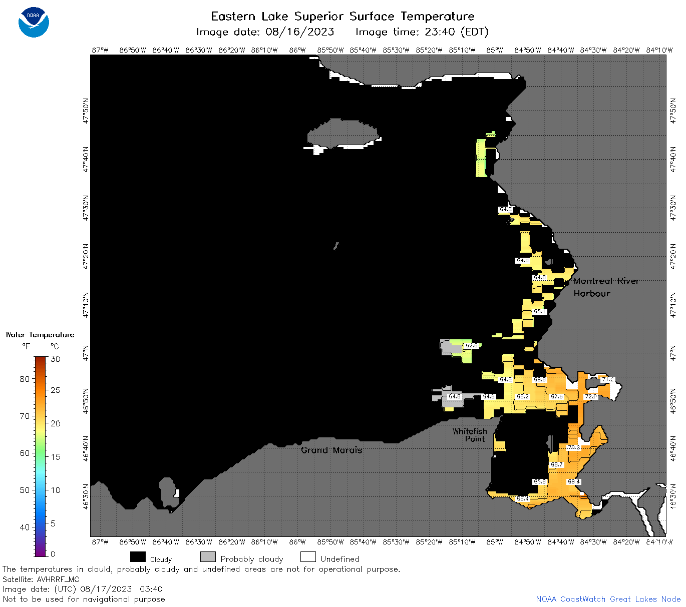 | s3_2023_08_17_0340.png | 17-Aug-2023 06:25 | 38437 | |
 | s3_2023_08_17_1500.png | 17-Aug-2023 18:29 | 44587 | |
 | s3_2023_08_17_1600.png | 17-Aug-2023 19:27 | 78023 | |
 | s3_2023_08_17_1640.png | 17-Aug-2023 20:25 | 75075 | |
 | s3_2023_08_17_1730.png | 17-Aug-2023 20:28 | 58768 | |
 | s3_2023_08_17_1830.png | 17-Aug-2023 22:26 | 47094 | |
 | s3_2023_08_17_1920.png | 17-Aug-2023 23:25 | 52555 | |
 | s3_2023_229.png | 18-Aug-2023 09:10 | 70186 | |