
Easier access to scientific data

Brought to you by NOAA CoastWatch Great Lakes Node
|
ERDDAP
Easier access to scientific data |
|
Brought to you by NOAA CoastWatch Great Lakes Node |
| Dataset Title: | Lake Superior Eastern Region Surface Temperature Contour Map (2022-present)


|
| Institution: | CoastWatch Great Lakes Node (Dataset ID: LS_NRT_TC_s3) |
| Information: | Summary
| License
| Metadata
| Background | Subset
| Data Access Form
| Make a graph
| Subset
| Data Access Form
| Make a graph
|
![[ICO]](https://apps.glerl.noaa.gov/erddap/images/fileIcons/blank.gif) | Name | Last modified | Size | Description |
|---|---|---|---|---|
![[DIR]](https://apps.glerl.noaa.gov/erddap/images/fileIcons/back.gif) | Parent Directory | - | - | |
![[IMG]](https://apps.glerl.noaa.gov/erddap/images/fileIcons/image2.gif)  | s3_2023_08_10_0110.png | 10-Aug-2023 05:27 | 44706 | |
 | s3_2023_08_10_0150.png | 10-Aug-2023 05:29 | 120198 | |
 | s3_2023_08_10_0250.png | 10-Aug-2023 05:33 | 107962 | |
 | s3_2023_08_10_0330.png | 10-Aug-2023 06:25 | 81851 | |
 | s3_2023_08_10_0730.png | 10-Aug-2023 13:25 | 56454 | |
 | s3_2023_08_10_0820.png | 10-Aug-2023 13:28 | 44463 | |
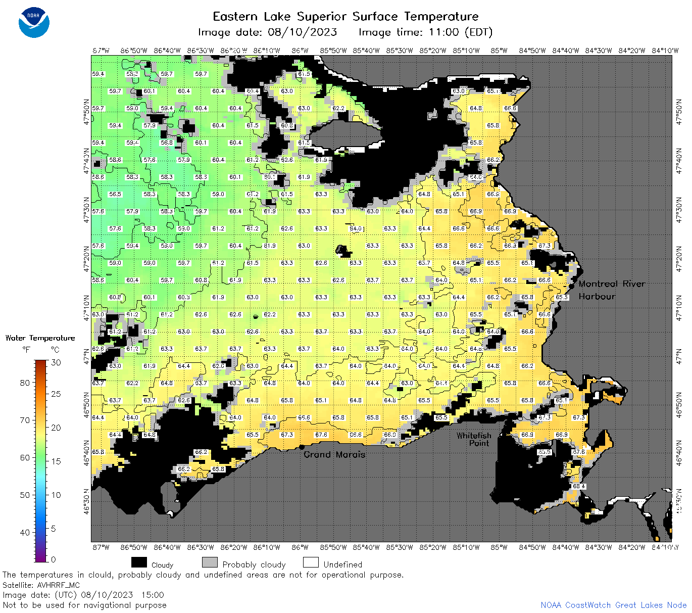 | s3_2023_08_10_1500.png | 10-Aug-2023 19:25 | 94506 | |
 | s3_2023_08_10_1550.png | 10-Aug-2023 19:28 | 120625 | |
 | s3_2023_08_10_1640.png | 10-Aug-2023 20:26 | 110562 | |
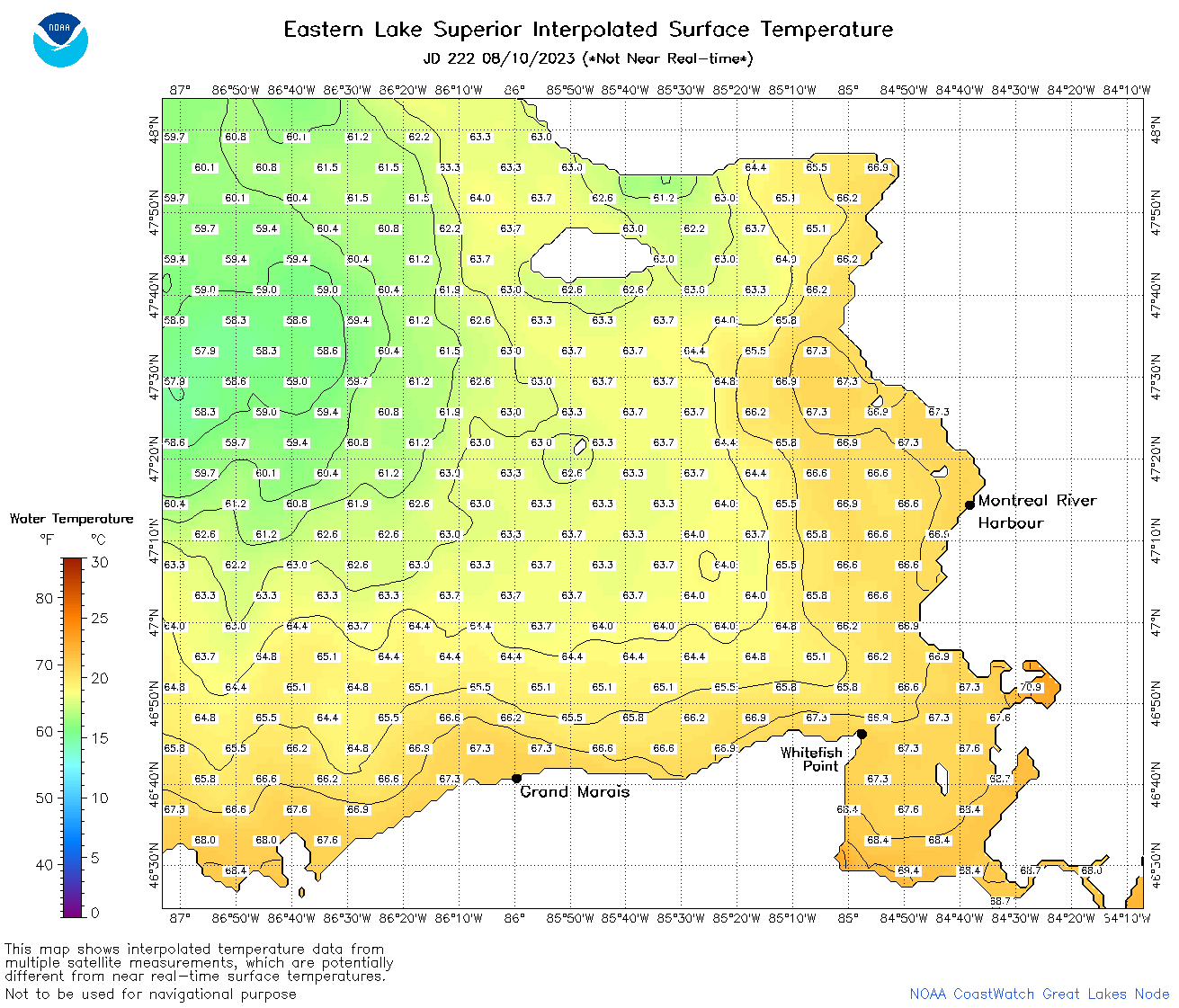 | s3_2023_222.png | 11-Aug-2023 09:10 | 68579 | |