
Easier access to scientific data

Brought to you by NOAA CoastWatch Great Lakes Node
|
ERDDAP
Easier access to scientific data |
|
Brought to you by NOAA CoastWatch Great Lakes Node |
| Dataset Title: | Lake Superior Eastern Region Surface Temperature Contour Map (2022-present)


|
| Institution: | CoastWatch Great Lakes Node (Dataset ID: LS_NRT_TC_s3) |
| Information: | Summary
| License
| Metadata
| Background | Subset
| Data Access Form
| Make a graph
| Subset
| Data Access Form
| Make a graph
|
![[ICO]](https://apps.glerl.noaa.gov/erddap/images/fileIcons/blank.gif) | Name | Last modified | Size | Description |
|---|---|---|---|---|
![[DIR]](https://apps.glerl.noaa.gov/erddap/images/fileIcons/back.gif) | Parent Directory | - | - | |
![[IMG]](https://apps.glerl.noaa.gov/erddap/images/fileIcons/image2.gif)  | s3_2023_07_24_0200.png | 24-Jul-2023 05:29 | 77989 | |
 | s3_2023_07_24_0250.png | 24-Jul-2023 05:34 | 68452 | |
 | s3_2023_07_24_0340.png | 24-Jul-2023 06:25 | 57212 | |
 | s3_2023_07_24_0700.png | 24-Jul-2023 10:27 | 83807 | |
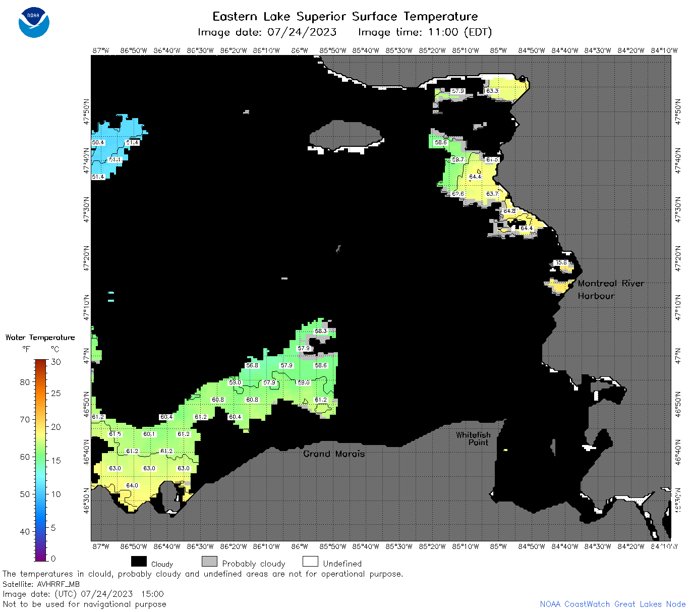
 | s3_2023_07_24_0750.png | 24-Jul-2023 11:25 | 95102 | |
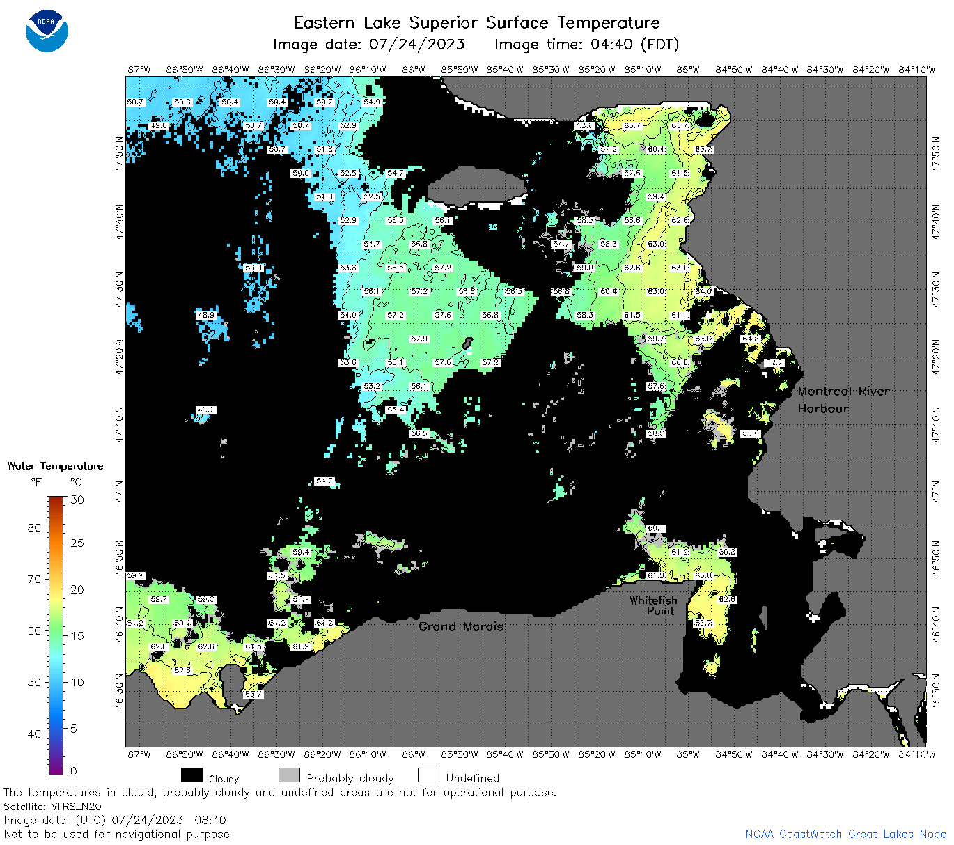 | s3_2023_07_24_0840.png | 24-Jul-2023 12:25 | 94832 | |
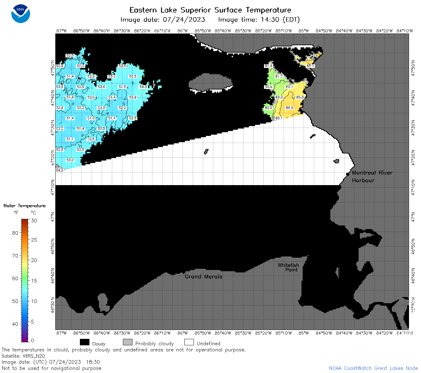
 | s3_2023_07_24_1500.png | 24-Jul-2023 18:28 | 44409 | |
 | s3_2023_07_24_1550.png | 24-Jul-2023 20:25 | 67139 | |
 | s3_2023_07_24_1640.png | 24-Jul-2023 20:28 | 51798 | |
 | s3_2023_07_24_1740.png | 24-Jul-2023 21:27 | 64279 | |
 | s3_2023_07_24_1820.png | 24-Jul-2023 21:29 | 57488 | |
 | s3_2023_07_24_1830.png | 24-Jul-2023 20:32 | 48824 | |
 | s3_2023_07_24_1920.png | 24-Jul-2023 23:25 | 57211 | |
 | s3_2023_205.png | 25-Jul-2023 09:10 | 95080 | |