
Easier access to scientific data

Brought to you by NOAA CoastWatch Great Lakes Node
|
ERDDAP
Easier access to scientific data |
|
Brought to you by NOAA CoastWatch Great Lakes Node |
| Dataset Title: | Lake Superior Eastern Region Surface Temperature Contour Map (2022-present)


|
| Institution: | CoastWatch Great Lakes Node (Dataset ID: LS_NRT_TC_s3) |
| Information: | Summary
| License
| Metadata
| Background | Subset
| Data Access Form
| Make a graph
| Subset
| Data Access Form
| Make a graph
|
![[ICO]](https://apps.glerl.noaa.gov/erddap/images/fileIcons/blank.gif) | Name | Last modified | Size | Description |
|---|---|---|---|---|
![[DIR]](https://apps.glerl.noaa.gov/erddap/images/fileIcons/back.gif) | Parent Directory | - | - | |
![[IMG]](https://apps.glerl.noaa.gov/erddap/images/fileIcons/image2.gif)  | s3_2023_07_01_0130.png | 01-Jul-2023 05:25 | 43080 | |
 | s3_2023_07_01_0220.png | 01-Jul-2023 05:30 | 44201 | |
 | s3_2023_07_01_0310.png | 01-Jul-2023 06:25 | 43281 | |
 | s3_2023_07_01_0640.png | 01-Jul-2023 10:25 | 47850 | |
 | s3_2023_07_01_0730.png | 01-Jul-2023 10:28 | 52187 | |
 | s3_2023_07_01_0820.png | 01-Jul-2023 12:25 | 50734 | |
 | s3_2023_07_01_0910.png | 01-Jul-2023 12:28 | 41083 | |
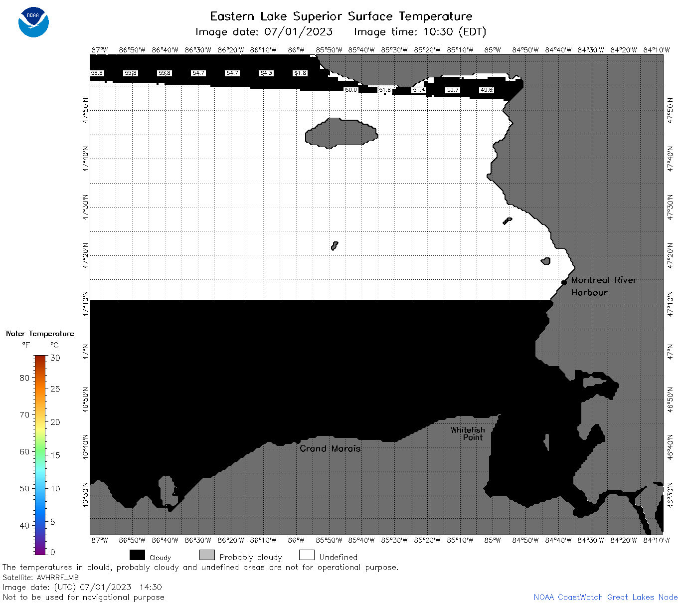 | s3_2023_07_01_1430.png | 01-Jul-2023 18:25 | 32595 | |
 | s3_2023_07_01_1440.png | 01-Jul-2023 18:27 | 42144 | |
 | s3_2023_07_01_1530.png | 01-Jul-2023 19:26 | 43330 | |
 | s3_2023_07_01_1620.png | 01-Jul-2023 19:30 | 44272 | |
 | s3_2023_07_01_1710.png | 01-Jul-2023 21:26 | 42559 | |
 | s3_2023_07_01_1720.png | 01-Jul-2023 19:33 | 43606 | |
 | s3_2023_07_01_1810.png | 01-Jul-2023 22:26 | 43336 | |
 | s3_2023_07_01_1900.png | 01-Jul-2023 21:30 | 43263 | |
 | s3_2023_07_01_1950.png | 01-Jul-2023 22:28 | 43110 | |
 | s3_2023_182.png | 02-Jul-2023 09:10 | 85452 | |