
Easier access to scientific data

Brought to you by NOAA CoastWatch Great Lakes Node
|
ERDDAP
Easier access to scientific data |
|
Brought to you by NOAA CoastWatch Great Lakes Node |
| Dataset Title: | Lake Superior Eastern Region Surface Temperature Contour Map (2022-present)


|
| Institution: | CoastWatch Great Lakes Node (Dataset ID: LS_NRT_TC_s3) |
| Information: | Summary
| License
| Metadata
| Background | Subset
| Data Access Form
| Make a graph
| Subset
| Data Access Form
| Make a graph
|
![[ICO]](https://apps.glerl.noaa.gov/erddap/images/fileIcons/blank.gif) | Name | Last modified | Size | Description |
|---|---|---|---|---|
![[DIR]](https://apps.glerl.noaa.gov/erddap/images/fileIcons/back.gif) | Parent Directory | - | - | |
![[IMG]](https://apps.glerl.noaa.gov/erddap/images/fileIcons/image2.gif)  | s3_2023_05_31_0120.png | 31-May-2023 05:26 | 43043 | |
 | s3_2023_05_31_0220.png | 31-May-2023 05:30 | 41030 | |
 | s3_2023_05_31_0300.png | 31-May-2023 05:33 | 43038 | |
 | s3_2023_05_31_0620.png | 31-May-2023 10:26 | 52311 | |
 | s3_2023_05_31_0710.png | 31-May-2023 10:28 | 75353 | |
 | s3_2023_05_31_0800.png | 31-May-2023 11:26 | 76166 | |
 | s3_2023_05_31_0850.png | 31-May-2023 11:28 | 59866 | |
 | s3_2023_05_31_1430.png | 31-May-2023 18:26 | 40668 | |
 | s3_2023_05_31_1520.png | 31-May-2023 18:28 | 47326 | |
 | s3_2023_05_31_1610.png | 31-May-2023 20:26 | 61628 | |
 | s3_2023_05_31_1700.png | 31-May-2023 20:28 | 46145 | |
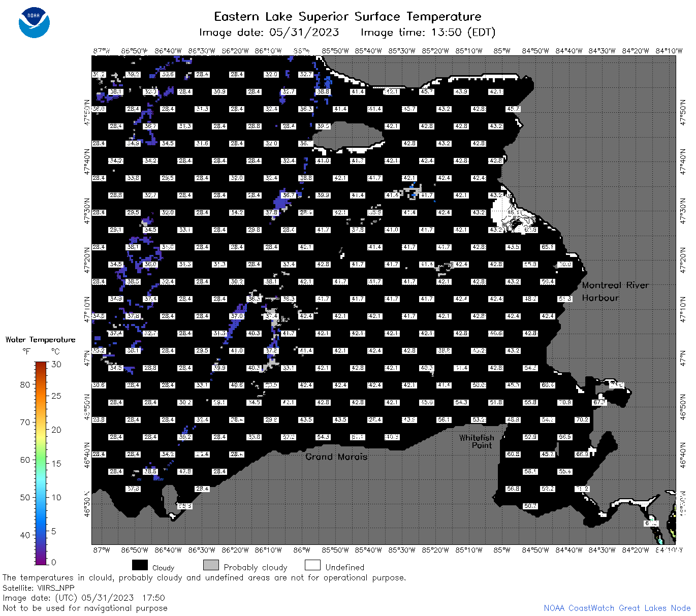 | s3_2023_05_31_1750.png | 31-May-2023 20:31 | 52741 | |
 | s3_2023_05_31_1840.png | 31-May-2023 21:26 | 63981 | |
 | s3_2023_05_31_1930.png | 31-May-2023 22:26 | 51419 | |
 | s3_2023_151.png | 01-Jun-2023 09:11 | 77129 | |