
Easier access to scientific data

Brought to you by NOAA CoastWatch Great Lakes Node
|
ERDDAP
Easier access to scientific data |
|
Brought to you by NOAA CoastWatch Great Lakes Node |
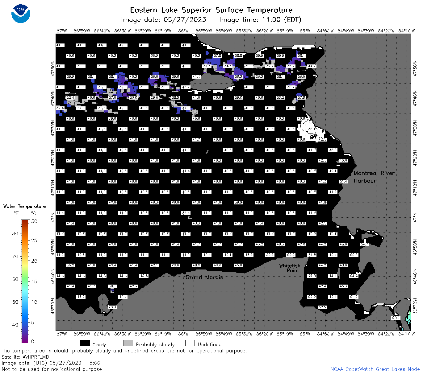
| Dataset Title: | Lake Superior Eastern Region Surface Temperature Contour Map (2022-present)


|
| Institution: | CoastWatch Great Lakes Node (Dataset ID: LS_NRT_TC_s3) |
| Information: | Summary
| License
| Metadata
| Background | Subset
| Data Access Form
| Make a graph
| Subset
| Data Access Form
| Make a graph
|
![[ICO]](https://apps.glerl.noaa.gov/erddap/images/fileIcons/blank.gif) | Name | Last modified | Size | Description |
|---|---|---|---|---|
![[DIR]](https://apps.glerl.noaa.gov/erddap/images/fileIcons/back.gif) | Parent Directory | - | - | |
![[IMG]](https://apps.glerl.noaa.gov/erddap/images/fileIcons/image2.gif)  | s3_2023_05_27_0110.png | 27-May-2023 05:28 | 40224 | |
 | s3_2023_05_27_0200.png | 27-May-2023 05:29 | 41833 | |
 | s3_2023_05_27_0250.png | 27-May-2023 05:34 | 42484 | |
 | s3_2023_05_27_0340.png | 27-May-2023 06:26 | 41081 | |
 | s3_2023_05_27_0650.png | 27-May-2023 09:29 | 98504 | |
 | s3_2023_05_27_0740.png | 27-May-2023 11:26 | 109943 | |
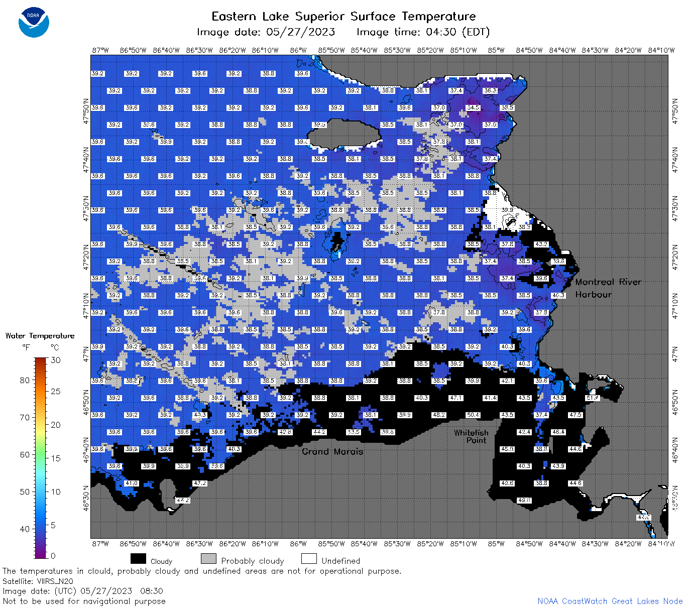 | s3_2023_05_27_0830.png | 27-May-2023 11:28 | 101053 | |
 | s3_2023_05_27_0920.png | 27-May-2023 13:26 | 36123 | |
 | s3_2023_05_27_1500.png | 27-May-2023 18:28 | 46437 | |
 | s3_2023_05_27_1550.png | 27-May-2023 20:26 | 43770 | |
 | s3_2023_05_27_1640.png | 27-May-2023 20:28 | 42990 | |
 | s3_2023_05_27_1720.png | 27-May-2023 20:30 | 53638 | |
 | s3_2023_05_27_1810.png | 27-May-2023 21:28 | 58758 | |
 | s3_2023_05_27_1900.png | 27-May-2023 21:30 | 57506 | |
 | s3_2023_147.png | 28-May-2023 09:11 | 66508 | |