
Easier access to scientific data

Brought to you by NOAA CoastWatch Great Lakes Node
|
ERDDAP
Easier access to scientific data |
|
Brought to you by NOAA CoastWatch Great Lakes Node |
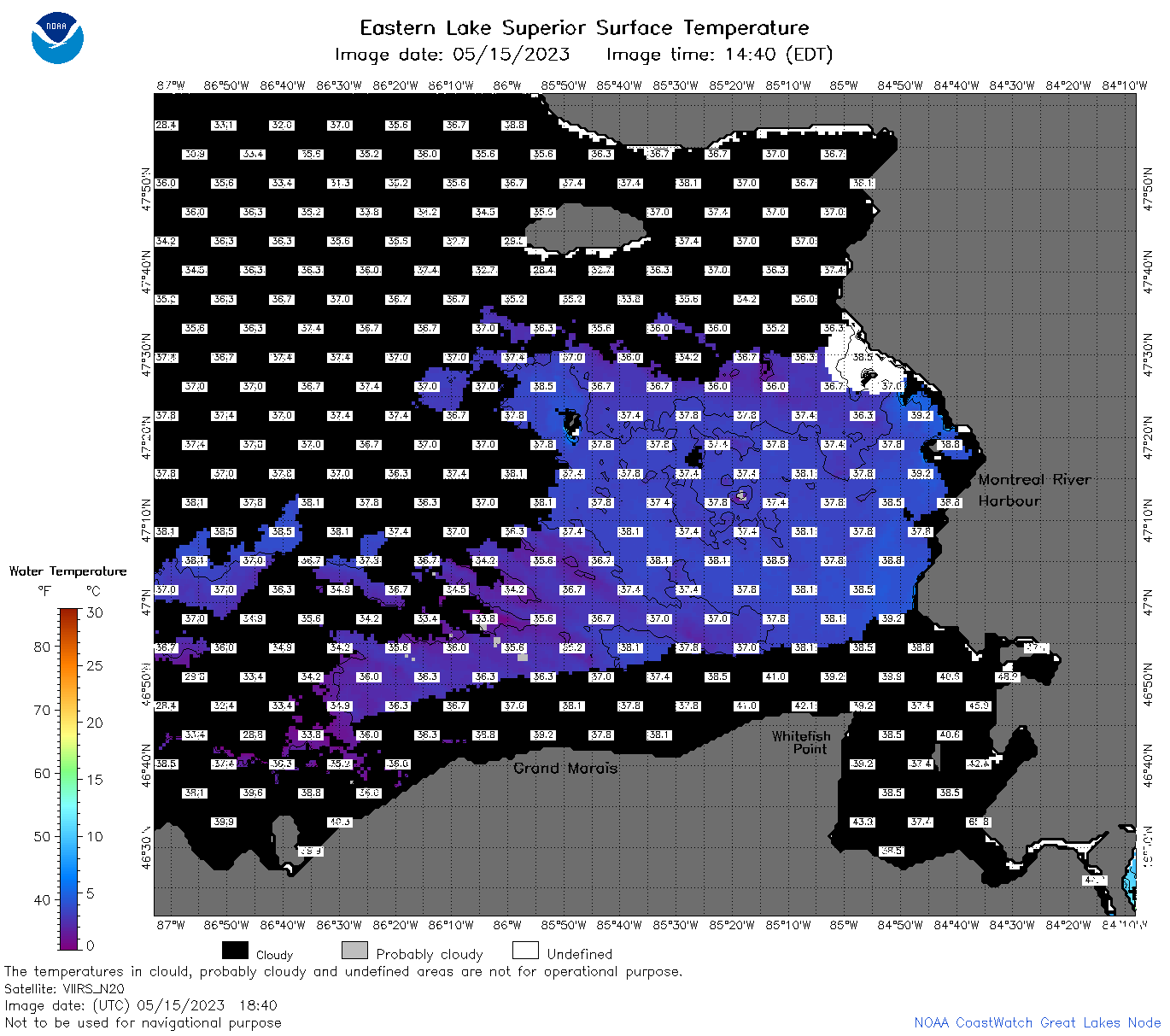
| Dataset Title: | Lake Superior Eastern Region Surface Temperature Contour Map (2022-present)


|
| Institution: | CoastWatch Great Lakes Node (Dataset ID: LS_NRT_TC_s3) |
| Information: | Summary
| License
| Metadata
| Background | Subset
| Data Access Form
| Make a graph
| Subset
| Data Access Form
| Make a graph
|
![[ICO]](https://apps.glerl.noaa.gov/erddap/images/fileIcons/blank.gif) | Name | Last modified | Size | Description |
|---|---|---|---|---|
![[DIR]](https://apps.glerl.noaa.gov/erddap/images/fileIcons/back.gif) | Parent Directory | - | - | |
![[IMG]](https://apps.glerl.noaa.gov/erddap/images/fileIcons/image2.gif)  | s3_2023_05_15_0110.png | 15-May-2023 16:25 | 39893 | |
 | s3_2023_05_15_0150.png | 15-May-2023 16:27 | 53066 | |
 | s3_2023_05_15_0250.png | 15-May-2023 16:33 | 48569 | |
 | s3_2023_05_15_0330.png | 15-May-2023 16:35 | 42704 | |
 | s3_2023_05_15_0620.png | 15-May-2023 16:39 | 60041 | |
 | s3_2023_05_15_0710.png | 15-May-2023 16:41 | 94489 | |
 | s3_2023_05_15_0800.png | 15-May-2023 16:43 | 92923 | |
 | s3_2023_05_15_0850.png | 15-May-2023 16:45 | 119630 | |
 | s3_2023_05_15_1500.png | 15-May-2023 19:25 | 50854 | |
 | s3_2023_05_15_1550.png | 15-May-2023 19:28 | 66196 | |
 | s3_2023_05_15_1640.png | 15-May-2023 20:25 | 51062 | |
 | s3_2023_05_15_1700.png | 15-May-2023 19:30 | 38944 | |
 | s3_2023_05_15_1750.png | 15-May-2023 22:25 | 62025 | |
 | s3_2023_05_15_1840.png | 15-May-2023 21:27 | 69776 | |
 | s3_2023_05_15_1930.png | 15-May-2023 22:28 | 42330 | |
 | s3_2023_135.png | 16-May-2023 09:10 | 72322 | |