
Easier access to scientific data

Brought to you by NOAA CoastWatch Great Lakes Node
|
ERDDAP
Easier access to scientific data |
|
Brought to you by NOAA CoastWatch Great Lakes Node |
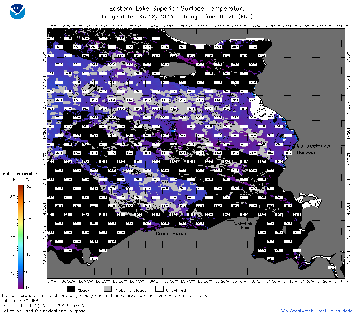
| Dataset Title: | Lake Superior Eastern Region Surface Temperature Contour Map (2022-present)


|
| Institution: | CoastWatch Great Lakes Node (Dataset ID: LS_NRT_TC_s3) |
| Information: | Summary
| License
| Metadata
| Background | Subset
| Data Access Form
| Make a graph
| Subset
| Data Access Form
| Make a graph
|
![[ICO]](https://apps.glerl.noaa.gov/erddap/images/fileIcons/blank.gif) | Name | Last modified | Size | Description |
|---|---|---|---|---|
![[DIR]](https://apps.glerl.noaa.gov/erddap/images/fileIcons/back.gif) | Parent Directory | - | - | |
![[IMG]](https://apps.glerl.noaa.gov/erddap/images/fileIcons/image2.gif)  | s3_2023_05_12_0120.png | 12-May-2023 05:27 | 46350 | |
 | s3_2023_05_12_0210.png | 12-May-2023 05:29 | 47456 | |
 | s3_2023_05_12_0300.png | 12-May-2023 05:34 | 52334 | |
 | s3_2023_05_12_0350.png | 12-May-2023 06:25 | 42887 | |
 | s3_2023_05_12_0630.png | 12-May-2023 09:25 | 68179 | |
 | s3_2023_05_12_0720.png | 12-May-2023 11:25 | 97865 | |
 | s3_2023_05_12_0810.png | 12-May-2023 11:28 | 106035 | |
 | s3_2023_05_12_0900.png | 12-May-2023 12:25 | 85759 | |
 | s3_2023_05_12_1510.png | 12-May-2023 18:27 | 52387 | |
 | s3_2023_05_12_1600.png | 12-May-2023 20:26 | 63979 | |
 | s3_2023_05_12_1650.png | 12-May-2023 20:30 | 52208 | |
 | s3_2023_05_12_1700.png | 12-May-2023 19:25 | 45034 | |
 | s3_2023_05_12_1750.png | 12-May-2023 20:32 | 72087 | |
 | s3_2023_05_12_1840.png | 12-May-2023 21:27 | 72115 | |
 | s3_2023_05_12_1930.png | 12-May-2023 22:27 | 43792 | |
 | s3_2023_132.png | 13-May-2023 09:10 | 76776 | |