
Easier access to scientific data

Brought to you by NOAA CoastWatch Great Lakes Node
|
ERDDAP
Easier access to scientific data |
|
Brought to you by NOAA CoastWatch Great Lakes Node |
| Dataset Title: | Lake Superior Eastern Region Surface Temperature Contour Map (2022-present)


|
| Institution: | CoastWatch Great Lakes Node (Dataset ID: LS_NRT_TC_s3) |
| Information: | Summary
| License
| Metadata
| Background | Subset
| Data Access Form
| Make a graph
| Subset
| Data Access Form
| Make a graph
|
![[ICO]](https://apps.glerl.noaa.gov/erddap/images/fileIcons/blank.gif) | Name | Last modified | Size | Description |
|---|---|---|---|---|
![[DIR]](https://apps.glerl.noaa.gov/erddap/images/fileIcons/back.gif) | Parent Directory | - | - | |
![[IMG]](https://apps.glerl.noaa.gov/erddap/images/fileIcons/image2.gif)  | s3_2023_05_11_0140.png | 11-May-2023 05:27 | 43021 | |
 | s3_2023_05_11_0230.png | 11-May-2023 05:30 | 45066 | |
 | s3_2023_05_11_0320.png | 11-May-2023 06:26 | 43512 | |
 | s3_2023_05_11_0650.png | 11-May-2023 09:27 | 57470 | |
 | s3_2023_05_11_0740.png | 11-May-2023 11:25 | 51806 | |
 | s3_2023_05_11_0830.png | 11-May-2023 11:28 | 51825 | |
 | s3_2023_05_11_0920.png | 11-May-2023 13:25 | 34152 | |
 | s3_2023_05_11_1440.png | 11-May-2023 18:25 | 45685 | |
 | s3_2023_05_11_1530.png | 11-May-2023 19:25 | 43048 | |
 | s3_2023_05_11_1620.png | 11-May-2023 20:25 | 42830 | |
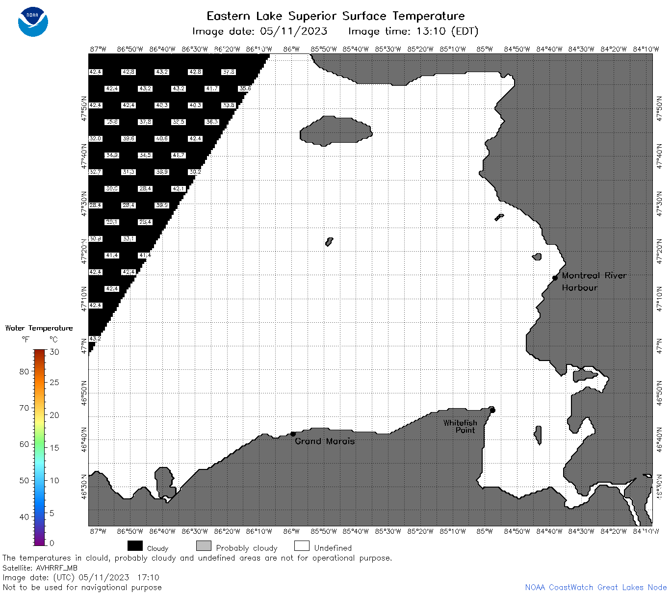 | s3_2023_05_11_1710.png | 11-May-2023 20:30 | 37770 | |
 | s3_2023_05_11_1720.png | 11-May-2023 20:32 | 43274 | |
 | s3_2023_05_11_1810.png | 11-May-2023 22:25 | 43812 | |
 | s3_2023_05_11_1900.png | 11-May-2023 21:25 | 42612 | |
 | s3_2023_131.png | 12-May-2023 09:10 | 72672 | |