
Easier access to scientific data

Brought to you by NOAA CoastWatch Great Lakes Node
|
ERDDAP
Easier access to scientific data |
|
Brought to you by NOAA CoastWatch Great Lakes Node |
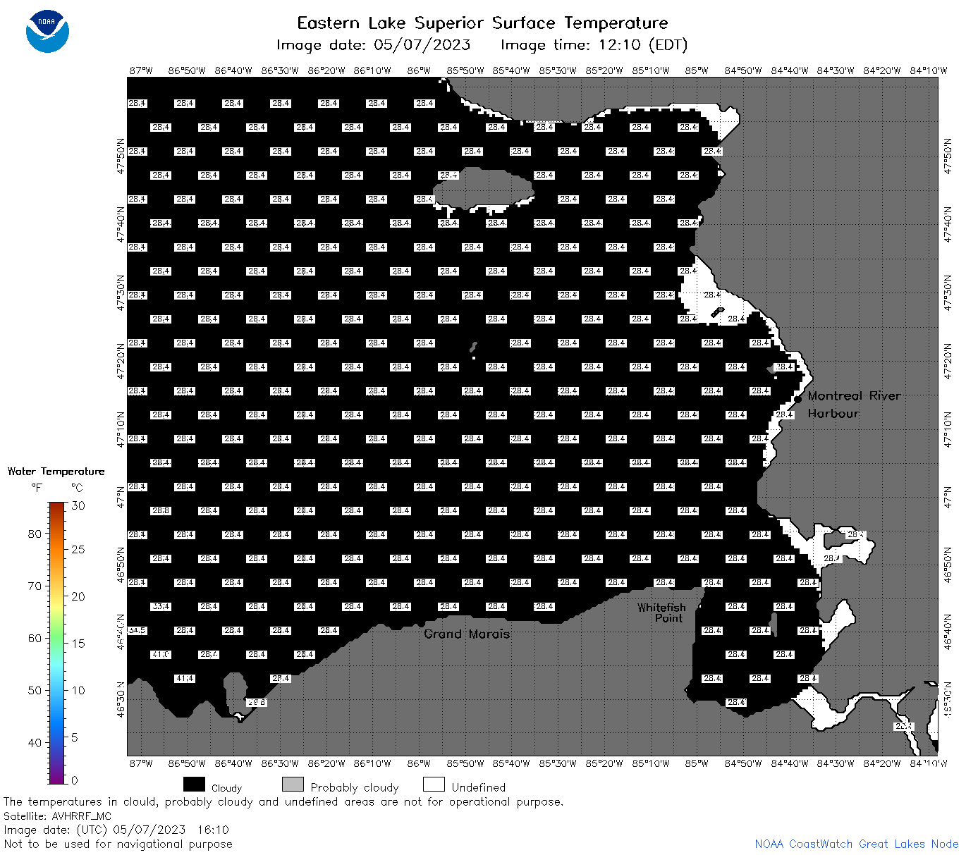
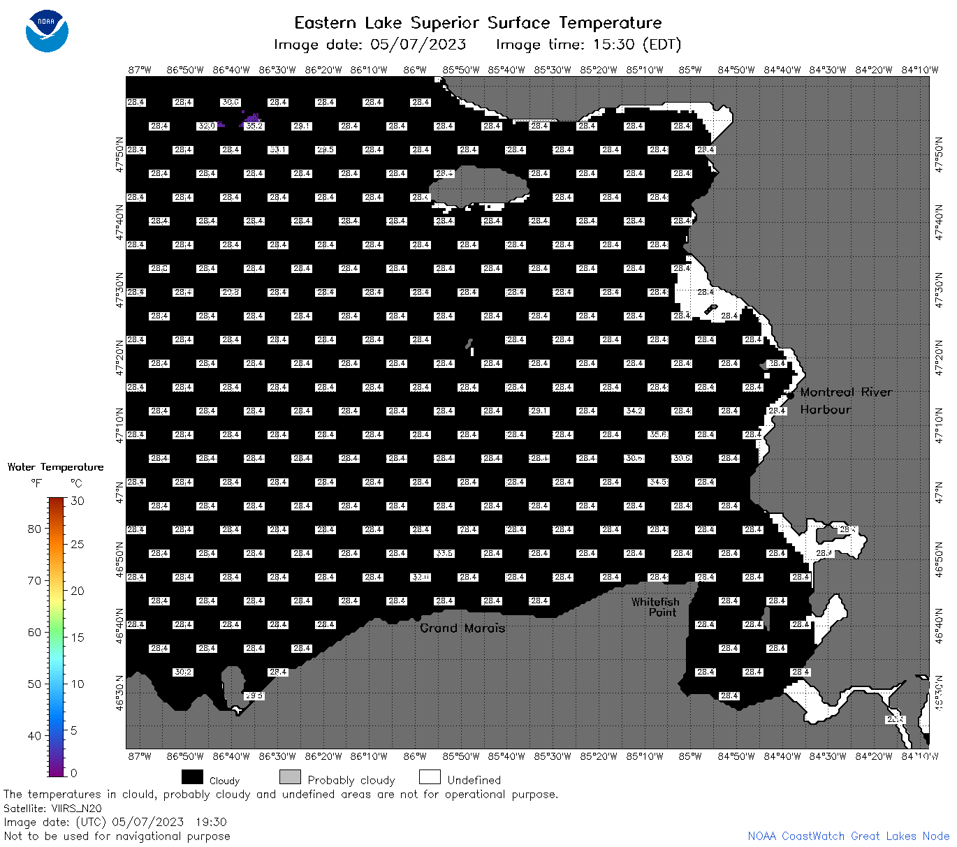
| Dataset Title: | Lake Superior Eastern Region Surface Temperature Contour Map (2022-present)


|
| Institution: | CoastWatch Great Lakes Node (Dataset ID: LS_NRT_TC_s3) |
| Information: | Summary
| License
| Metadata
| Background | Subset
| Data Access Form
| Make a graph
| Subset
| Data Access Form
| Make a graph
|
![[ICO]](https://apps.glerl.noaa.gov/erddap/images/fileIcons/blank.gif) | Name | Last modified | Size | Description |
|---|---|---|---|---|
![[DIR]](https://apps.glerl.noaa.gov/erddap/images/fileIcons/back.gif) | Parent Directory | - | - | |
![[IMG]](https://apps.glerl.noaa.gov/erddap/images/fileIcons/image2.gif)  | s3_2023_05_07_0120.png | 07-May-2023 05:25 | 37455 | |
 | s3_2023_05_07_0210.png | 07-May-2023 05:28 | 37754 | |
 | s3_2023_05_07_0300.png | 07-May-2023 05:30 | 37442 | |
 | s3_2023_05_07_0620.png | 07-May-2023 09:25 | 38885 | |
 | s3_2023_05_07_0710.png | 07-May-2023 11:25 | 37281 | |
 | s3_2023_05_07_0800.png | 07-May-2023 10:25 | 37384 | |
 | s3_2023_05_07_0850.png | 07-May-2023 12:25 | 37389 | |
 | s3_2023_05_07_1430.png | 07-May-2023 18:27 | 36369 | |
 | s3_2023_05_07_1510.png | 07-May-2023 18:29 | 37331 | |
 | s3_2023_05_07_1610.png | 07-May-2023 20:25 | 37517 | |
 | s3_2023_05_07_1650.png | 07-May-2023 20:28 | 38495 | |
 | s3_2023_05_07_1700.png | 07-May-2023 21:25 | 39815 | |
 | s3_2023_05_07_1750.png | 07-May-2023 20:34 | 38279 | |
 | s3_2023_05_07_1840.png | 07-May-2023 21:27 | 41600 | |
 | s3_2023_05_07_1930.png | 07-May-2023 22:25 | 38320 | |
 | s3_2023_127.png | 08-May-2023 09:10 | 65518 | |