
Easier access to scientific data

Brought to you by NOAA CoastWatch Great Lakes Node
|
ERDDAP
Easier access to scientific data |
|
Brought to you by NOAA CoastWatch Great Lakes Node |
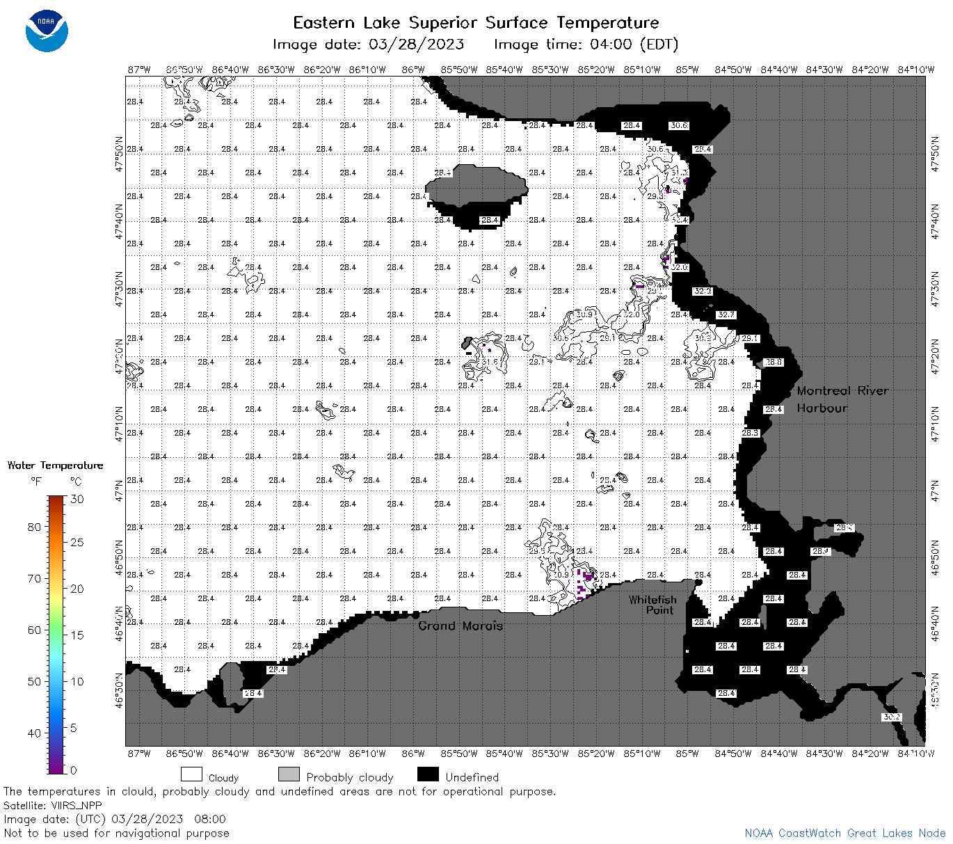
| Dataset Title: | Lake Superior Eastern Region Surface Temperature Contour Map (2022-present)


|
| Institution: | CoastWatch Great Lakes Node (Dataset ID: LS_NRT_TC_s3) |
| Information: | Summary
| License
| Metadata
| Background | Subset
| Data Access Form
| Make a graph
| Subset
| Data Access Form
| Make a graph
|
![[ICO]](https://apps.glerl.noaa.gov/erddap/images/fileIcons/blank.gif) | Name | Last modified | Size | Description |
|---|---|---|---|---|
![[DIR]](https://apps.glerl.noaa.gov/erddap/images/fileIcons/back.gif) | Parent Directory | - | - | |
![[IMG]](https://apps.glerl.noaa.gov/erddap/images/fileIcons/image2.gif)  | s3_2023_03_28_0150.png | 28-Mar-2023 05:27 | 91463 | |
 | s3_2023_03_28_0240.png | 28-Mar-2023 05:30 | 97051 | |
 | s3_2023_03_28_0330.png | 28-Mar-2023 06:25 | 50262 | |
 | s3_2023_03_28_0620.png | 28-Mar-2023 10:25 | 40760 | |
 | s3_2023_03_28_0710.png | 28-Mar-2023 10:28 | 55315 | |
 | s3_2023_03_28_0800.png | 28-Mar-2023 11:25 | 48639 | |
 | s3_2023_03_28_0850.png | 28-Mar-2023 12:25 | 46029 | |
 | s3_2023_03_28_1450.png | 28-Mar-2023 19:26 | 64085 | |
 | s3_2023_03_28_1540.png | 28-Mar-2023 18:27 | 85178 | |
 | s3_2023_03_28_1630.png | 28-Mar-2023 20:25 | 72988 | |
 | s3_2023_03_28_1700.png | 28-Mar-2023 19:30 | 47780 | |
 | s3_2023_03_28_1750.png | 28-Mar-2023 20:32 | 110039 | |
 | s3_2023_03_28_1840.png | 28-Mar-2023 21:27 | 115079 | |
 | s3_2023_03_28_1930.png | 28-Mar-2023 22:25 | 105031 | |
 | s3_2023_087.png | 29-Mar-2023 09:10 | 65919 | |