
Easier access to scientific data

Brought to you by NOAA CoastWatch Great Lakes Node
|
ERDDAP
Easier access to scientific data |
|
Brought to you by NOAA CoastWatch Great Lakes Node |
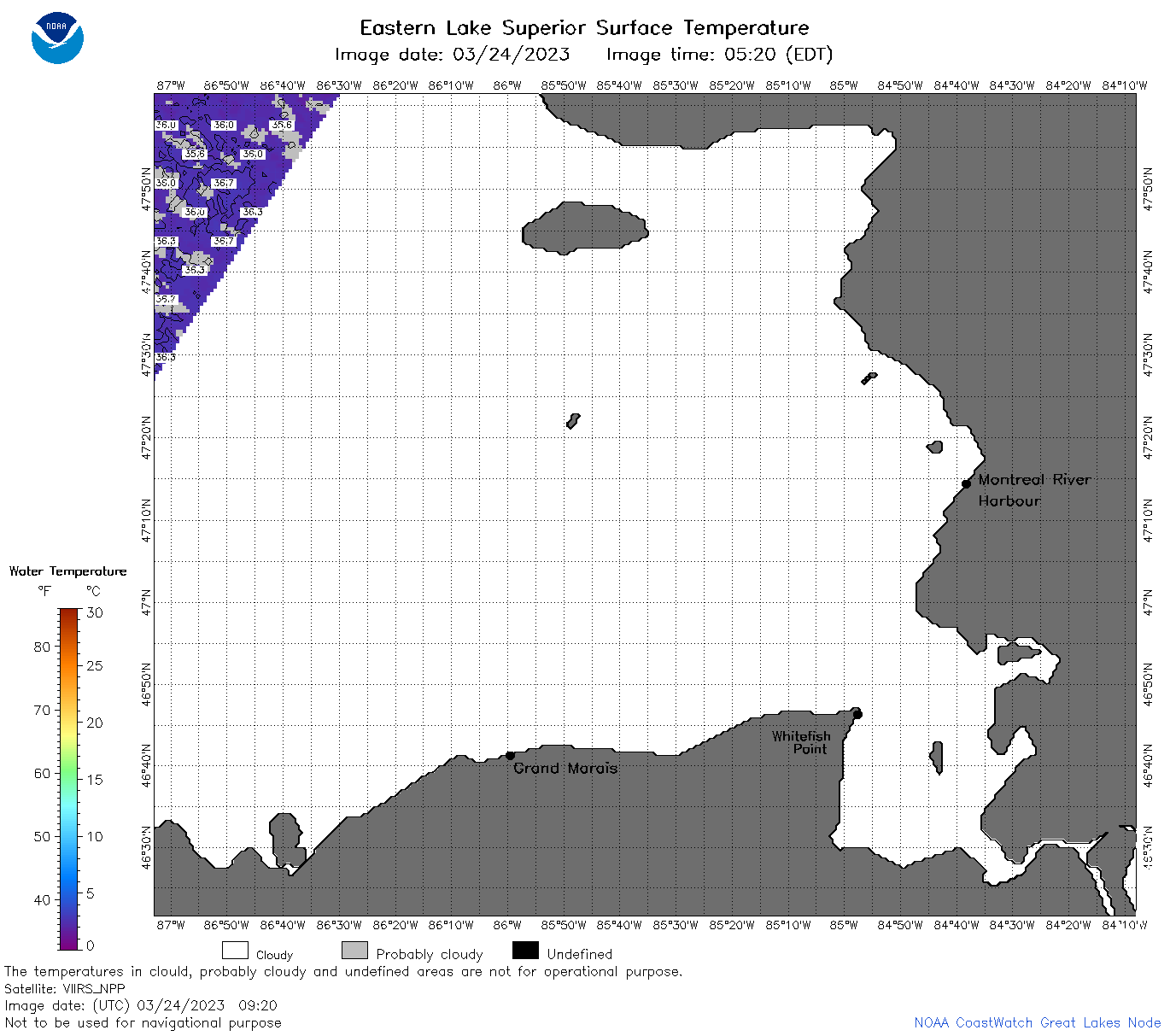
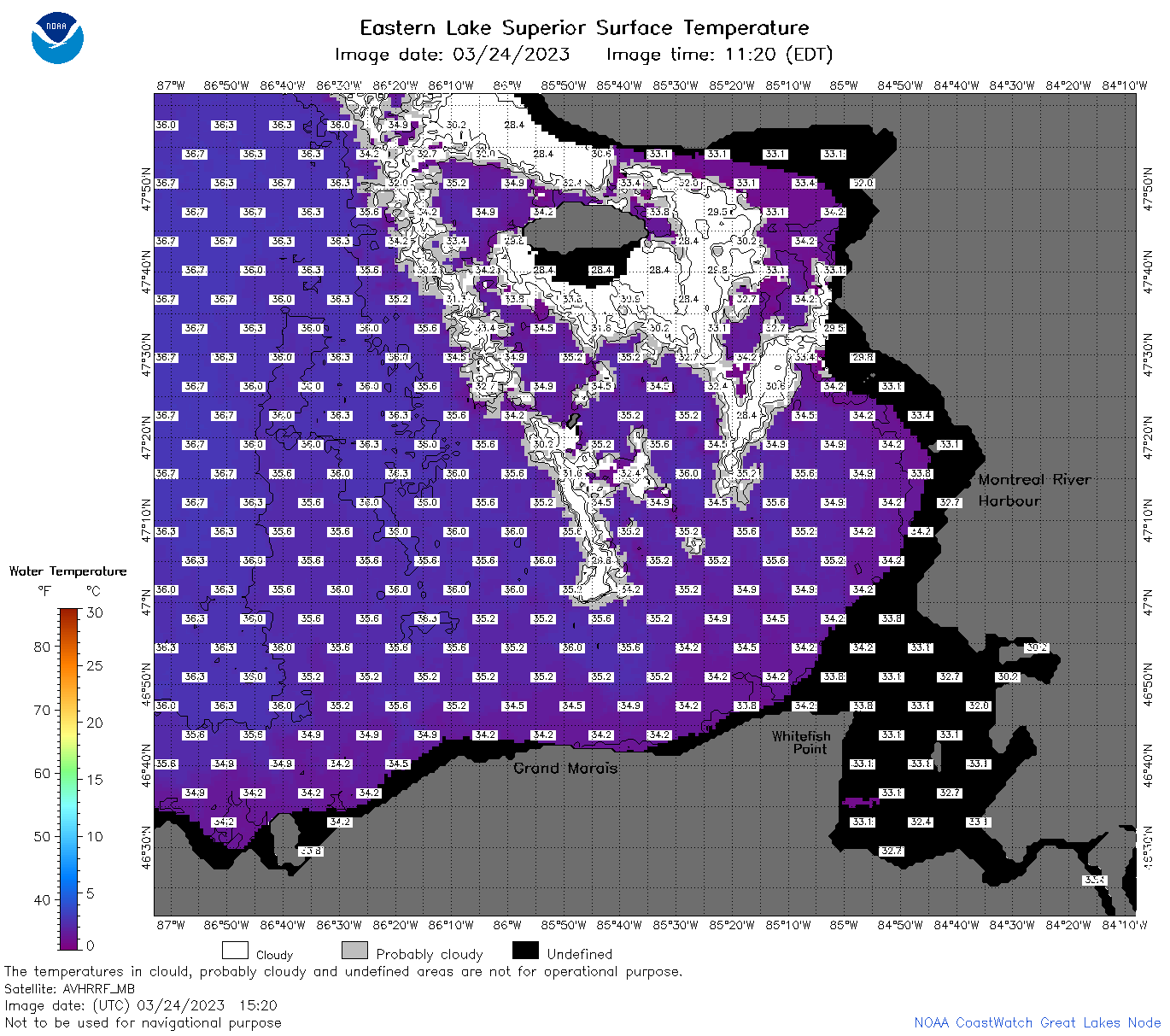
| Dataset Title: | Lake Superior Eastern Region Surface Temperature Contour Map (2022-present)


|
| Institution: | CoastWatch Great Lakes Node (Dataset ID: LS_NRT_TC_s3) |
| Information: | Summary
| License
| Metadata
| Background | Subset
| Data Access Form
| Make a graph
| Subset
| Data Access Form
| Make a graph
|
![[ICO]](https://apps.glerl.noaa.gov/erddap/images/fileIcons/blank.gif) | Name | Last modified | Size | Description |
|---|---|---|---|---|
![[DIR]](https://apps.glerl.noaa.gov/erddap/images/fileIcons/back.gif) | Parent Directory | - | - | |
![[IMG]](https://apps.glerl.noaa.gov/erddap/images/fileIcons/image2.gif) 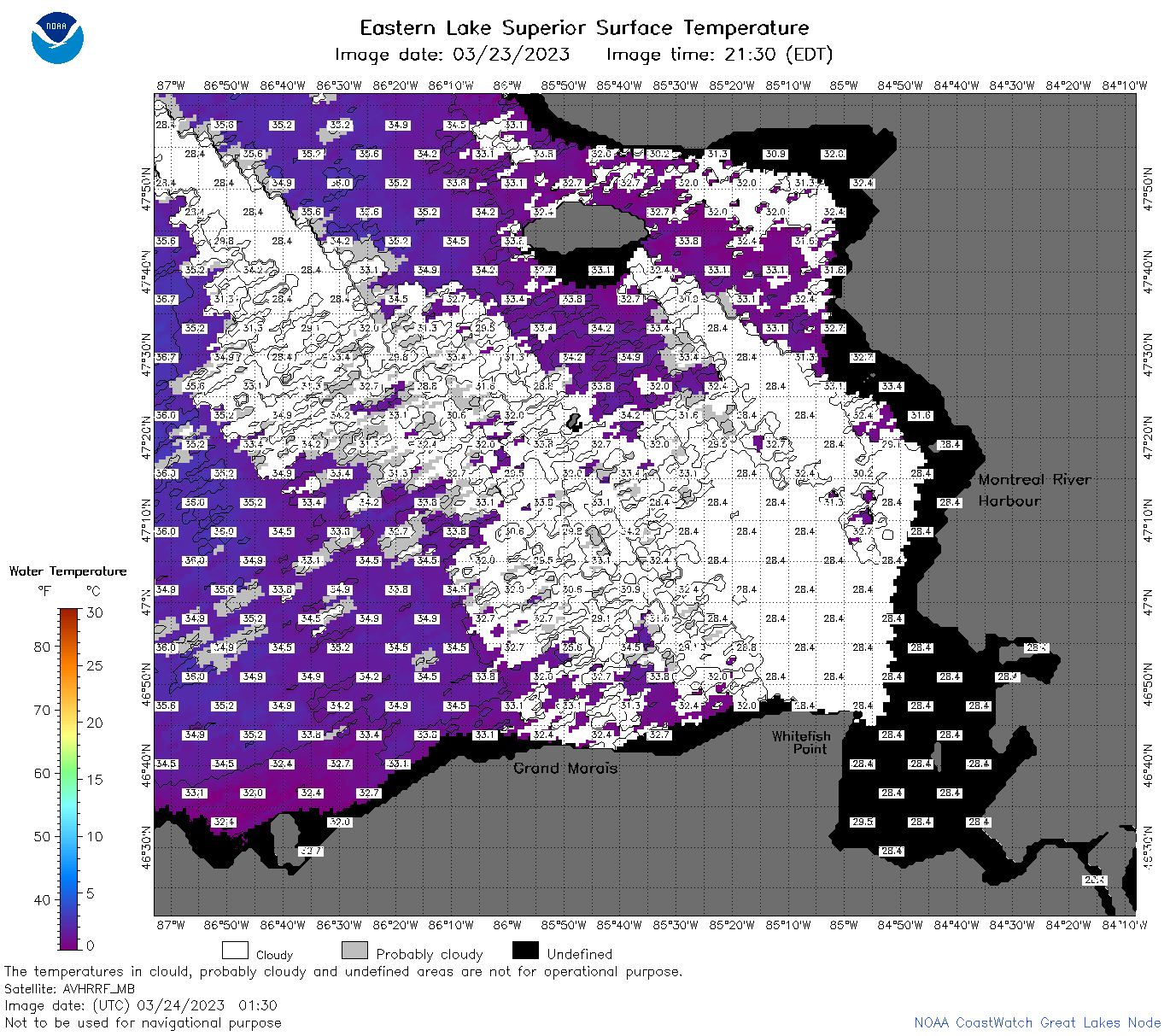 | s3_2023_03_24_0130.png | 24-Mar-2023 05:25 | 115818 | |
 | s3_2023_03_24_0220.png | 24-Mar-2023 05:28 | 124771 | |
 | s3_2023_03_24_0310.png | 24-Mar-2023 05:30 | 104686 | |
 | s3_2023_03_24_0640.png | 24-Mar-2023 10:25 | 60617 | |
 | s3_2023_03_24_0650.png | 24-Mar-2023 10:27 | 99019 | |
 | s3_2023_03_24_0740.png | 24-Mar-2023 12:25 | 119101 | |
 | s3_2023_03_24_0830.png | 24-Mar-2023 11:29 | 111109 | |
 | s3_2023_03_24_0920.png | 24-Mar-2023 13:25 | 41532 | |
 | s3_2023_03_24_1440.png | 24-Mar-2023 18:25 | 68330 | |
 | s3_2023_03_24_1520.png | 24-Mar-2023 18:28 | 94089 | |
 | s3_2023_03_24_1620.png | 24-Mar-2023 20:25 | 87264 | |
 | s3_2023_03_24_1700.png | 24-Mar-2023 20:28 | 77584 | |
 | s3_2023_03_24_1720.png | 24-Mar-2023 20:32 | 97605 | |
 | s3_2023_03_24_1810.png | 24-Mar-2023 21:25 | 82809 | |
 | s3_2023_03_24_1900.png | 24-Mar-2023 21:28 | 81568 | |
 | s3_2023_083.png | 25-Mar-2023 09:10 | 66836 | |