
Easier access to scientific data

Brought to you by NOAA CoastWatch Great Lakes Node
|
ERDDAP
Easier access to scientific data |
|
Brought to you by NOAA CoastWatch Great Lakes Node |
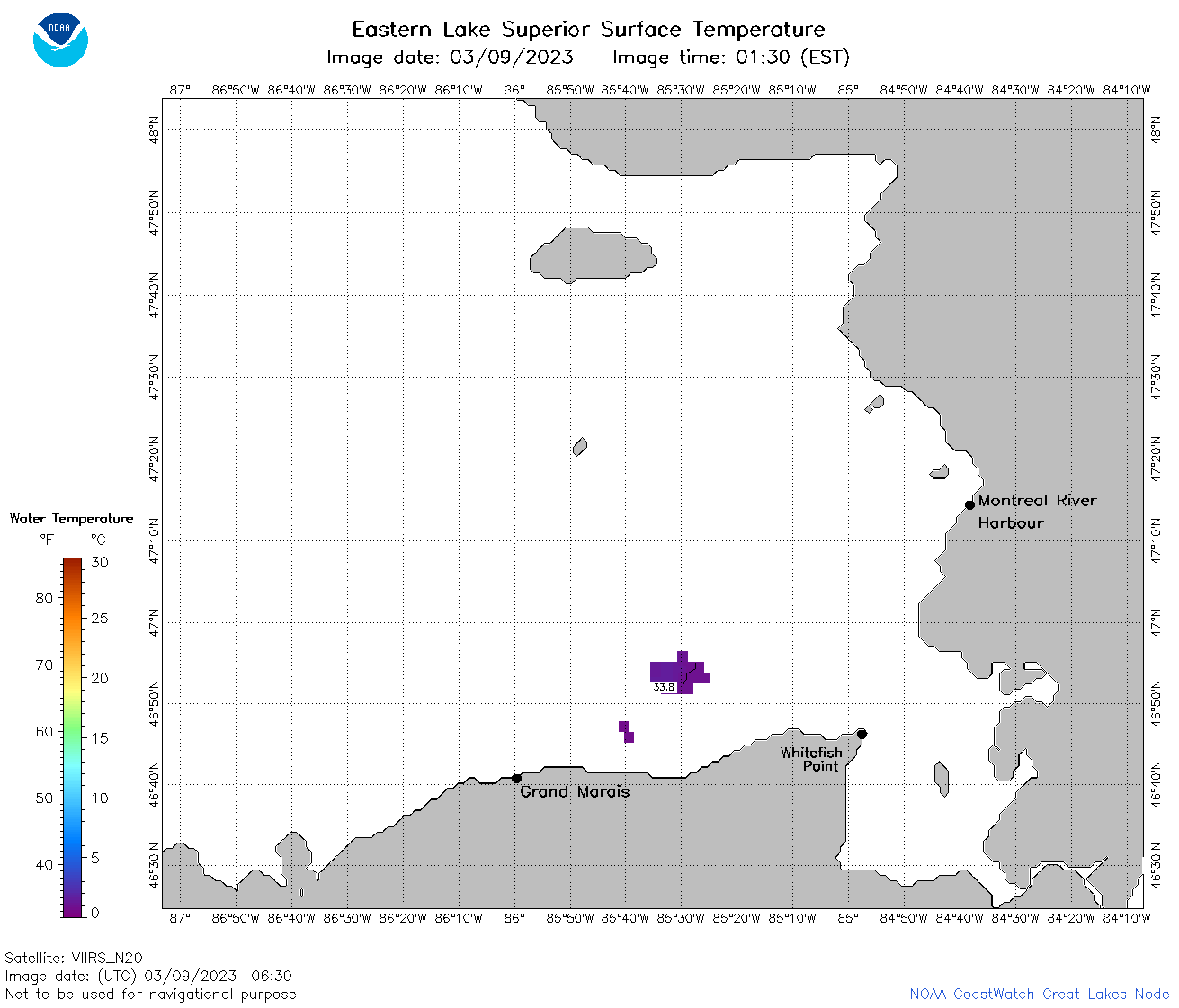
| Dataset Title: | Lake Superior Eastern Region Surface Temperature Contour Map (2022-present)


|
| Institution: | CoastWatch Great Lakes Node (Dataset ID: LS_NRT_TC_s3) |
| Information: | Summary
| License
| Metadata
| Background | Subset
| Data Access Form
| Make a graph
| Subset
| Data Access Form
| Make a graph
|
![[ICO]](https://apps.glerl.noaa.gov/erddap/images/fileIcons/blank.gif) | Name | Last modified | Size | Description |
|---|---|---|---|---|
![[DIR]](https://apps.glerl.noaa.gov/erddap/images/fileIcons/back.gif) | Parent Directory | - | - | |
![[IMG]](https://apps.glerl.noaa.gov/erddap/images/fileIcons/image2.gif)  | s3_2023_03_09_0140.png | 09-Mar-2023 06:24 | 32629 | |
 | s3_2023_03_09_0230.png | 09-Mar-2023 06:25 | 44398 | |
 | s3_2023_03_09_0320.png | 09-Mar-2023 06:26 | 35562 | |
 | s3_2023_03_09_0630.png | 09-Mar-2023 10:24 | 32728 | |
 | s3_2023_03_09_0720.png | 09-Mar-2023 11:24 | 38634 | |
 | s3_2023_03_09_0810.png | 09-Mar-2023 12:24 | 47518 | |
 | s3_2023_03_09_0900.png | 09-Mar-2023 13:24 | 41627 | |
 | s3_2023_03_09_1450.png | 09-Mar-2023 18:24 | 40251 | |
 | s3_2023_03_09_1530.png | 09-Mar-2023 18:25 | 41387 | |
 | s3_2023_03_09_1540.png | 09-Mar-2023 18:26 | 38330 | |
 | s3_2023_03_09_1630.png | 09-Mar-2023 20:24 | 44606 | |
 | s3_2023_03_09_1700.png | 09-Mar-2023 20:25 | 49143 | |
 | s3_2023_03_09_1710.png | 09-Mar-2023 20:26 | 32693 | |
 | s3_2023_03_09_1750.png | 09-Mar-2023 21:25 | 43799 | |
 | s3_2023_03_09_1840.png | 09-Mar-2023 21:26 | 43673 | |
 | s3_2023_03_09_1930.png | 09-Mar-2023 22:24 | 45130 | |
 | s3_2023_068.png | 10-Mar-2023 10:10 | 72409 | |