
Easier access to scientific data

Brought to you by NOAA CoastWatch Great Lakes Node
|
ERDDAP
Easier access to scientific data |
|
Brought to you by NOAA CoastWatch Great Lakes Node |
| Dataset Title: | Lake Superior Eastern Region Surface Temperature Contour Map (2022-present)


|
| Institution: | CoastWatch Great Lakes Node (Dataset ID: LS_NRT_TC_s3) |
| Information: | Summary
| License
| Metadata
| Background | Subset
| Data Access Form
| Make a graph
| Subset
| Data Access Form
| Make a graph
|
![[ICO]](https://apps.glerl.noaa.gov/erddap/images/fileIcons/blank.gif) | Name | Last modified | Size | Description |
|---|---|---|---|---|
![[DIR]](https://apps.glerl.noaa.gov/erddap/images/fileIcons/back.gif) | Parent Directory | - | - | |
![[IMG]](https://apps.glerl.noaa.gov/erddap/images/fileIcons/image2.gif)  | s3_2023_03_05_0650.png | 05-Mar-2023 10:24 | 32768 | |
 | s3_2023_03_05_0740.png | 05-Mar-2023 12:24 | 36830 | |
 | s3_2023_03_05_0830.png | 05-Mar-2023 12:25 | 36879 | |
 | s3_2023_03_05_1430.png | 05-Mar-2023 18:24 | 38807 | |
 | s3_2023_03_05_1520.png | 05-Mar-2023 18:25 | 53020 | |
 | s3_2023_03_05_1610.png | 05-Mar-2023 20:24 | 53797 | |
 | s3_2023_03_05_1700.png | 05-Mar-2023 20:25 | 50668 | |
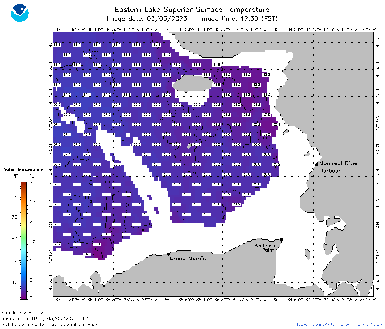 | s3_2023_03_05_1730.png | 05-Mar-2023 20:26 | 56069 | |
 | s3_2023_03_05_1820.png | 05-Mar-2023 21:24 | 54950 | |
 | s3_2023_03_05_1910.png | 05-Mar-2023 22:24 | 56479 | |
 | s3_2023_064.png | 06-Mar-2023 10:10 | 72394 | |