
Easier access to scientific data

Brought to you by NOAA CoastWatch Great Lakes Node
|
ERDDAP
Easier access to scientific data |
|
Brought to you by NOAA CoastWatch Great Lakes Node |
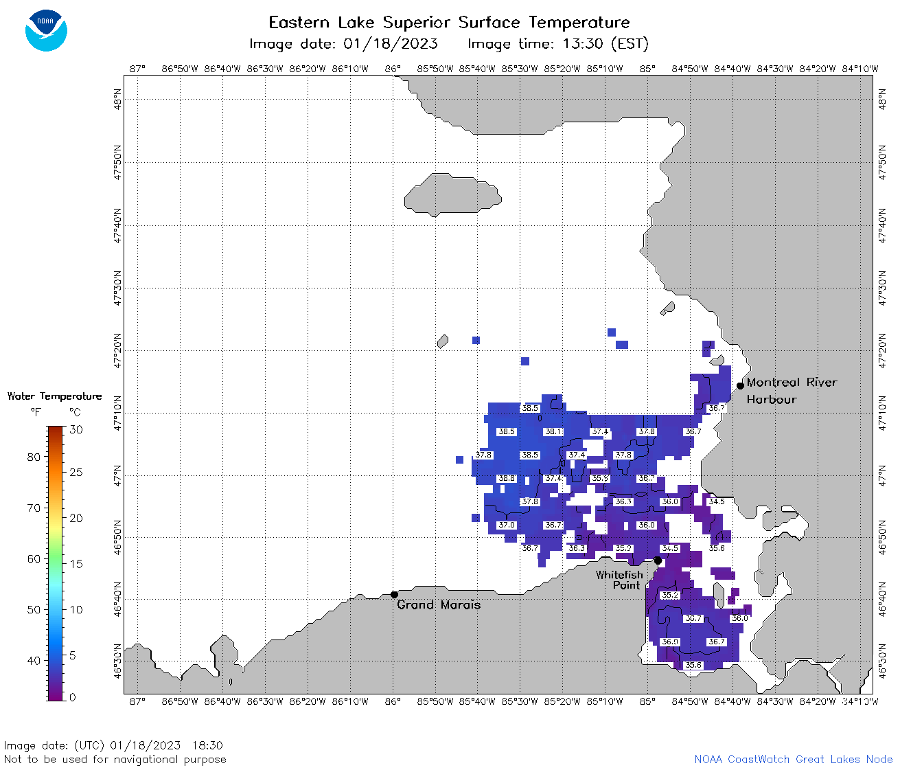
| Dataset Title: | Lake Superior Eastern Region Surface Temperature Contour Map (2022-present)


|
| Institution: | CoastWatch Great Lakes Node (Dataset ID: LS_NRT_TC_s3) |
| Information: | Summary
| License
| Metadata
| Background | Subset
| Data Access Form
| Make a graph
| Subset
| Data Access Form
| Make a graph
|
![[ICO]](https://apps.glerl.noaa.gov/erddap/images/fileIcons/blank.gif) | Name | Last modified | Size | Description |
|---|---|---|---|---|
![[DIR]](https://apps.glerl.noaa.gov/erddap/images/fileIcons/back.gif) | Parent Directory | - | - | |
![[IMG]](https://apps.glerl.noaa.gov/erddap/images/fileIcons/image2.gif)  | s3_2023_018.png | 19-Jan-2023 10:10 | 67619 | |
 | s3_2023_01_18_0800.png | 18-Jan-2023 11:24 | 32381 | |
 | s3_2023_01_18_1740.png | 18-Jan-2023 21:24 | 32146 | |
 | s3_2023_01_18_1830.png | 18-Jan-2023 20:24 | 38988 | |
 | s3_2023_01_18_1920.png | 18-Jan-2023 22:24 | 35492 | |