
Easier access to scientific data

Brought to you by NOAA CoastWatch Great Lakes Node
|
ERDDAP
Easier access to scientific data |
|
Brought to you by NOAA CoastWatch Great Lakes Node |
| Dataset Title: | Lake Superior Marquette Surface Temperature Contour Map (2022-present)


|
| Institution: | CoastWatch Great Lakes Node (Dataset ID: LS_NRT_TC_s24) |
| Information: | Summary
| License
| Metadata
| Background | Subset
| Data Access Form
| Make a graph
| Subset
| Data Access Form
| Make a graph
|
![[ICO]](https://apps.glerl.noaa.gov/erddap/images/fileIcons/blank.gif) | Name | Last modified | Size | Description |
|---|---|---|---|---|
![[DIR]](https://apps.glerl.noaa.gov/erddap/images/fileIcons/back.gif) | Parent Directory | - | - | |
![[IMG]](https://apps.glerl.noaa.gov/erddap/images/fileIcons/image2.gif)  | s24_2024_09_19_0100.png | 19-Sep-2024 11:33 | 20818 | |
 | s24_2024_09_19_0110.png | 19-Sep-2024 11:36 | 22183 | |
 | s24_2024_09_19_0150.png | 19-Sep-2024 13:34 | 26570 | |
 | s24_2024_09_19_0240.png | 19-Sep-2024 13:36 | 20842 | |
 | s24_2024_09_19_0250.png | 19-Sep-2024 13:39 | 42828 | |
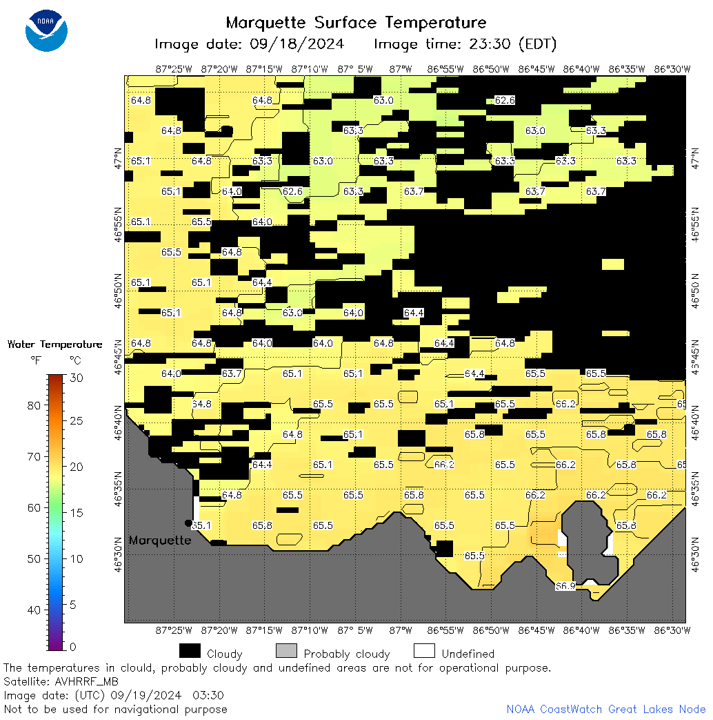 | s24_2024_09_19_0330.png | 19-Sep-2024 16:33 | 38500 | |
 | s24_2024_09_19_0340.png | 19-Sep-2024 16:35 | 20850 | |
 | s24_2024_09_19_1410.png | 20-Sep-2024 00:32 | 22181 | |
 | s24_2024_09_19_1500.png | 20-Sep-2024 01:32 | 40907 | |
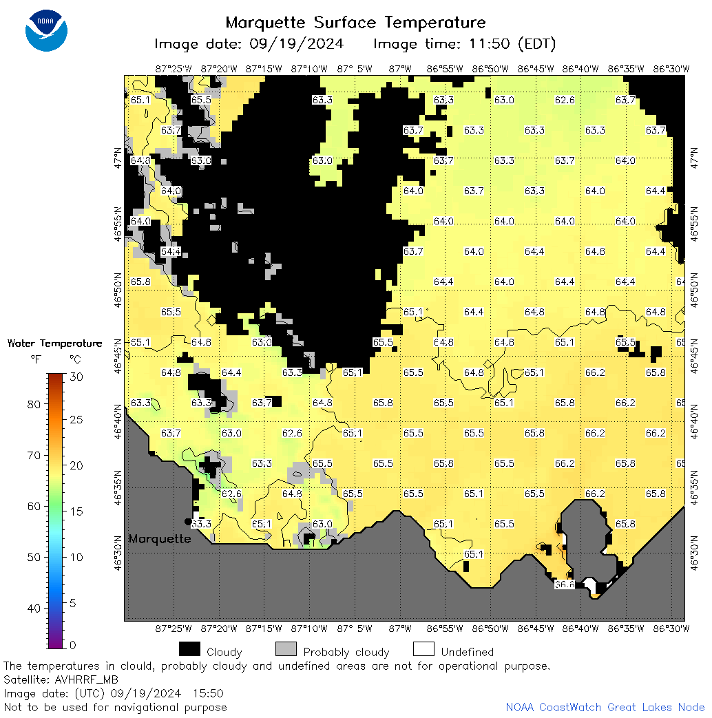 | s24_2024_09_19_1550.png | 20-Sep-2024 03:33 | 47658 | |
 | s24_2024_09_19_1640.png | 20-Sep-2024 03:35 | 55692 | |
 | s24_2024_263.png | 20-Sep-2024 09:16 | 38733 | |