
Easier access to scientific data

Brought to you by NOAA CoastWatch Great Lakes Node
|
ERDDAP
Easier access to scientific data |
|
Brought to you by NOAA CoastWatch Great Lakes Node |
| Dataset Title: | Lake Superior Marquette Surface Temperature Contour Map (2022-present)


|
| Institution: | CoastWatch Great Lakes Node (Dataset ID: LS_NRT_TC_s24) |
| Information: | Summary
| License
| Metadata
| Background | Subset
| Data Access Form
| Make a graph
| Subset
| Data Access Form
| Make a graph
|
![[ICO]](https://apps.glerl.noaa.gov/erddap/images/fileIcons/blank.gif) | Name | Last modified | Size | Description |
|---|---|---|---|---|
![[DIR]](https://apps.glerl.noaa.gov/erddap/images/fileIcons/back.gif) | Parent Directory | - | - | |
![[IMG]](https://apps.glerl.noaa.gov/erddap/images/fileIcons/image2.gif)  | s24_2024_08_22_0130.png | 22-Aug-2024 21:32 | 57790 | |
 | s24_2024_08_22_0220.png | 22-Aug-2024 22:37 | 22166 | |
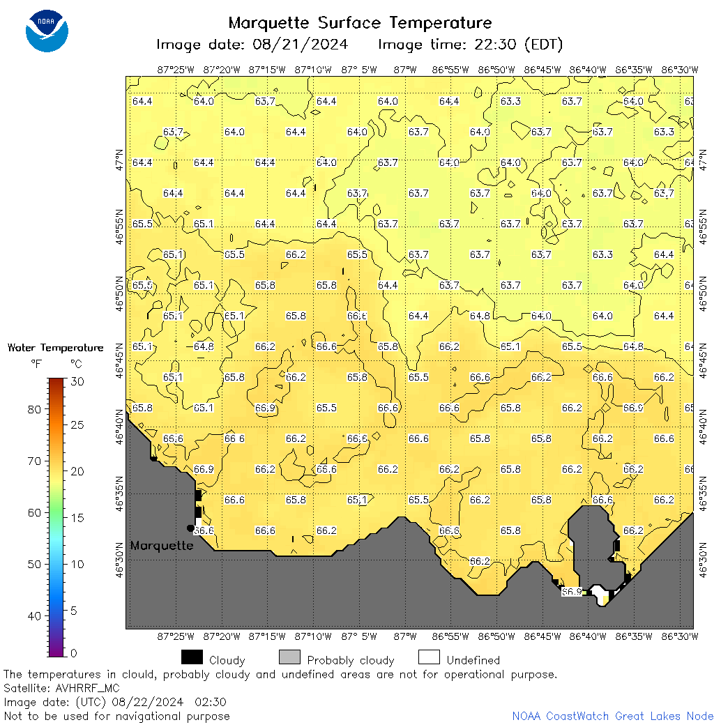 | s24_2024_08_22_0230.png | 22-Aug-2024 22:39 | 58030 | |
 | s24_2024_08_22_0310.png | 22-Aug-2024 22:41 | 54345 | |
 | s24_2024_08_22_0400.png | 22-Aug-2024 22:44 | 20838 | |
 | s24_2024_08_22_0410.png | 22-Aug-2024 22:46 | 22398 | |
 | s24_2024_08_22_0900.png | 22-Aug-2024 17:33 | 64240 | |
 | s24_2024_08_22_0950.png | 22-Aug-2024 17:36 | 20847 | |
 | s24_2024_08_22_1350.png | 22-Aug-2024 23:32 | 20842 | |
 | s24_2024_08_22_1440.png | 23-Aug-2024 00:32 | 39308 | |
 | s24_2024_08_22_1530.png | 23-Aug-2024 01:32 | 50764 | |
 | s24_2024_08_22_1620.png | 23-Aug-2024 02:32 | 52793 | |
 | s24_2024_08_22_1700.png | 22-Aug-2024 22:48 | 22559 | |
 | s24_2024_08_22_1710.png | 23-Aug-2024 03:32 | 22369 | |
 | s24_2024_235.png | 23-Aug-2024 09:16 | 36616 | |