
Easier access to scientific data

Brought to you by NOAA CoastWatch Great Lakes Node
|
ERDDAP
Easier access to scientific data |
|
Brought to you by NOAA CoastWatch Great Lakes Node |
| Dataset Title: | Lake Superior Marquette Surface Temperature Contour Map (2022-present)


|
| Institution: | CoastWatch Great Lakes Node (Dataset ID: LS_NRT_TC_s24) |
| Information: | Summary
| License
| Metadata
| Background | Subset
| Data Access Form
| Make a graph
| Subset
| Data Access Form
| Make a graph
|
![[ICO]](https://apps.glerl.noaa.gov/erddap/images/fileIcons/blank.gif) | Name | Last modified | Size | Description |
|---|---|---|---|---|
![[DIR]](https://apps.glerl.noaa.gov/erddap/images/fileIcons/back.gif) | Parent Directory | - | - | |
![[IMG]](https://apps.glerl.noaa.gov/erddap/images/fileIcons/image2.gif)  | s24_2024_05_10_0130.png | 10-May-2024 05:30 | 20827 | |
 | s24_2024_05_10_0140.png | 10-May-2024 05:32 | 26395 | |
 | s24_2024_05_10_0220.png | 10-May-2024 05:35 | 35889 | |
 | s24_2024_05_10_0230.png | 10-May-2024 05:37 | 20843 | |
 | s24_2024_05_10_0320.png | 10-May-2024 05:40 | 26540 | |
 | s24_2024_05_10_0650.png | 10-May-2024 13:29 | 63775 | |
 | s24_2024_05_10_0720.png | 10-May-2024 13:32 | 51032 | |
 | s24_2024_05_10_0830.png | 10-May-2024 13:34 | 54081 | |
 | s24_2024_05_10_0900.png | 10-May-2024 13:37 | 59657 | |
 | s24_2024_05_10_1440.png | 10-May-2024 18:26 | 23809 | |
 | s24_2024_05_10_1530.png | 10-May-2024 18:29 | 27235 | |
 | s24_2024_05_10_1620.png | 10-May-2024 19:27 | 22771 | |
 | s24_2024_05_10_1700.png | 10-May-2024 18:31 | 26769 | |
 | s24_2024_05_10_1710.png | 10-May-2024 20:27 | 24616 | |
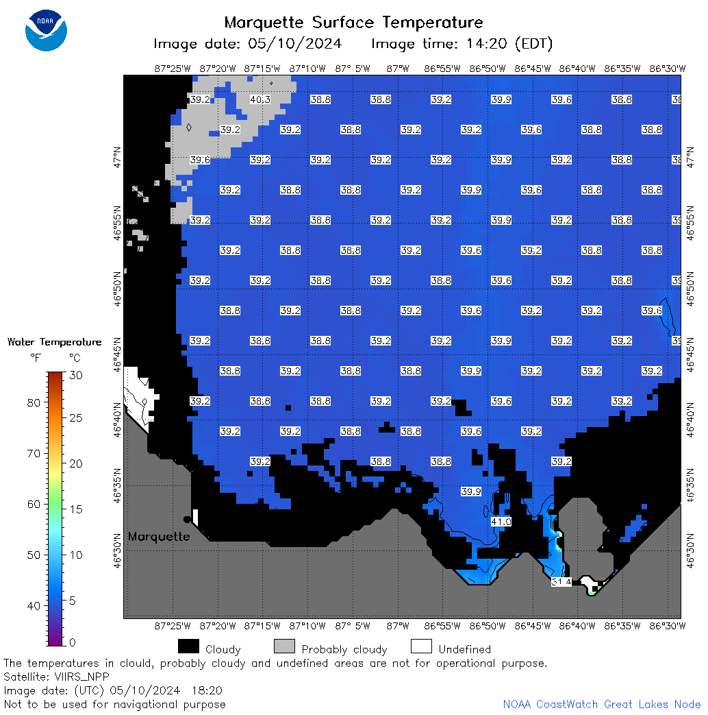 | s24_2024_05_10_1820.png | 10-May-2024 21:27 | 40070 | |
 | s24_2024_05_10_1840.png | 10-May-2024 20:30 | 39884 | |
 | s24_2024_131.png | 11-May-2024 09:16 | 36999 | |