
Easier access to scientific data

Brought to you by NOAA CoastWatch Great Lakes Node
|
ERDDAP
Easier access to scientific data |
|
Brought to you by NOAA CoastWatch Great Lakes Node |
| Dataset Title: | Lake Superior Marquette Surface Temperature Contour Map (2022-present)


|
| Institution: | CoastWatch Great Lakes Node (Dataset ID: LS_NRT_TC_s24) |
| Information: | Summary
| License
| Metadata
| Background | Subset
| Data Access Form
| Make a graph
| Subset
| Data Access Form
| Make a graph
|
![[ICO]](https://apps.glerl.noaa.gov/erddap/images/fileIcons/blank.gif) | Name | Last modified | Size | Description |
|---|---|---|---|---|
![[DIR]](https://apps.glerl.noaa.gov/erddap/images/fileIcons/back.gif) | Parent Directory | - | - | |
![[IMG]](https://apps.glerl.noaa.gov/erddap/images/fileIcons/image2.gif)  | s24_2024_03_14_0110.png | 14-Mar-2024 09:33 | 20835 | |
 | s24_2024_03_14_0120.png | 14-Mar-2024 09:35 | 50334 | |
 | s24_2024_03_14_0200.png | 14-Mar-2024 09:37 | 83200 | |
 | s24_2024_03_14_0210.png | 14-Mar-2024 09:39 | 20821 | |
 | s24_2024_03_14_0250.png | 14-Mar-2024 09:41 | 20831 | |
 | s24_2024_03_14_0300.png | 14-Mar-2024 09:44 | 72419 | |
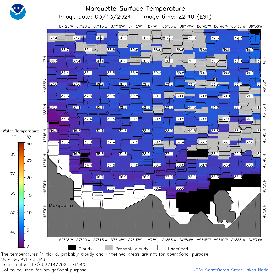 | s24_2024_03_14_0340.png | 14-Mar-2024 09:46 | 52242 | |
 | s24_2024_03_14_0350.png | 14-Mar-2024 09:48 | 20829 | |
 | s24_2024_03_14_0620.png | 14-Mar-2024 09:50 | 22160 | |
 | s24_2024_03_14_0710.png | 14-Mar-2024 09:52 | 57904 | |
 | s24_2024_03_14_0800.png | 14-Mar-2024 12:27 | 51292 | |
 | s24_2024_03_14_0850.png | 14-Mar-2024 12:29 | 69734 | |
 | s24_2024_03_14_0940.png | 14-Mar-2024 15:26 | 20836 | |
 | s24_2024_03_14_1420.png | 14-Mar-2024 18:26 | 22140 | |
 | s24_2024_03_14_1510.png | 14-Mar-2024 18:28 | 22120 | |
 | s24_2024_03_14_1600.png | 14-Mar-2024 18:31 | 22170 | |
 | s24_2024_074.png | 15-Mar-2024 11:16 | 38014 | |