
Easier access to scientific data

Brought to you by NOAA CoastWatch Great Lakes Node
|
ERDDAP
Easier access to scientific data |
|
Brought to you by NOAA CoastWatch Great Lakes Node |
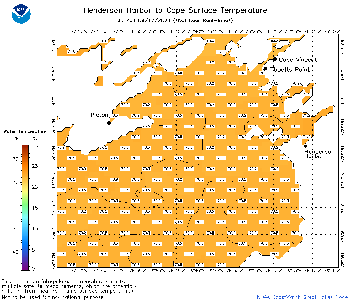
| Dataset Title: | Lake Ontario Henderson Harbor to Cape Vincent Surface Temperature Contour Map (2022-present) 

|
| Institution: | CoastWatch Great Lakes Node (Dataset ID: LO_NRT_TC_o23) |
| Information: | Summary
| License
| Metadata
| Background | Subset
| Data Access Form
| Make a graph
| Subset
| Data Access Form
| Make a graph
|
![[ICO]](https://apps.glerl.noaa.gov/erddap/images/fileIcons/blank.gif) | Name | Last modified | Size | Description |
|---|---|---|---|---|
![[DIR]](https://apps.glerl.noaa.gov/erddap/images/fileIcons/back.gif) | Parent Directory | - | - | |
![[IMG]](https://apps.glerl.noaa.gov/erddap/images/fileIcons/image2.gif)  | o23_2024_09_17_0150.png | 17-Sep-2024 13:34 | 62768 | |
 | o23_2024_09_17_0230.png | 17-Sep-2024 12:33 | 59092 | |
 | o23_2024_09_17_0240.png | 17-Sep-2024 13:36 | 26980 | |
 | o23_2024_09_17_0330.png | 17-Sep-2024 16:33 | 29926 | |
 | o23_2024_09_17_0550.png | 18-Sep-2024 00:35 | 28739 | |
 | o23_2024_09_17_0640.png | 18-Sep-2024 00:38 | 30126 | |
 | o23_2024_09_17_0910.png | 18-Sep-2024 00:40 | 26958 | |
 | o23_2024_09_17_0930.png | 18-Sep-2024 00:42 | 26952 | |
 | o23_2024_09_17_1740.png | 18-Sep-2024 03:34 | 53527 | |
 | o23_2024_09_17_1800.png | 18-Sep-2024 03:36 | 60331 | |
 | o23_2024_261.png | 18-Sep-2024 09:53 | 39108 | |