
Easier access to scientific data

Brought to you by NOAA CoastWatch Great Lakes Node
|
ERDDAP
Easier access to scientific data |
|
Brought to you by NOAA CoastWatch Great Lakes Node |
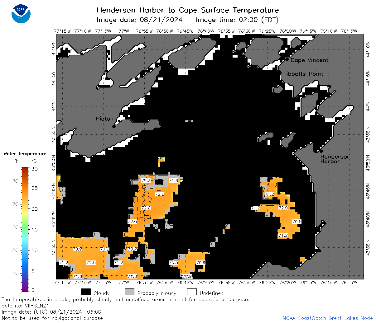
| Dataset Title: | Lake Ontario Henderson Harbor to Cape Vincent Surface Temperature Contour Map (2022-present) 

|
| Institution: | CoastWatch Great Lakes Node (Dataset ID: LO_NRT_TC_o23) |
| Information: | Summary
| License
| Metadata
| Background | Subset
| Data Access Form
| Make a graph
| Subset
| Data Access Form
| Make a graph
|
![[ICO]](https://apps.glerl.noaa.gov/erddap/images/fileIcons/blank.gif) | Name | Last modified | Size | Description |
|---|---|---|---|---|
![[DIR]](https://apps.glerl.noaa.gov/erddap/images/fileIcons/back.gif) | Parent Directory | - | - | |
![[IMG]](https://apps.glerl.noaa.gov/erddap/images/fileIcons/image2.gif)  | o23_2024_08_21_0100.png | 21-Aug-2024 16:44 | 27063 | |
 | o23_2024_08_21_0550.png | 21-Aug-2024 16:46 | 29240 | |
 | o23_2024_08_21_0600.png | 21-Aug-2024 16:48 | 41160 | |
 | o23_2024_08_21_0620.png | 21-Aug-2024 16:51 | 37974 | |
 | o23_2024_08_21_0640.png | 21-Aug-2024 16:53 | 36245 | |
 | o23_2024_08_21_0650.png | 21-Aug-2024 16:55 | 29931 | |
 | o23_2024_08_21_0730.png | 21-Aug-2024 16:57 | 26963 | |
 | o23_2024_08_21_0740.png | 21-Aug-2024 17:00 | 37720 | |
 | o23_2024_08_21_0800.png | 21-Aug-2024 17:02 | 37610 | |
 | o23_2024_08_21_0820.png | 21-Aug-2024 17:04 | 29397 | |
 | o23_2024_08_21_0830.png | 21-Aug-2024 17:06 | 29956 | |
 | o23_2024_08_21_0920.png | 21-Aug-2024 17:08 | 26976 | |
 | o23_2024_08_21_0940.png | 21-Aug-2024 17:10 | 26986 | |
 | o23_2024_08_21_1810.png | 21-Aug-2024 22:33 | 30345 | |
 | o23_2024_08_21_1950.png | 22-Aug-2024 03:32 | 26976 | |
 | o23_2024_234.png | 22-Aug-2024 09:35 | 40804 | |