
Easier access to scientific data

Brought to you by NOAA CoastWatch Great Lakes Node
|
ERDDAP
Easier access to scientific data |
|
Brought to you by NOAA CoastWatch Great Lakes Node |
| Dataset Title: | Lake Ontario Henderson Harbor to Cape Vincent Surface Temperature Contour Map (2022-present) 

|
| Institution: | CoastWatch Great Lakes Node (Dataset ID: LO_NRT_TC_o23) |
| Information: | Summary
| License
| Metadata
| Background | Subset
| Data Access Form
| Make a graph
| Subset
| Data Access Form
| Make a graph
|
![[ICO]](https://apps.glerl.noaa.gov/erddap/images/fileIcons/blank.gif) | Name | Last modified | Size | Description |
|---|---|---|---|---|
![[DIR]](https://apps.glerl.noaa.gov/erddap/images/fileIcons/back.gif) | Parent Directory | - | - | |
![[IMG]](https://apps.glerl.noaa.gov/erddap/images/fileIcons/image2.gif) 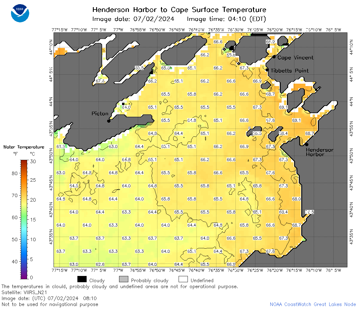 | o23_2024_07_02_0810.png | 03-Jul-2024 15:41 | 65597 | |
 | o23_2024_07_02_0840.png | 03-Jul-2024 15:43 | 29931 | |
 | o23_2024_07_02_0900.png | 03-Jul-2024 15:46 | 26955 | |
 | o23_2024_07_02_1640.png | 03-Jul-2024 15:48 | 35224 | |
 | o23_2024_07_02_1940.png | 03-Jul-2024 15:51 | 26951 | |
 | o23_2024_07_02_2000.png | 03-Jul-2024 15:53 | 26939 | |
 | o23_2024_184.png | 03-Jul-2024 09:35 | 44608 | |