
Easier access to scientific data

Brought to you by NOAA CoastWatch Great Lakes Node
|
ERDDAP
Easier access to scientific data |
|
Brought to you by NOAA CoastWatch Great Lakes Node |
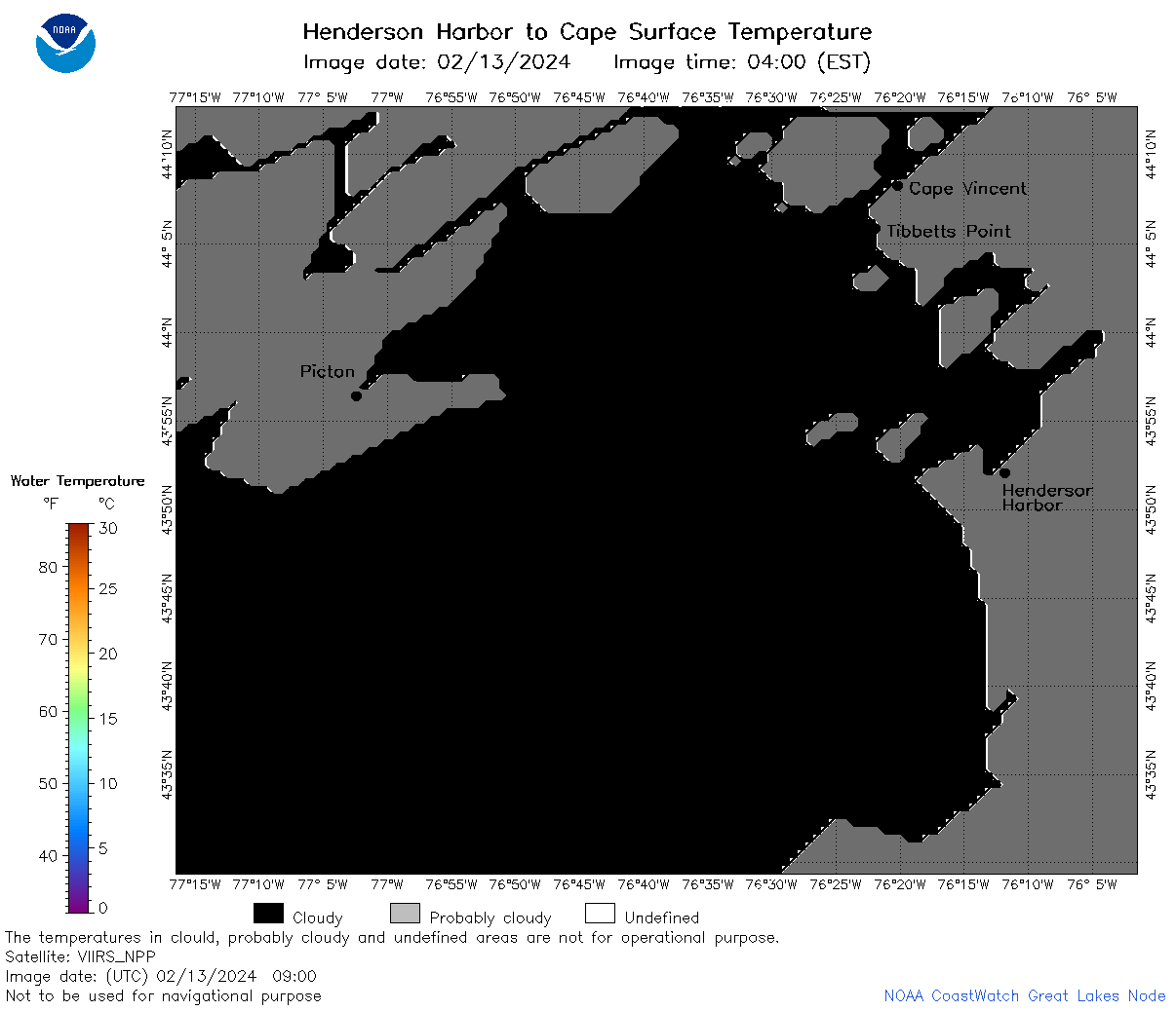
| Dataset Title: | Lake Ontario Henderson Harbor to Cape Vincent Surface Temperature Contour Map (2022-present) 

|
| Institution: | CoastWatch Great Lakes Node (Dataset ID: LO_NRT_TC_o23) |
| Information: | Summary
| License
| Metadata
| Background | Subset
| Data Access Form
| Make a graph
| Subset
| Data Access Form
| Make a graph
|
![[ICO]](https://apps.glerl.noaa.gov/erddap/images/fileIcons/blank.gif) | Name | Last modified | Size | Description |
|---|---|---|---|---|
![[DIR]](https://apps.glerl.noaa.gov/erddap/images/fileIcons/back.gif) | Parent Directory | - | - | |
![[IMG]](https://apps.glerl.noaa.gov/erddap/images/fileIcons/image2.gif)  | o23_2024_02_13_0130.png | 13-Feb-2024 06:41 | 27074 | |
 | o23_2024_02_13_0140.png | 13-Feb-2024 06:48 | 50362 | |
 | o23_2024_02_13_0220.png | 13-Feb-2024 06:54 | 53018 | |
 | o23_2024_02_13_0230.png | 13-Feb-2024 07:00 | 26950 | |
 | o23_2024_02_13_0320.png | 13-Feb-2024 07:07 | 29899 | |
 | o23_2024_02_13_0630.png | 13-Feb-2024 13:44 | 31699 | |
 | o23_2024_02_13_0720.png | 13-Feb-2024 13:50 | 31188 | |
 | o23_2024_02_13_0730.png | 13-Feb-2024 13:56 | 26949 | |
 | o23_2024_02_13_0810.png | 13-Feb-2024 14:03 | 30560 | |
 | o23_2024_02_13_0820.png | 13-Feb-2024 14:09 | 26963 | |
 | o23_2024_02_13_0900.png | 13-Feb-2024 14:16 | 26960 | |
 | o23_2024_02_13_0910.png | 13-Feb-2024 14:22 | 26955 | |
 | o23_2024_02_13_1440.png | 13-Feb-2024 18:32 | 54298 | |
 | o23_2024_02_13_1530.png | 13-Feb-2024 20:39 | 50080 | |
 | o23_2024_02_13_1620.png | 13-Feb-2024 20:45 | 29358 | |
 | o23_2024_02_13_1710.png | 13-Feb-2024 20:58 | 41879 | |
 | o23_2024_02_13_1800.png | 13-Feb-2024 21:05 | 46624 | |
 | o23_2024_02_13_1850.png | 13-Feb-2024 22:32 | 43262 | |
 | o23_2024_02_13_1940.png | 13-Feb-2024 21:32 | 26971 | |
 | o23_2024_044.png | 14-Feb-2024 11:19 | 48052 | |