
Easier access to scientific data

Brought to you by NOAA CoastWatch Great Lakes Node
|
ERDDAP
Easier access to scientific data |
|
Brought to you by NOAA CoastWatch Great Lakes Node |
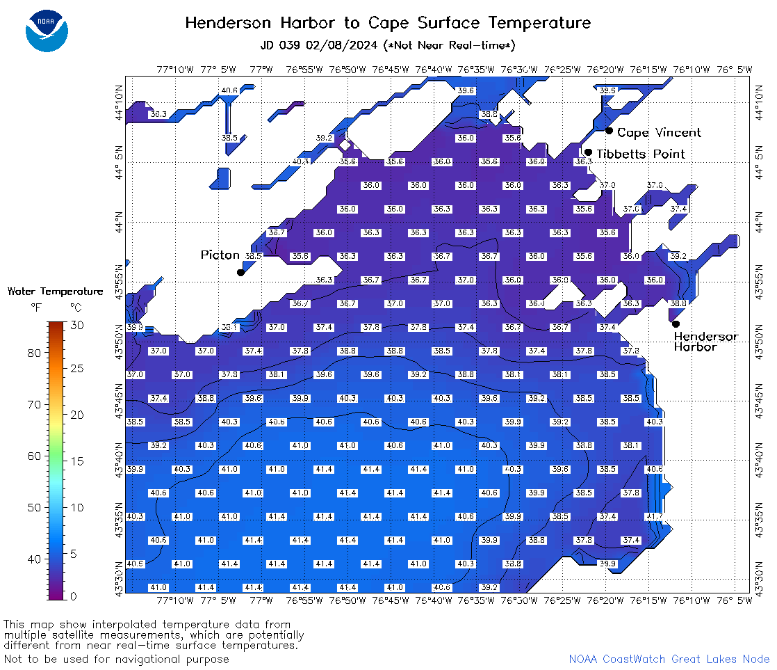
| Dataset Title: | Lake Ontario Henderson Harbor to Cape Vincent Surface Temperature Contour Map (2022-present) 

|
| Institution: | CoastWatch Great Lakes Node (Dataset ID: LO_NRT_TC_o23) |
| Information: | Summary
| License
| Metadata
| Background | Subset
| Data Access Form
| Make a graph
| Subset
| Data Access Form
| Make a graph
|
![[ICO]](https://apps.glerl.noaa.gov/erddap/images/fileIcons/blank.gif) | Name | Last modified | Size | Description |
|---|---|---|---|---|
![[DIR]](https://apps.glerl.noaa.gov/erddap/images/fileIcons/back.gif) | Parent Directory | - | - | |
![[IMG]](https://apps.glerl.noaa.gov/erddap/images/fileIcons/image2.gif)  | o23_2024_02_08_0140.png | 08-Feb-2024 14:37 | 31673 | |
 | o23_2024_02_08_0230.png | 08-Feb-2024 09:34 | 32299 | |
 | o23_2024_02_08_0320.png | 08-Feb-2024 09:41 | 29897 | |
 | o23_2024_02_08_0720.png | 08-Feb-2024 14:43 | 38916 | |
 | o23_2024_02_08_0900.png | 08-Feb-2024 14:49 | 26950 | |
 | o23_2024_02_08_1440.png | 08-Feb-2024 18:32 | 54354 | |
 | o23_2024_02_08_1710.png | 08-Feb-2024 23:34 | 26941 | |
 | o23_2024_02_08_1720.png | 08-Feb-2024 23:40 | 26939 | |
 | o23_2024_039.png | 09-Feb-2024 11:20 | 47273 | |