
Easier access to scientific data

Brought to you by NOAA CoastWatch Great Lakes Node
|
ERDDAP
Easier access to scientific data |
|
Brought to you by NOAA CoastWatch Great Lakes Node |
| Dataset Title: | Lake Ontario Henderson Harbor to Cape Vincent Surface Temperature Contour Map (2022-present) 

|
| Institution: | CoastWatch Great Lakes Node (Dataset ID: LO_NRT_TC_o23) |
| Information: | Summary
| License
| Metadata
| Background | Subset
| Data Access Form
| Make a graph
| Subset
| Data Access Form
| Make a graph
|
![[ICO]](https://apps.glerl.noaa.gov/erddap/images/fileIcons/blank.gif) | Name | Last modified | Size | Description |
|---|---|---|---|---|
![[DIR]](https://apps.glerl.noaa.gov/erddap/images/fileIcons/back.gif) | Parent Directory | - | - | |
![[IMG]](https://apps.glerl.noaa.gov/erddap/images/fileIcons/image2.gif)  | o23_2024_02_06_0130.png | 06-Feb-2024 06:37 | 72165 | |
 | o23_2024_02_06_0220.png | 06-Feb-2024 06:44 | 58357 | |
 | o23_2024_02_06_0310.png | 06-Feb-2024 06:50 | 33030 | |
 | o23_2024_02_06_0610.png | 06-Feb-2024 10:34 | 63567 | |
 | o23_2024_02_06_0620.png | 06-Feb-2024 10:41 | 27067 | |
 | o23_2024_02_06_0750.png | 06-Feb-2024 10:47 | 53127 | |
 | o23_2024_02_06_0800.png | 06-Feb-2024 10:53 | 43414 | |
 | o23_2024_02_06_1430.png | 06-Feb-2024 18:32 | 30374 | |
 | o23_2024_02_06_1440.png | 06-Feb-2024 18:39 | 55323 | |
 | o23_2024_02_06_1520.png | 06-Feb-2024 18:45 | 57879 | |
 | o23_2024_02_06_1530.png | 06-Feb-2024 18:51 | 26987 | |
 | o23_2024_02_06_1610.png | 06-Feb-2024 19:36 | 29224 | |
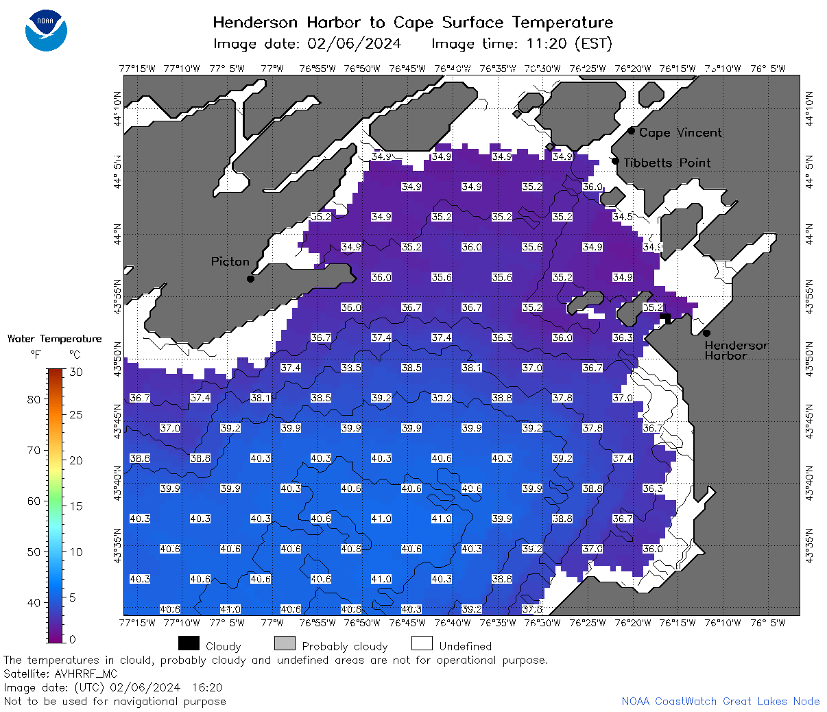 | o23_2024_02_06_1620.png | 06-Feb-2024 19:43 | 55968 | |
 | o23_2024_02_06_1700.png | 06-Feb-2024 19:49 | 26970 | |
 | o23_2024_02_06_1740.png | 06-Feb-2024 19:56 | 57215 | |
 | o23_2024_02_06_1920.png | 07-Feb-2024 00:32 | 29919 | |
 | o23_2024_037.png | 07-Feb-2024 11:20 | 46652 | |