
Easier access to scientific data

Brought to you by NOAA CoastWatch Great Lakes Node
|
ERDDAP
Easier access to scientific data |
|
Brought to you by NOAA CoastWatch Great Lakes Node |
| Dataset Title: | Lake Ontario Henderson Harbor to Cape Vincent Surface Temperature Contour Map (2022-present) 

|
| Institution: | CoastWatch Great Lakes Node (Dataset ID: LO_NRT_TC_o23) |
| Information: | Summary
| License
| Metadata
| Background | Subset
| Data Access Form
| Make a graph
| Subset
| Data Access Form
| Make a graph
|
![[ICO]](https://apps.glerl.noaa.gov/erddap/images/fileIcons/blank.gif) | Name | Last modified | Size | Description |
|---|---|---|---|---|
![[DIR]](https://apps.glerl.noaa.gov/erddap/images/fileIcons/back.gif) | Parent Directory | - | - | |
![[IMG]](https://apps.glerl.noaa.gov/erddap/images/fileIcons/image2.gif)  | o23_2022_11_10_0150.png | 13-Dec-2022 00:50 | 42750 | |
 | o23_2022_11_10_0240.png | 13-Dec-2022 00:53 | 44738 | |
 | o23_2022_11_10_0610.png | 13-Dec-2022 00:55 | 43746 | |
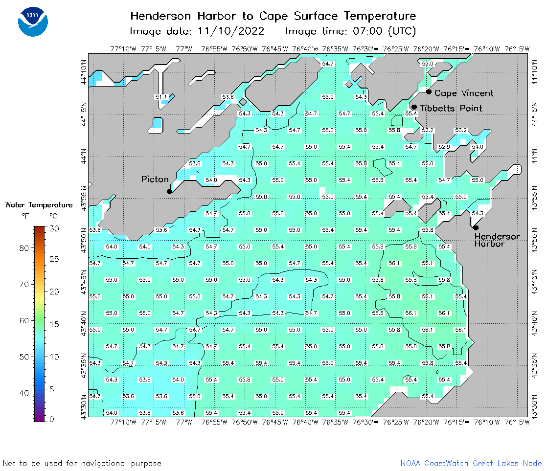 | o23_2022_11_10_0700.png | 13-Dec-2022 00:57 | 43302 | |
 | o23_2022_11_10_0750.png | 13-Dec-2022 01:00 | 42102 | |
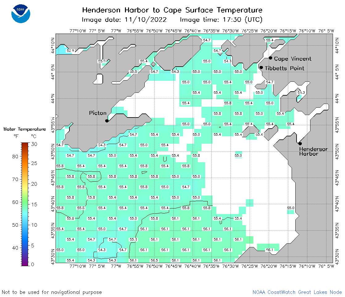 | o23_2022_11_10_1730.png | 13-Dec-2022 01:07 | 37559 | |
 | o23_2022_11_10_1820.png | 13-Dec-2022 01:09 | 40218 | |
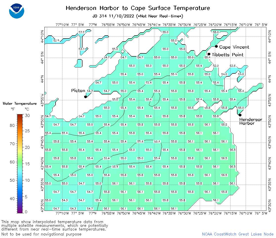 | o23_2022_314.png | 11-Nov-2022 11:21 | 40130 | |