
Easier access to scientific data

Brought to you by NOAA CoastWatch Great Lakes Node
|
ERDDAP
Easier access to scientific data |
|
Brought to you by NOAA CoastWatch Great Lakes Node |
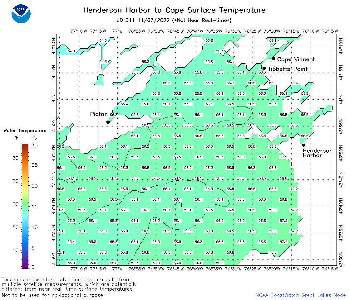
| Dataset Title: | Lake Ontario Henderson Harbor to Cape Vincent Surface Temperature Contour Map (2022-present) 

|
| Institution: | CoastWatch Great Lakes Node (Dataset ID: LO_NRT_TC_o23) |
| Information: | Summary
| License
| Metadata
| Background | Subset
| Data Access Form
| Make a graph
| Subset
| Data Access Form
| Make a graph
|
![[ICO]](https://apps.glerl.noaa.gov/erddap/images/fileIcons/blank.gif) | Name | Last modified | Size | Description |
|---|---|---|---|---|
![[DIR]](https://apps.glerl.noaa.gov/erddap/images/fileIcons/back.gif) | Parent Directory | - | - | |
![[IMG]](https://apps.glerl.noaa.gov/erddap/images/fileIcons/image2.gif)  | o23_2022_11_07_0610.png | 12-Dec-2022 23:50 | 41785 | |
 | o23_2022_11_07_0710.png | 12-Dec-2022 23:53 | 43071 | |
 | o23_2022_11_07_0750.png | 12-Dec-2022 23:55 | 43140 | |
 | o23_2022_11_07_1420.png | 13-Dec-2022 00:00 | 39091 | |
 | o23_2022_11_07_1510.png | 13-Dec-2022 00:03 | 41125 | |
 | o23_2022_11_07_1600.png | 13-Dec-2022 00:06 | 40147 | |
 | o23_2022_11_07_1740.png | 13-Dec-2022 00:11 | 42126 | |
 | o23_2022_11_07_1830.png | 13-Dec-2022 00:15 | 42286 | |
 | o23_2022_311.png | 08-Nov-2022 11:22 | 39326 | |