
Easier access to scientific data

Brought to you by NOAA CoastWatch Great Lakes Node
|
ERDDAP
Easier access to scientific data |
|
Brought to you by NOAA CoastWatch Great Lakes Node |
| Dataset Title: | Lake Ontario Wetern Region Surface Temperature Contour Map (2022-present)


|
| Institution: | CoastWatch Great Lakes Node (Dataset ID: LO_NRT_TC_o1) |
| Information: | Summary
| License
| Metadata
| Background | Subset
| Data Access Form
| Make a graph
| Subset
| Data Access Form
| Make a graph
|
![[ICO]](https://apps.glerl.noaa.gov/erddap/images/fileIcons/blank.gif) | Name | Last modified | Size | Description |
|---|---|---|---|---|
![[DIR]](https://apps.glerl.noaa.gov/erddap/images/fileIcons/back.gif) | Parent Directory | - | - | |
![[IMG]](https://apps.glerl.noaa.gov/erddap/images/fileIcons/image2.gif)  | o1_2023_11_17_0100.png | 17-Nov-2023 06:26 | 41273 | |
 | o1_2023_11_17_0200.png | 17-Nov-2023 06:28 | 43606 | |
 | o1_2023_11_17_0240.png | 17-Nov-2023 06:30 | 37346 | |
 | o1_2023_11_17_0340.png | 17-Nov-2023 06:32 | 19781 | |
 | o1_2023_11_17_0630.png | 17-Nov-2023 10:26 | 20569 | |
 | o1_2023_11_17_0720.png | 17-Nov-2023 10:28 | 20573 | |
 | o1_2023_11_17_0810.png | 17-Nov-2023 12:26 | 20548 | |
 | o1_2023_11_17_0820.png | 17-Nov-2023 12:28 | 19750 | |
 | o1_2023_11_17_0900.png | 17-Nov-2023 11:26 | 19746 | |
 | o1_2023_11_17_0910.png | 17-Nov-2023 12:30 | 19744 | |
 | o1_2023_11_17_1410.png | 17-Nov-2023 18:26 | 20486 | |
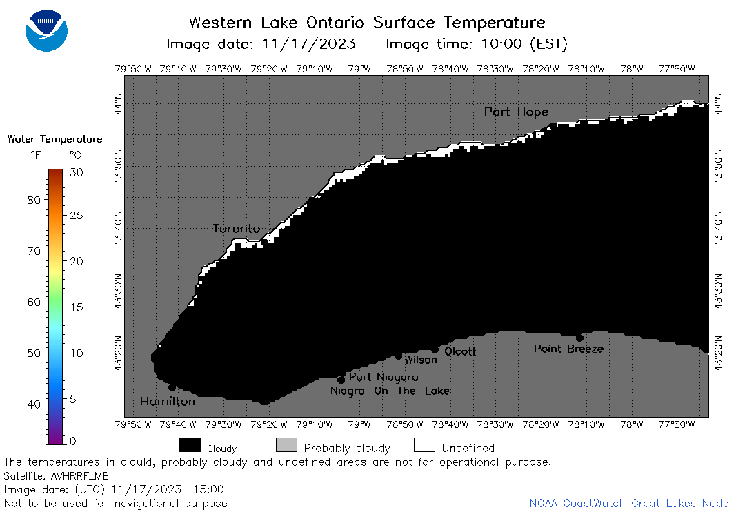 | o1_2023_11_17_1500.png | 17-Nov-2023 18:28 | 20564 | |
 | o1_2023_11_17_1550.png | 17-Nov-2023 19:26 | 20522 | |
 | o1_2023_11_17_1640.png | 17-Nov-2023 19:28 | 21001 | |
 | o1_2023_11_17_1710.png | 17-Nov-2023 19:30 | 20505 | |
 | o1_2023_11_17_1800.png | 17-Nov-2023 21:26 | 20571 | |
 | o1_2023_321.png | 18-Nov-2023 10:17 | 31088 | |