
Easier access to scientific data

Brought to you by NOAA CoastWatch Great Lakes Node
|
ERDDAP
Easier access to scientific data |
|
Brought to you by NOAA CoastWatch Great Lakes Node |
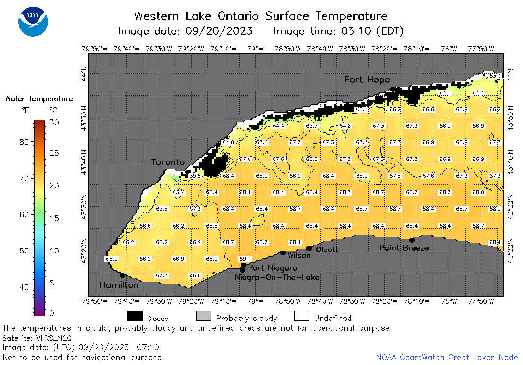
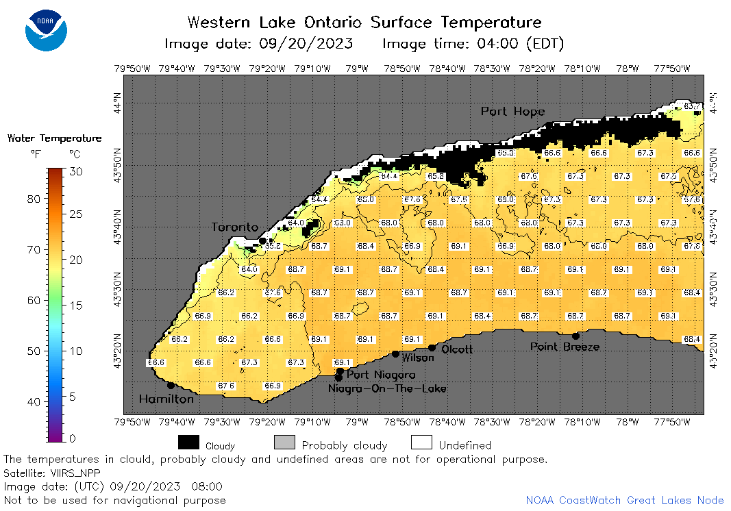
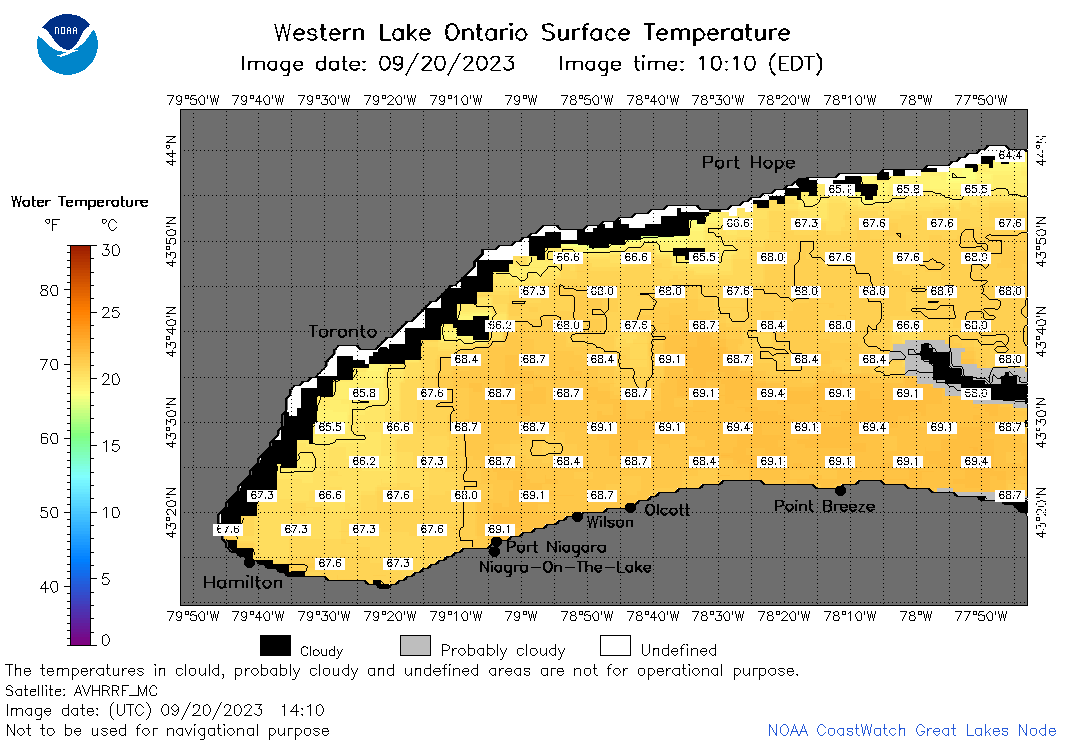
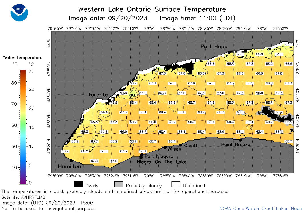
| Dataset Title: | Lake Ontario Wetern Region Surface Temperature Contour Map (2022-present)


|
| Institution: | CoastWatch Great Lakes Node (Dataset ID: LO_NRT_TC_o1) |
| Information: | Summary
| License
| Metadata
| Background | Subset
| Data Access Form
| Make a graph
| Subset
| Data Access Form
| Make a graph
|
![[ICO]](https://apps.glerl.noaa.gov/erddap/images/fileIcons/blank.gif) | Name | Last modified | Size | Description |
|---|---|---|---|---|
![[DIR]](https://apps.glerl.noaa.gov/erddap/images/fileIcons/back.gif) | Parent Directory | - | - | |
![[IMG]](https://apps.glerl.noaa.gov/erddap/images/fileIcons/image2.gif) 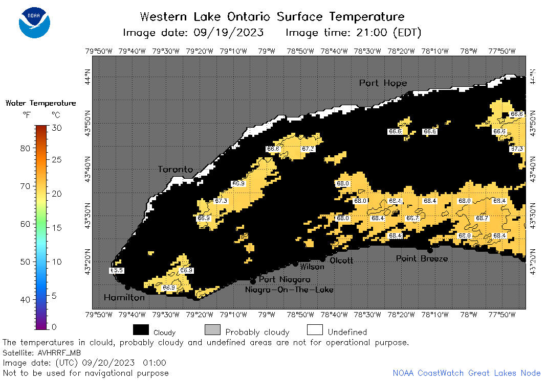 | o1_2023_09_20_0100.png | 20-Sep-2023 05:25 | 29875 | |
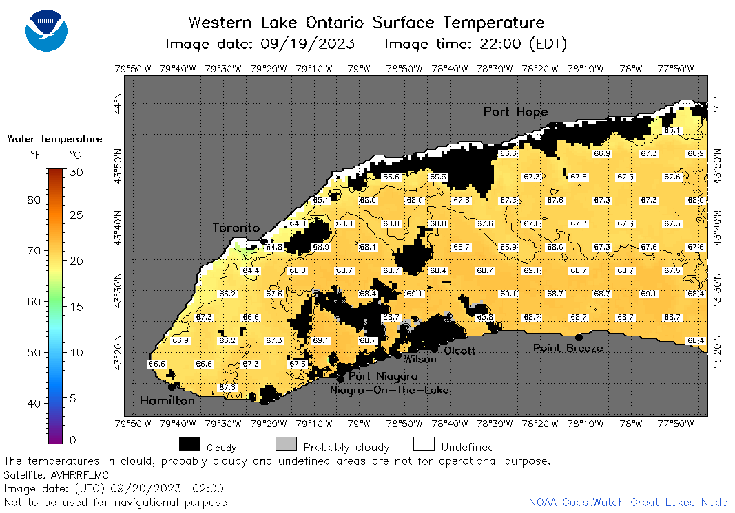 | o1_2023_09_20_0200.png | 20-Sep-2023 05:31 | 44286 | |
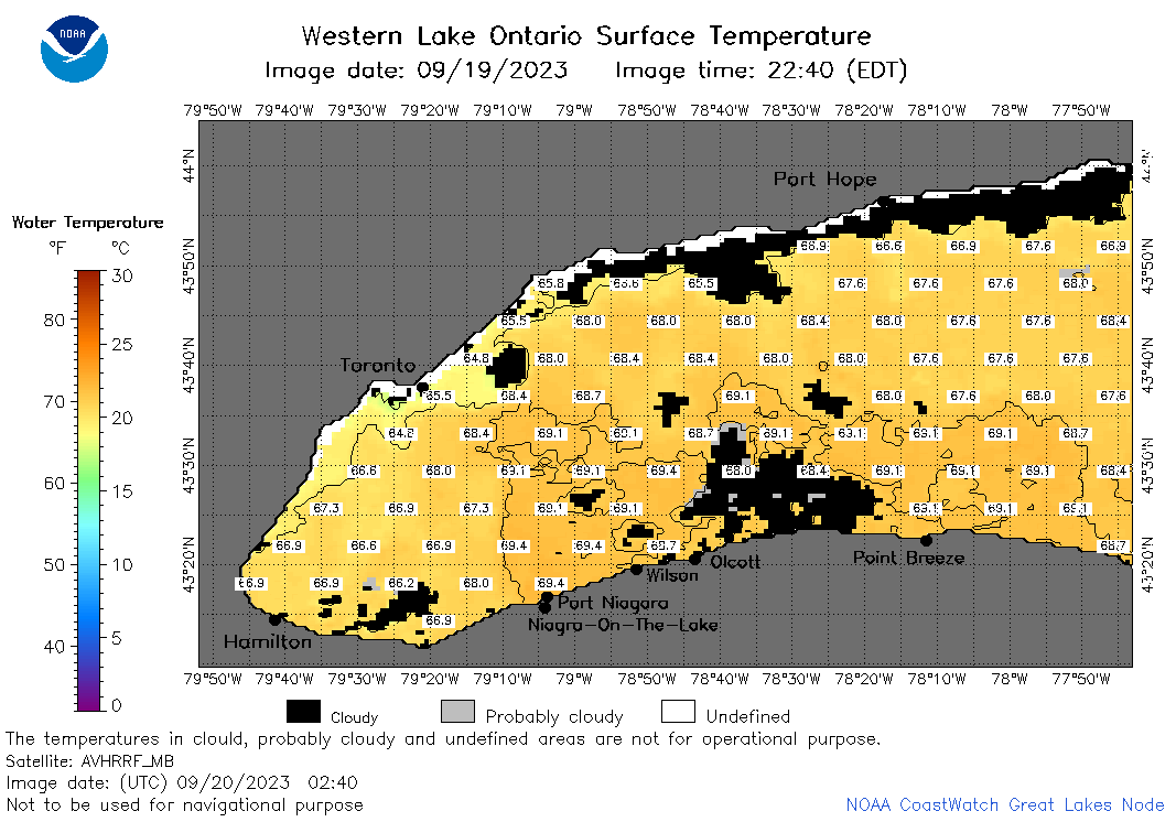 | o1_2023_09_20_0240.png | 20-Sep-2023 05:34 | 42515 | |
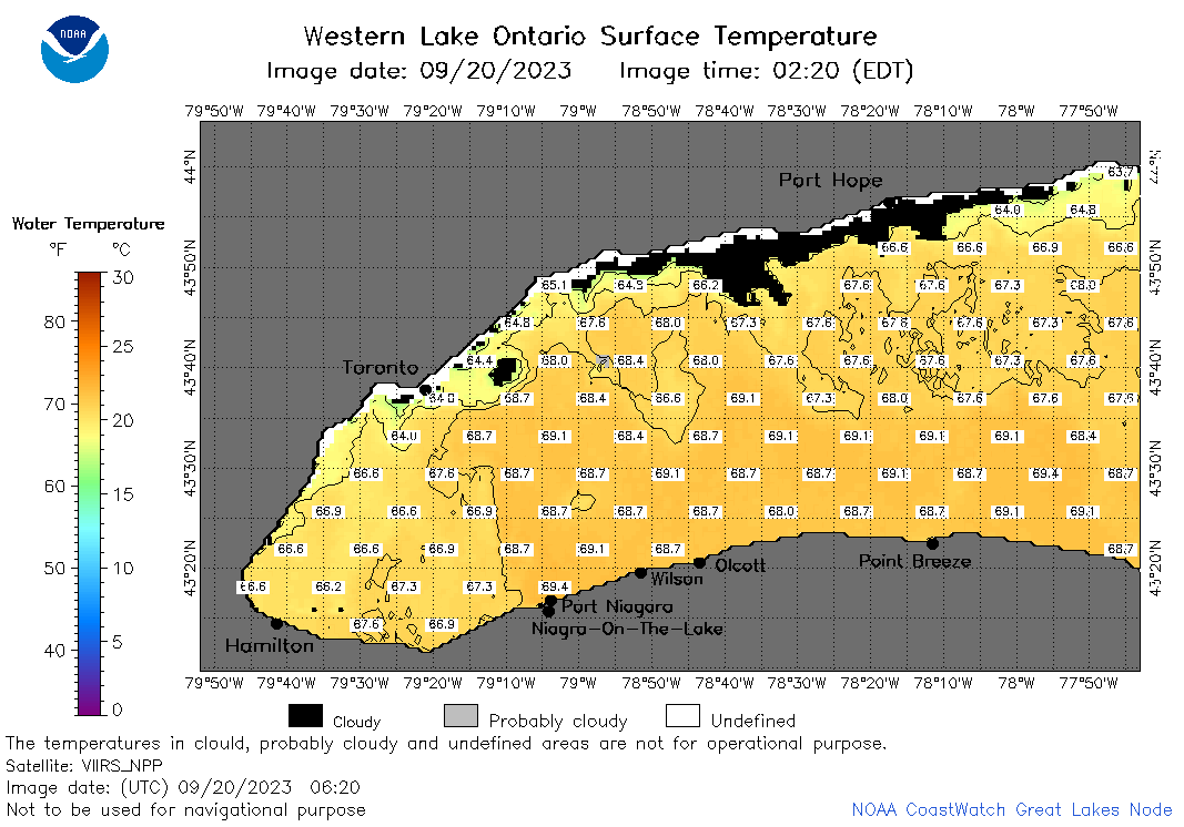 | o1_2023_09_20_0620.png | 20-Sep-2023 10:26 | 46493 | |
 | o1_2023_09_20_0710.png | 20-Sep-2023 10:28 | 43438 | |
 | o1_2023_09_20_0800.png | 20-Sep-2023 12:26 | 45916 | |
 | o1_2023_09_20_1410.png | 20-Sep-2023 18:26 | 36361 | |
 | o1_2023_09_20_1500.png | 20-Sep-2023 18:28 | 43393 | |
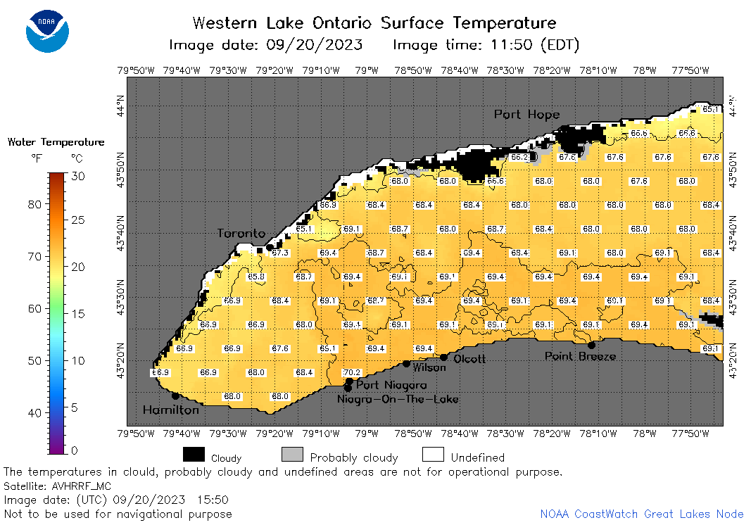 | o1_2023_09_20_1550.png | 20-Sep-2023 19:26 | 41291 | |
 | o1_2023_09_20_1700.png | 20-Sep-2023 19:28 | 45450 | |
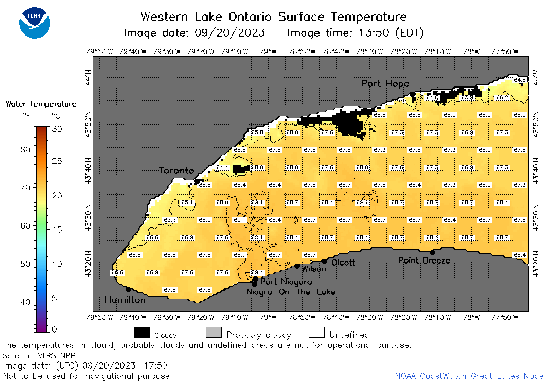 | o1_2023_09_20_1750.png | 20-Sep-2023 22:26 | 40029 | |
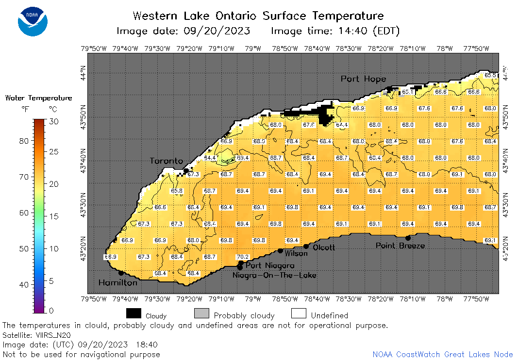 | o1_2023_09_20_1840.png | 20-Sep-2023 22:28 | 41630 | |
 | o1_2023_263.png | 21-Sep-2023 09:17 | 28832 | |