
Easier access to scientific data

Brought to you by NOAA CoastWatch Great Lakes Node
|
ERDDAP
Easier access to scientific data |
|
Brought to you by NOAA CoastWatch Great Lakes Node |
| Dataset Title: | Lake Ontario Wetern Region Surface Temperature Contour Map (2022-present)


|
| Institution: | CoastWatch Great Lakes Node (Dataset ID: LO_NRT_TC_o1) |
| Information: | Summary
| License
| Metadata
| Background | Subset
| Data Access Form
| Make a graph
| Subset
| Data Access Form
| Make a graph
|
![[ICO]](https://apps.glerl.noaa.gov/erddap/images/fileIcons/blank.gif) | Name | Last modified | Size | Description |
|---|---|---|---|---|
![[DIR]](https://apps.glerl.noaa.gov/erddap/images/fileIcons/back.gif) | Parent Directory | - | - | |
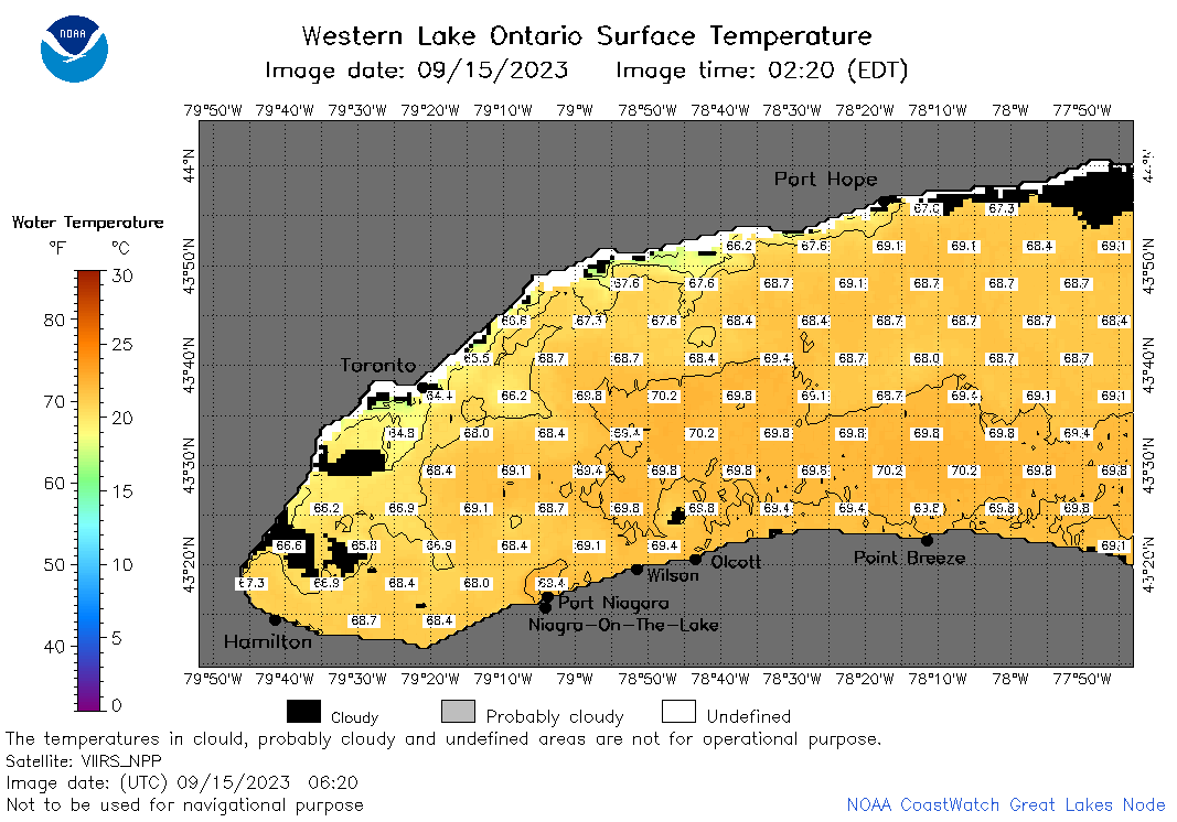
![[IMG]](https://apps.glerl.noaa.gov/erddap/images/fileIcons/image2.gif)  | o1_2023_09_15_0200.png | 15-Sep-2023 05:28 | 37771 | |
 | o1_2023_09_15_0250.png | 15-Sep-2023 05:30 | 39163 | |
 | o1_2023_09_15_0620.png | 15-Sep-2023 18:27 | 45807 | |
 | o1_2023_09_15_0710.png | 15-Sep-2023 10:28 | 43490 | |
 | o1_2023_09_15_0800.png | 15-Sep-2023 18:30 | 44230 | |
 | o1_2023_09_15_1410.png | 15-Sep-2023 18:32 | 25219 | |
 | o1_2023_09_15_1420.png | 15-Sep-2023 18:34 | 32504 | |
 | o1_2023_09_15_1500.png | 15-Sep-2023 18:36 | 41734 | |
 | o1_2023_09_15_1600.png | 15-Sep-2023 20:29 | 41264 | |
 | o1_2023_09_15_1740.png | 15-Sep-2023 20:34 | 41108 | |
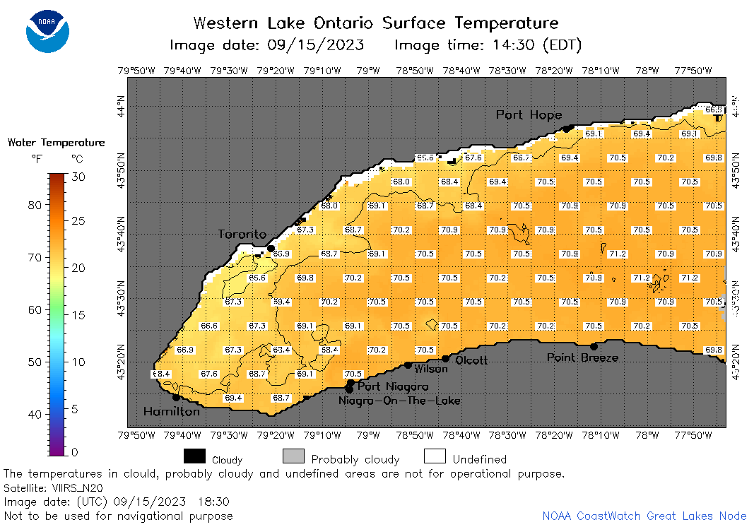 | o1_2023_09_15_1830.png | 15-Sep-2023 21:26 | 39833 | |
 | o1_2023_09_15_1920.png | 15-Sep-2023 22:26 | 28725 | |