
Easier access to scientific data

Brought to you by NOAA CoastWatch Great Lakes Node
|
ERDDAP
Easier access to scientific data |
|
Brought to you by NOAA CoastWatch Great Lakes Node |
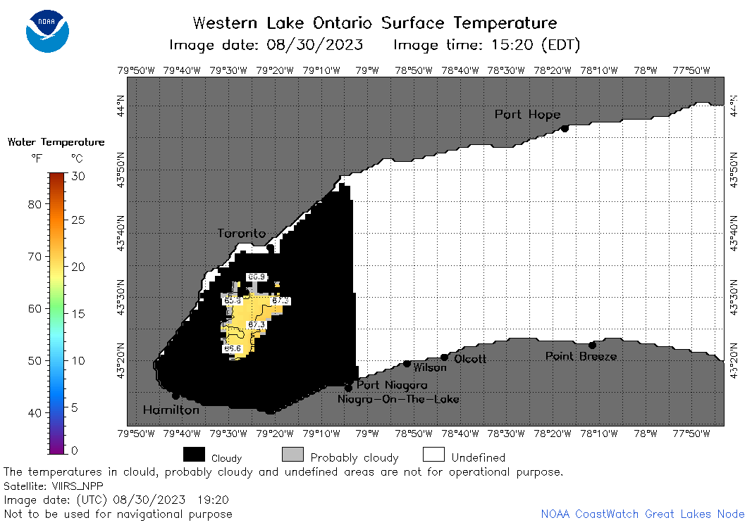
| Dataset Title: | Lake Ontario Wetern Region Surface Temperature Contour Map (2022-present)


|
| Institution: | CoastWatch Great Lakes Node (Dataset ID: LO_NRT_TC_o1) |
| Information: | Summary
| License
| Metadata
| Background | Subset
| Data Access Form
| Make a graph
| Subset
| Data Access Form
| Make a graph
|
![[ICO]](https://apps.glerl.noaa.gov/erddap/images/fileIcons/blank.gif) | Name | Last modified | Size | Description |
|---|---|---|---|---|
![[DIR]](https://apps.glerl.noaa.gov/erddap/images/fileIcons/back.gif) | Parent Directory | - | - | |
![[IMG]](https://apps.glerl.noaa.gov/erddap/images/fileIcons/image2.gif) 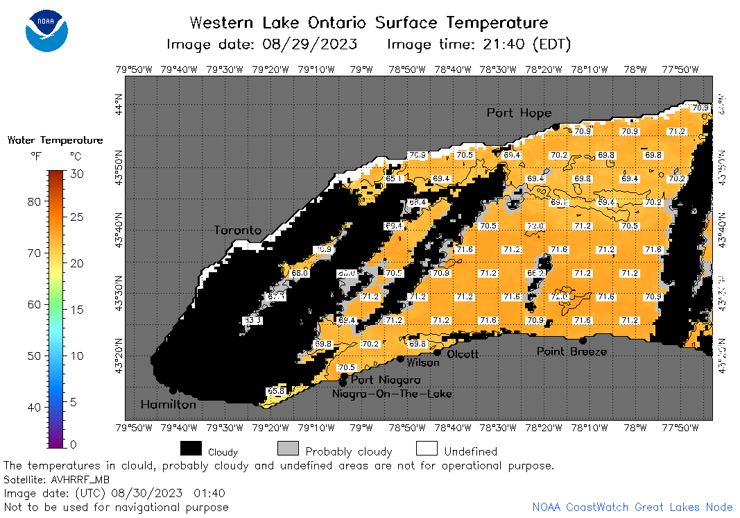 | o1_2023_08_30_0140.png | 30-Aug-2023 05:26 | 44191 | |
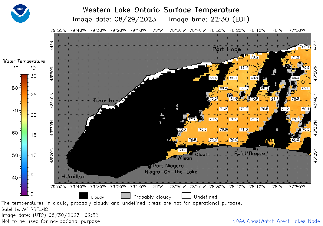 | o1_2023_08_30_0230.png | 30-Aug-2023 05:28 | 35176 | |
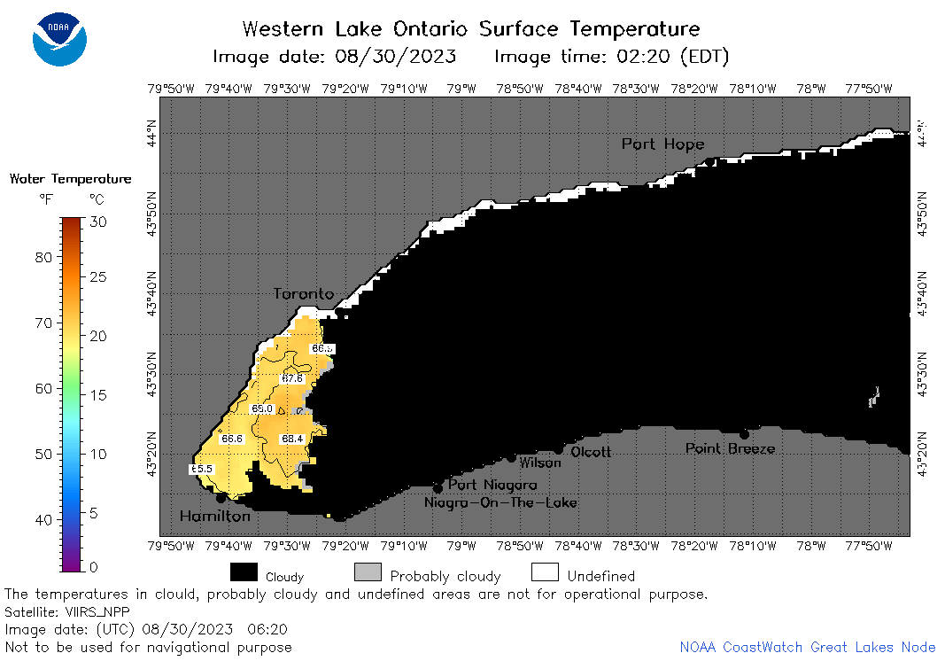 | o1_2023_08_30_0620.png | 30-Aug-2023 10:27 | 24420 | |
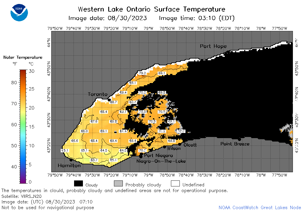 | o1_2023_08_30_0710.png | 30-Aug-2023 10:32 | 35714 | |
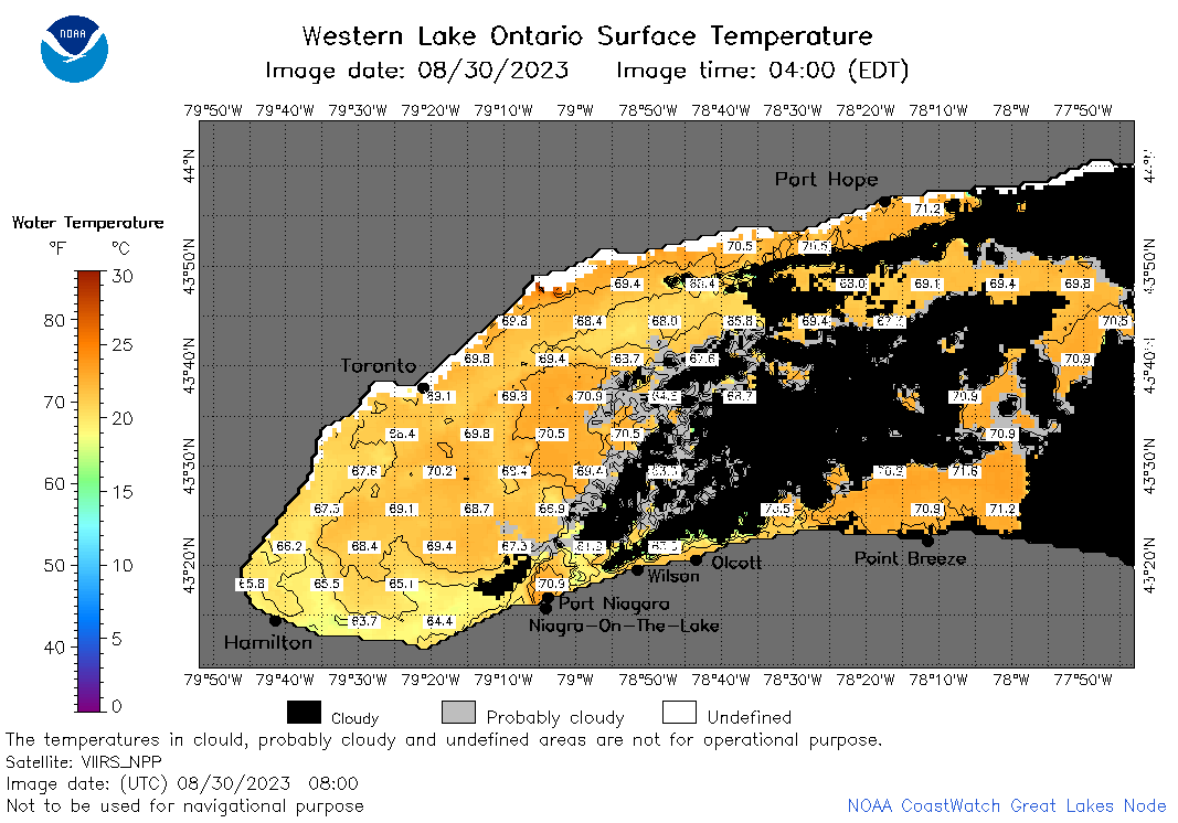 | o1_2023_08_30_0800.png | 30-Aug-2023 11:28 | 51582 | |
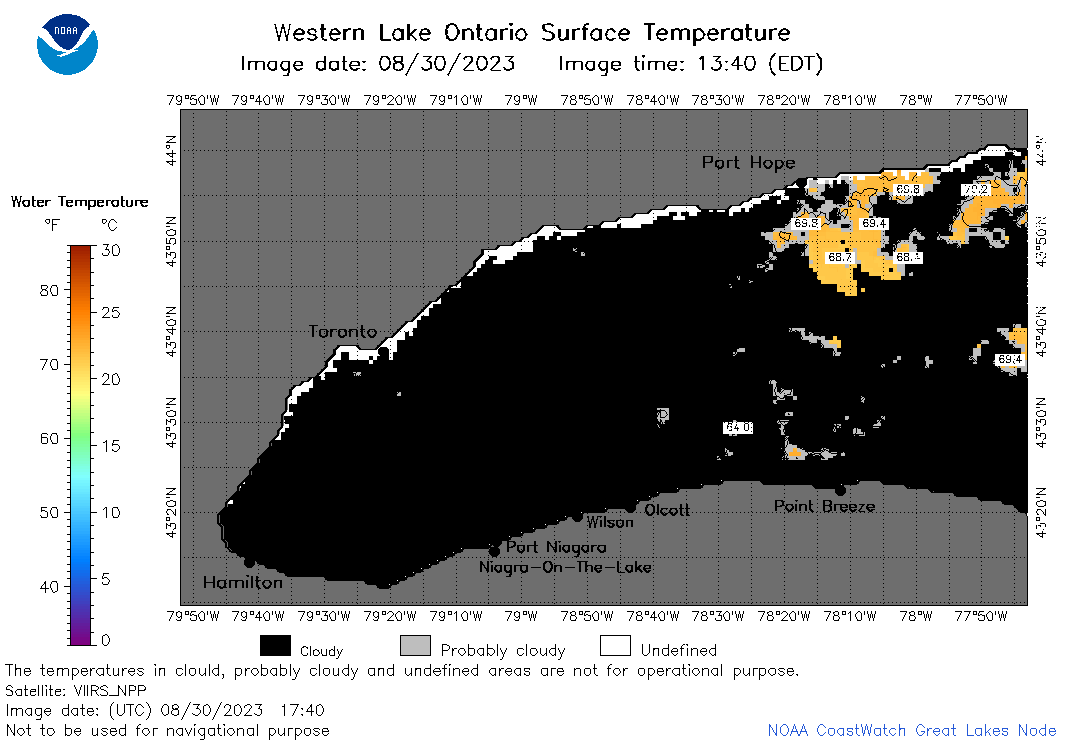 | o1_2023_08_30_1740.png | 30-Aug-2023 21:26 | 25095 | |
 | o1_2023_08_30_1830.png | 30-Aug-2023 22:26 | 28549 | |
 | o1_2023_08_30_1920.png | 30-Aug-2023 22:28 | 22806 | |
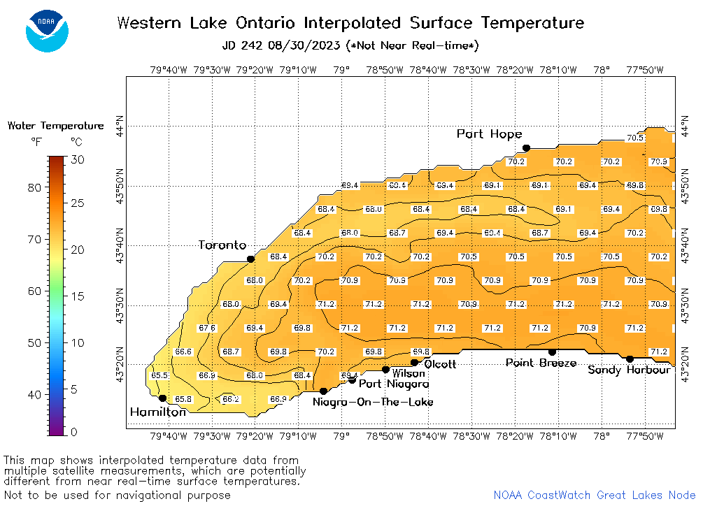 | o1_2023_242.png | 31-Aug-2023 09:17 | 29783 | |