
Easier access to scientific data

Brought to you by NOAA CoastWatch Great Lakes Node
|
ERDDAP
Easier access to scientific data |
|
Brought to you by NOAA CoastWatch Great Lakes Node |
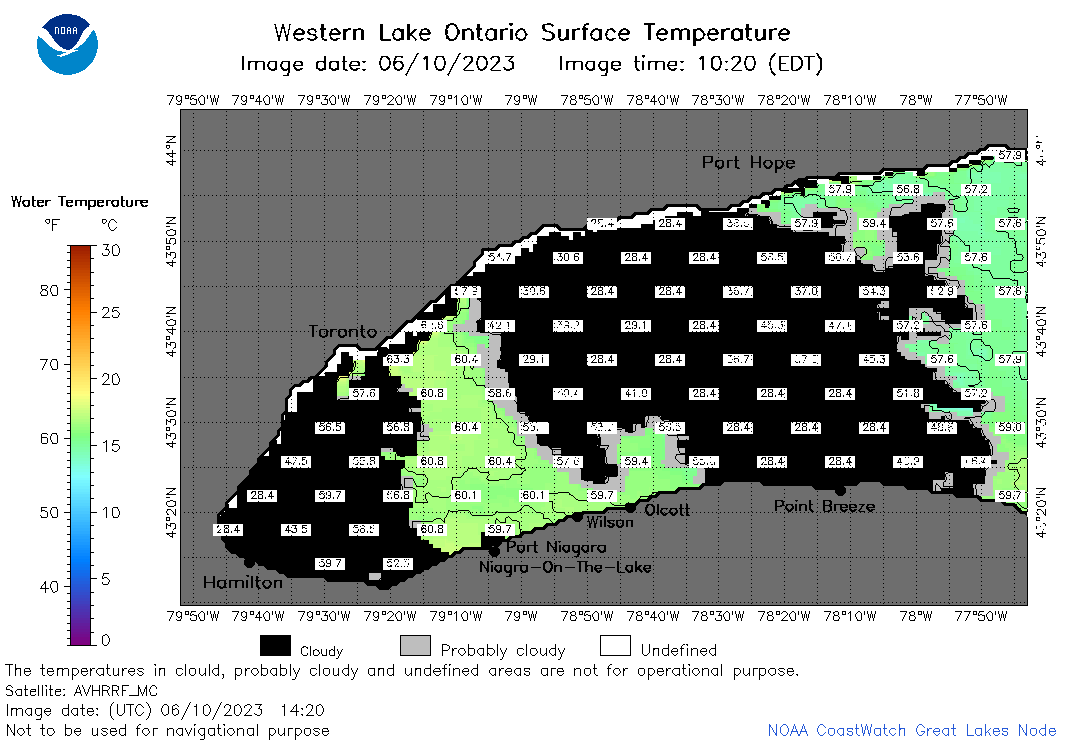
| Dataset Title: | Lake Ontario Wetern Region Surface Temperature Contour Map (2022-present)


|
| Institution: | CoastWatch Great Lakes Node (Dataset ID: LO_NRT_TC_o1) |
| Information: | Summary
| License
| Metadata
| Background | Subset
| Data Access Form
| Make a graph
| Subset
| Data Access Form
| Make a graph
|
![[ICO]](https://apps.glerl.noaa.gov/erddap/images/fileIcons/blank.gif) | Name | Last modified | Size | Description |
|---|---|---|---|---|
![[DIR]](https://apps.glerl.noaa.gov/erddap/images/fileIcons/back.gif) | Parent Directory | - | - | |
![[IMG]](https://apps.glerl.noaa.gov/erddap/images/fileIcons/image2.gif) 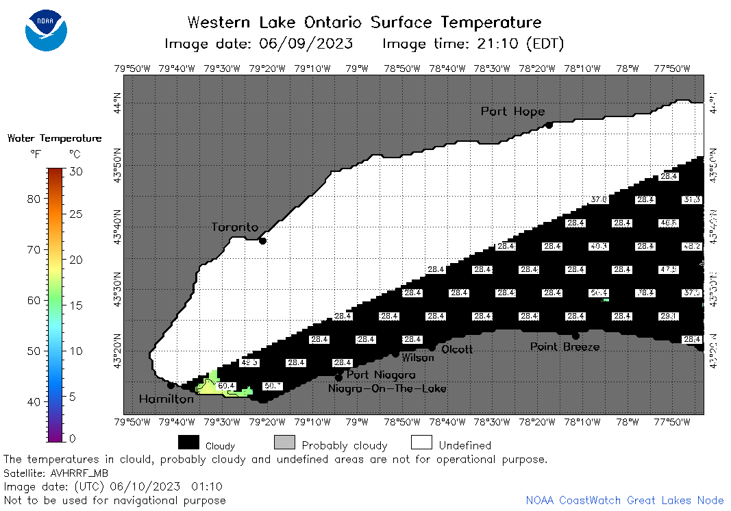 | o1_2023_06_10_0110.png | 10-Jun-2023 05:26 | 23798 | |
 | o1_2023_06_10_0120.png | 10-Jun-2023 05:28 | 24476 | |
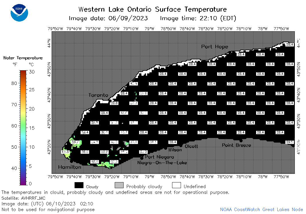 | o1_2023_06_10_0210.png | 10-Jun-2023 05:30 | 25110 | |
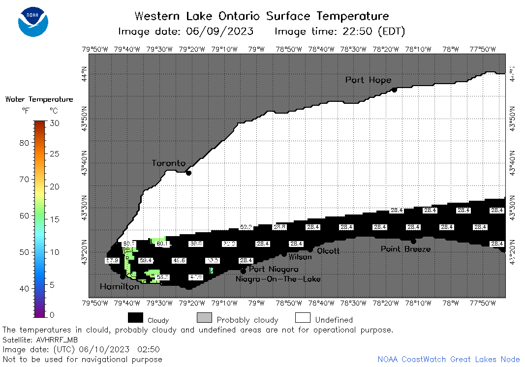 | o1_2023_06_10_0250.png | 10-Jun-2023 05:32 | 22950 | |
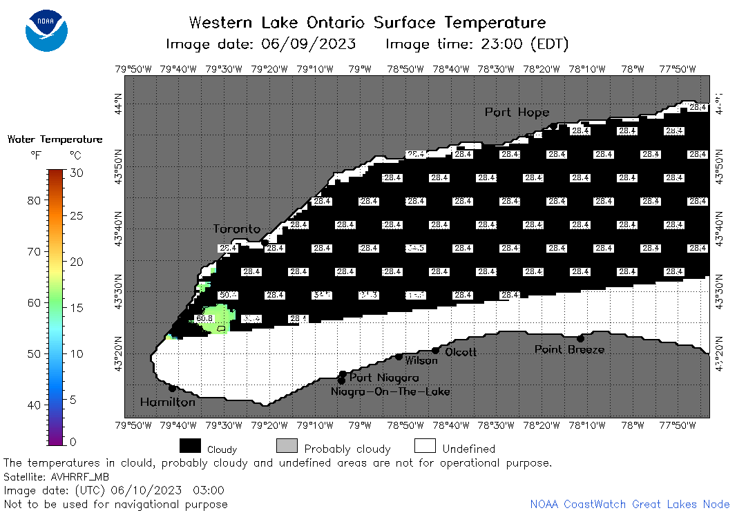 | o1_2023_06_10_0300.png | 10-Jun-2023 05:35 | 23812 | |
 | o1_2023_06_10_0630.png | 10-Jun-2023 10:26 | 28242 | |
 | o1_2023_06_10_0720.png | 10-Jun-2023 10:30 | 33840 | |
 | o1_2023_06_10_0810.png | 10-Jun-2023 12:26 | 39612 | |
 | o1_2023_06_10_1420.png | 10-Jun-2023 18:26 | 32931 | |
 | o1_2023_06_10_1510.png | 10-Jun-2023 18:28 | 40636 | |
 | o1_2023_06_10_1600.png | 10-Jun-2023 20:26 | 30148 | |
 | o1_2023_06_10_1710.png | 10-Jun-2023 19:26 | 28541 | |
 | o1_2023_06_10_1800.png | 10-Jun-2023 21:28 | 34048 | |
 | o1_2023_06_10_1850.png | 10-Jun-2023 21:31 | 28203 | |
 | o1_2023_161.png | 11-Jun-2023 09:17 | 30509 | |