
Easier access to scientific data

Brought to you by NOAA CoastWatch Great Lakes Node
|
ERDDAP
Easier access to scientific data |
|
Brought to you by NOAA CoastWatch Great Lakes Node |
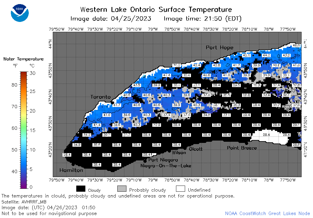
| Dataset Title: | Lake Ontario Wetern Region Surface Temperature Contour Map (2022-present)


|
| Institution: | CoastWatch Great Lakes Node (Dataset ID: LO_NRT_TC_o1) |
| Information: | Summary
| License
| Metadata
| Background | Subset
| Data Access Form
| Make a graph
| Subset
| Data Access Form
| Make a graph
|
![[ICO]](https://apps.glerl.noaa.gov/erddap/images/fileIcons/blank.gif) | Name | Last modified | Size | Description |
|---|---|---|---|---|
![[DIR]](https://apps.glerl.noaa.gov/erddap/images/fileIcons/back.gif) | Parent Directory | - | - | |
![[IMG]](https://apps.glerl.noaa.gov/erddap/images/fileIcons/image2.gif)  | o1_2023_04_26_0100.png | 26-Apr-2023 16:25 | 35192 | |
 | o1_2023_04_26_0150.png | 26-Apr-2023 16:28 | 43086 | |
 | o1_2023_04_26_0240.png | 26-Apr-2023 16:30 | 33527 | |
 | o1_2023_04_26_0630.png | 26-Apr-2023 16:34 | 32346 | |
 | o1_2023_04_26_0720.png | 26-Apr-2023 16:37 | 30019 | |
 | o1_2023_04_26_0810.png | 26-Apr-2023 16:39 | 28351 | |
 | o1_2023_04_26_1400.png | 26-Apr-2023 17:25 | 26051 | |
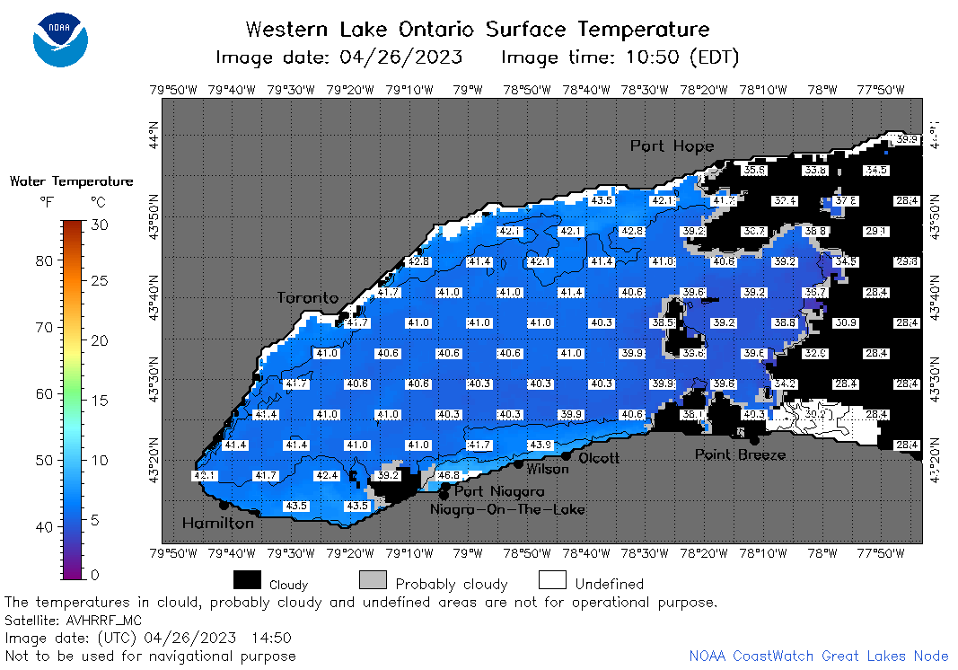 | o1_2023_04_26_1450.png | 26-Apr-2023 20:26 | 41014 | |
 | o1_2023_04_26_1540.png | 26-Apr-2023 18:26 | 45323 | |
 | o1_2023_04_26_1700.png | 26-Apr-2023 20:34 | 50953 | |
 | o1_2023_04_26_1840.png | 26-Apr-2023 21:28 | 39905 | |