
Easier access to scientific data

Brought to you by NOAA CoastWatch Great Lakes Node
|
ERDDAP
Easier access to scientific data |
|
Brought to you by NOAA CoastWatch Great Lakes Node |
| Dataset Title: | Lake Ontario Wetern Region Surface Temperature Contour Map (2022-present)


|
| Institution: | CoastWatch Great Lakes Node (Dataset ID: LO_NRT_TC_o1) |
| Information: | Summary
| License
| Metadata
| Background | Subset
| Data Access Form
| Make a graph
| Subset
| Data Access Form
| Make a graph
|
![[ICO]](https://apps.glerl.noaa.gov/erddap/images/fileIcons/blank.gif) | Name | Last modified | Size | Description |
|---|---|---|---|---|
![[DIR]](https://apps.glerl.noaa.gov/erddap/images/fileIcons/back.gif) | Parent Directory | - | - | |
![[IMG]](https://apps.glerl.noaa.gov/erddap/images/fileIcons/image2.gif)  | o1_2023_04_21_0100.png | 21-Apr-2023 05:25 | 25629 | |
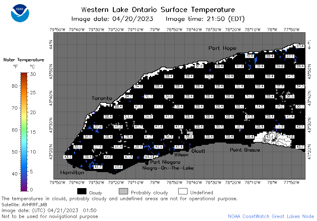 | o1_2023_04_21_0150.png | 21-Apr-2023 05:28 | 28752 | |
 | o1_2023_04_21_0240.png | 21-Apr-2023 05:30 | 24908 | |
 | o1_2023_04_21_0620.png | 21-Apr-2023 09:26 | 29117 | |
 | o1_2023_04_21_0710.png | 21-Apr-2023 11:26 | 32502 | |
 | o1_2023_04_21_0800.png | 21-Apr-2023 11:28 | 27956 | |
 | o1_2023_04_21_1410.png | 21-Apr-2023 17:27 | 23164 | |
 | o1_2023_04_21_1500.png | 21-Apr-2023 19:26 | 32383 | |
 | o1_2023_04_21_1550.png | 21-Apr-2023 18:28 | 29730 | |
 | o1_2023_04_21_1700.png | 21-Apr-2023 22:25 | 35544 | |
 | o1_2023_04_21_1750.png | 21-Apr-2023 20:32 | 37402 | |
 | o1_2023_04_21_1840.png | 21-Apr-2023 22:28 | 27600 | |
 | o1_2023_111.png | 22-Apr-2023 09:17 | 35513 | |