
Easier access to scientific data

Brought to you by NOAA CoastWatch Great Lakes Node
|
ERDDAP
Easier access to scientific data |
|
Brought to you by NOAA CoastWatch Great Lakes Node |
| Dataset Title: | Lake Ontario Wetern Region Surface Temperature Contour Map (2022-present)


|
| Institution: | CoastWatch Great Lakes Node (Dataset ID: LO_NRT_TC_o1) |
| Information: | Summary
| License
| Metadata
| Background | Subset
| Data Access Form
| Make a graph
| Subset
| Data Access Form
| Make a graph
|
![[ICO]](https://apps.glerl.noaa.gov/erddap/images/fileIcons/blank.gif) | Name | Last modified | Size | Description |
|---|---|---|---|---|
![[DIR]](https://apps.glerl.noaa.gov/erddap/images/fileIcons/back.gif) | Parent Directory | - | - | |
![[IMG]](https://apps.glerl.noaa.gov/erddap/images/fileIcons/image2.gif)  | o1_2023_04_12_0140.png | 12-Apr-2023 05:26 | 31132 | |
 | o1_2023_04_12_0230.png | 12-Apr-2023 05:28 | 23708 | |
 | o1_2023_04_12_0320.png | 12-Apr-2023 06:26 | 22675 | |
 | o1_2023_04_12_0640.png | 12-Apr-2023 10:26 | 23014 | |
 | o1_2023_04_12_0730.png | 12-Apr-2023 10:28 | 24168 | |
 | o1_2023_04_12_0820.png | 12-Apr-2023 12:26 | 22855 | |
 | o1_2023_04_12_1440.png | 12-Apr-2023 18:26 | 24011 | |
 | o1_2023_04_12_1530.png | 12-Apr-2023 18:31 | 24173 | |
 | o1_2023_04_12_1620.png | 12-Apr-2023 20:26 | 24495 | |
 | o1_2023_04_12_1710.png | 12-Apr-2023 20:32 | 25686 | |
 | o1_2023_04_12_1810.png | 12-Apr-2023 22:26 | 27235 | |
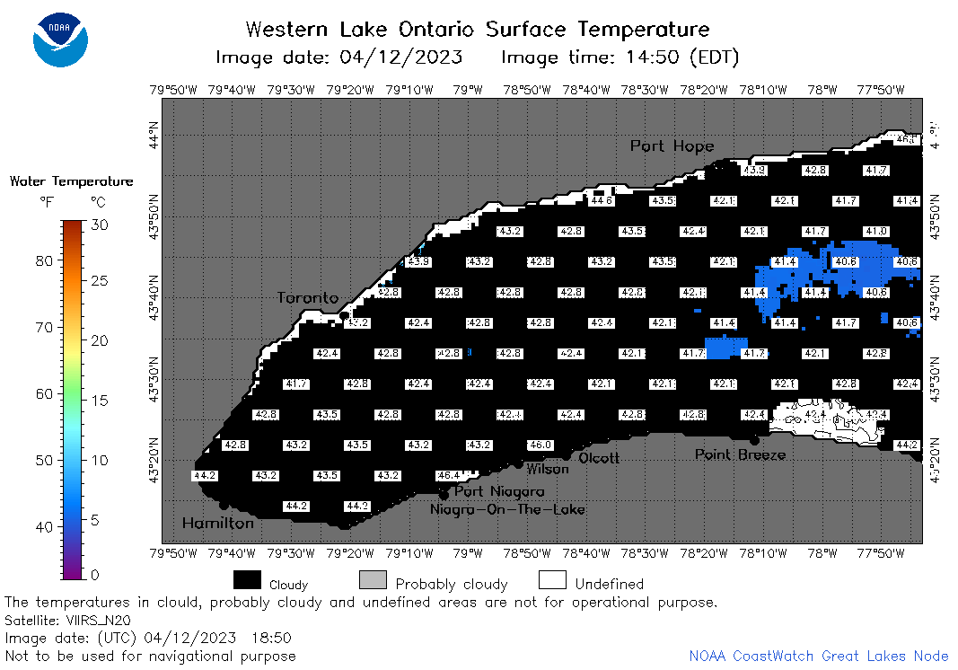 | o1_2023_04_12_1850.png | 12-Apr-2023 21:26 | 25540 | |
 | o1_2023_102.png | 13-Apr-2023 09:17 | 31856 | |