
Easier access to scientific data

Brought to you by NOAA CoastWatch Great Lakes Node
|
ERDDAP
Easier access to scientific data |
|
Brought to you by NOAA CoastWatch Great Lakes Node |
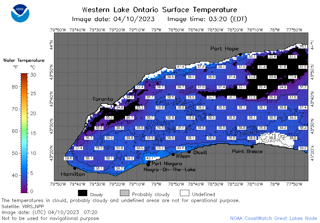
| Dataset Title: | Lake Ontario Wetern Region Surface Temperature Contour Map (2022-present)


|
| Institution: | CoastWatch Great Lakes Node (Dataset ID: LO_NRT_TC_o1) |
| Information: | Summary
| License
| Metadata
| Background | Subset
| Data Access Form
| Make a graph
| Subset
| Data Access Form
| Make a graph
|
![[ICO]](https://apps.glerl.noaa.gov/erddap/images/fileIcons/blank.gif) | Name | Last modified | Size | Description |
|---|---|---|---|---|
![[DIR]](https://apps.glerl.noaa.gov/erddap/images/fileIcons/back.gif) | Parent Directory | - | - | |
![[IMG]](https://apps.glerl.noaa.gov/erddap/images/fileIcons/image2.gif)  | o1_2023_04_10_0130.png | 10-Apr-2023 05:26 | 46385 | |
 | o1_2023_04_10_0220.png | 10-Apr-2023 05:28 | 59616 | |
 | o1_2023_04_10_0310.png | 10-Apr-2023 06:26 | 40462 | |
 | o1_2023_04_10_0630.png | 10-Apr-2023 10:26 | 46322 | |
 | o1_2023_04_10_0720.png | 10-Apr-2023 11:26 | 51228 | |
 | o1_2023_04_10_0810.png | 10-Apr-2023 11:28 | 52322 | |
 | o1_2023_04_10_1430.png | 10-Apr-2023 17:26 | 23982 | |
 | o1_2023_04_10_1530.png | 10-Apr-2023 19:28 | 24544 | |
 | o1_2023_04_10_1610.png | 10-Apr-2023 19:30 | 26816 | |
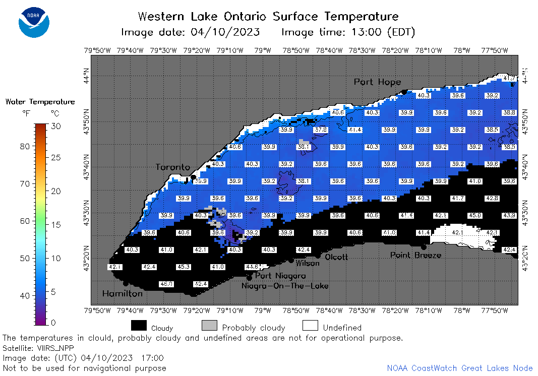 | o1_2023_04_10_1700.png | 10-Apr-2023 19:32 | 37522 | |
 | o1_2023_04_10_1750.png | 10-Apr-2023 20:26 | 32856 | |
 | o1_2023_04_10_1840.png | 10-Apr-2023 21:32 | 35700 | |
 | o1_2023_100.png | 11-Apr-2023 09:17 | 28152 | |