
Easier access to scientific data

Brought to you by NOAA CoastWatch Great Lakes Node
|
ERDDAP
Easier access to scientific data |
|
Brought to you by NOAA CoastWatch Great Lakes Node |
| Dataset Title: | Lake Ontario Wetern Region Surface Temperature Contour Map (2022-present)


|
| Institution: | CoastWatch Great Lakes Node (Dataset ID: LO_NRT_TC_o1) |
| Information: | Summary
| License
| Metadata
| Background | Subset
| Data Access Form
| Make a graph
| Subset
| Data Access Form
| Make a graph
|
![[ICO]](https://apps.glerl.noaa.gov/erddap/images/fileIcons/blank.gif) | Name | Last modified | Size | Description |
|---|---|---|---|---|
![[DIR]](https://apps.glerl.noaa.gov/erddap/images/fileIcons/back.gif) | Parent Directory | - | - | |
![[IMG]](https://apps.glerl.noaa.gov/erddap/images/fileIcons/image2.gif)  | o1_2023_044.png | 14-Feb-2023 10:17 | 28997 | |
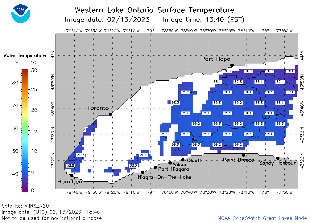 | o1_2023_02_13_1840.png | 13-Feb-2023 22:24 | 25159 | |
 | o1_2023_02_13_1750.png | 13-Feb-2023 20:27 | 26930 | |
 | o1_2023_02_13_1700.png | 13-Feb-2023 20:26 | 25297 | |
 | o1_2023_02_13_1620.png | 13-Feb-2023 20:24 | 23075 | |
 | o1_2023_02_13_1530.png | 13-Feb-2023 18:25 | 19651 | |
 | o1_2023_02_13_1440.png | 13-Feb-2023 18:24 | 20251 | |
 | o1_2023_02_13_0810.png | 13-Feb-2023 12:24 | 27760 | |
 | o1_2023_02_13_0720.png | 13-Feb-2023 10:25 | 27013 | |
 | o1_2023_02_13_0630.png | 13-Feb-2023 10:24 | 27110 | |
 | o1_2023_02_13_0320.png | 13-Feb-2023 06:26 | 26869 | |
 | o1_2023_02_13_0230.png | 13-Feb-2023 06:25 | 27895 | |
 | o1_2023_02_13_0140.png | 13-Feb-2023 06:24 | 28439 | |