
Easier access to scientific data

Brought to you by NOAA CoastWatch Great Lakes Node
|
ERDDAP
Easier access to scientific data |
|
Brought to you by NOAA CoastWatch Great Lakes Node |
| Dataset Title: | Lake Michigan Milwaukee Bay Surface Temperature Contour Map (2022-present)


|
| Institution: | CoastWatch Great Lakes Node (Dataset ID: LM_NRT_TC_m65) |
| Information: | Summary
| License
| Metadata
| Background | Subset
| Data Access Form
| Make a graph
| Subset
| Data Access Form
| Make a graph
|
![[ICO]](https://apps.glerl.noaa.gov/erddap/images/fileIcons/blank.gif) | Name | Last modified | Size | Description |
|---|---|---|---|---|
![[DIR]](https://apps.glerl.noaa.gov/erddap/images/fileIcons/back.gif) | Parent Directory | - | - | |
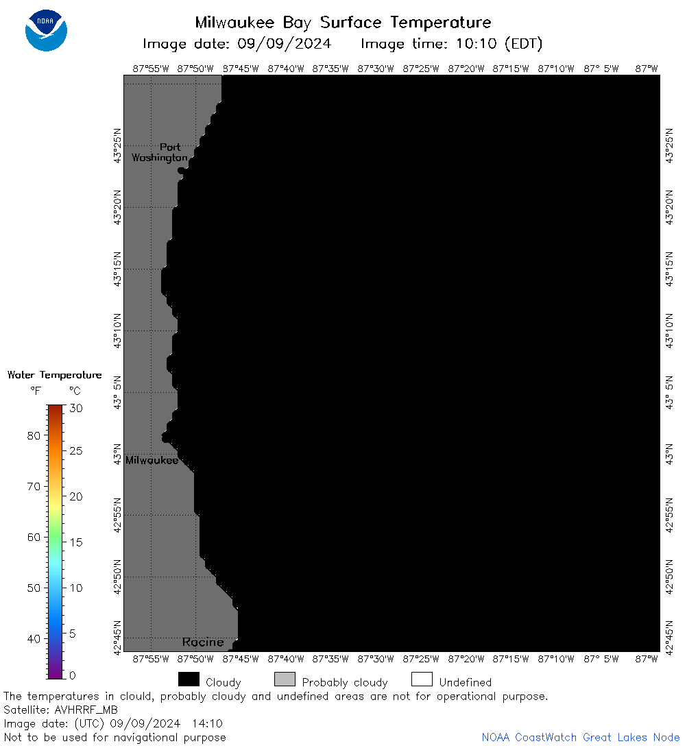
![[IMG]](https://apps.glerl.noaa.gov/erddap/images/fileIcons/image2.gif) 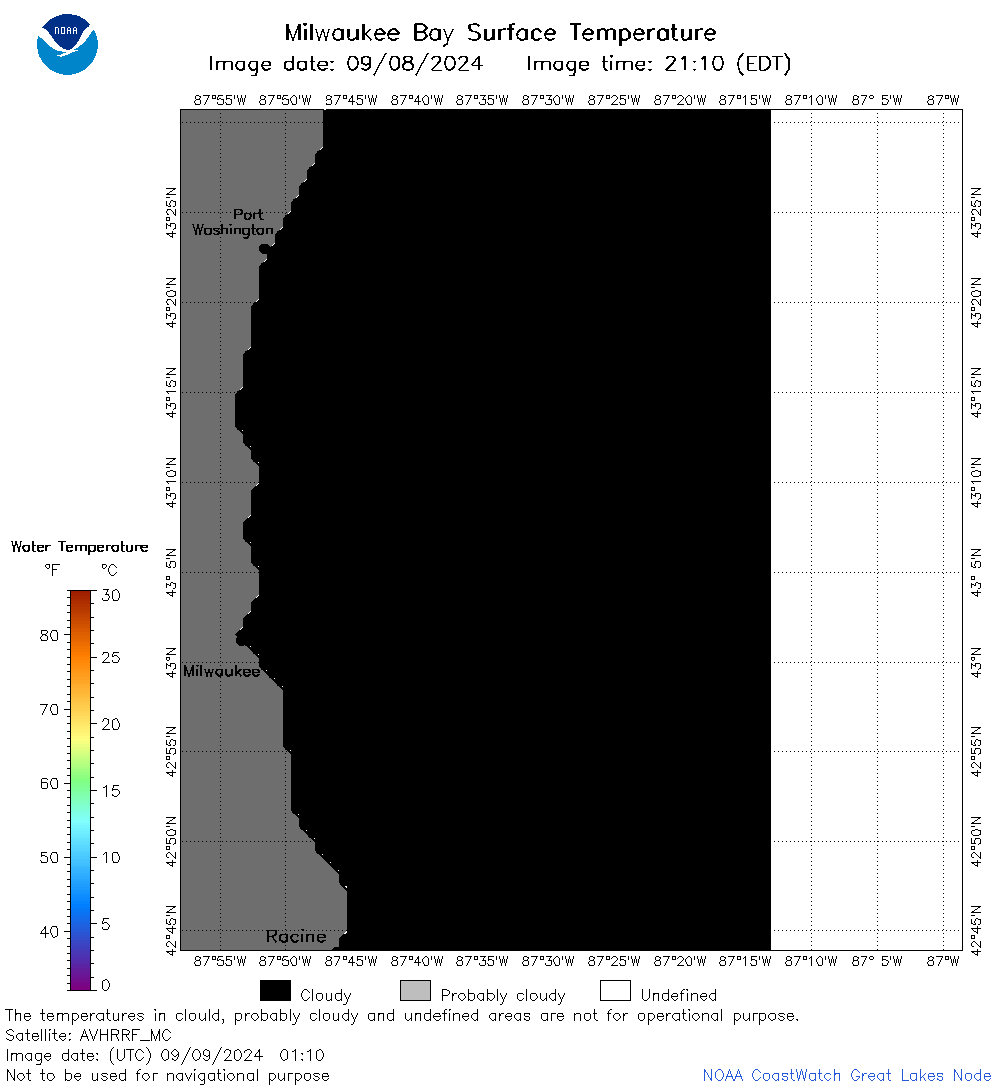 | m65_2024_09_09_0110.png | 09-Sep-2024 12:33 | 22491 | |
 | m65_2024_09_09_0200.png | 09-Sep-2024 12:36 | 21320 | |
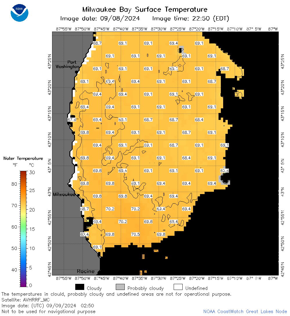 | m65_2024_09_09_0250.png | 09-Sep-2024 13:33 | 40823 | |
 | m65_2024_09_09_0300.png | 09-Sep-2024 13:36 | 20720 | |
 | m65_2024_09_09_0340.png | 09-Sep-2024 16:32 | 21236 | |
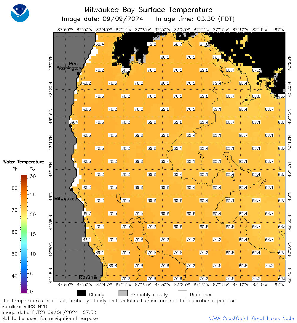 | m65_2024_09_09_0730.png | 10-Sep-2024 03:32 | 47508 | |
 | m65_2024_09_09_1410.png | 10-Sep-2024 00:33 | 20717 | |
 | m65_2024_09_09_1420.png | 10-Sep-2024 00:35 | 22497 | |
 | m65_2024_09_09_1550.png | 10-Sep-2024 01:33 | 20722 | |
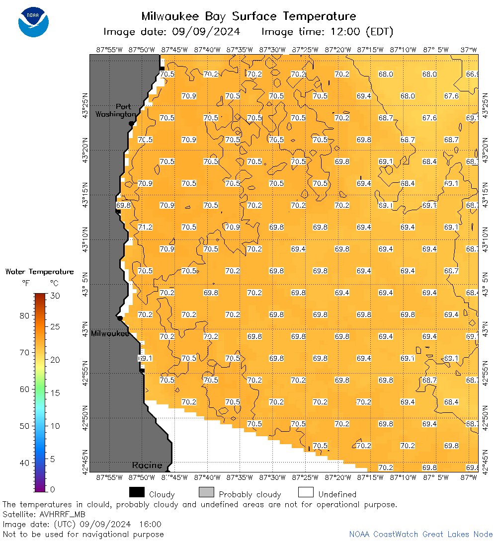 | m65_2024_09_09_1600.png | 10-Sep-2024 01:36 | 50196 | |
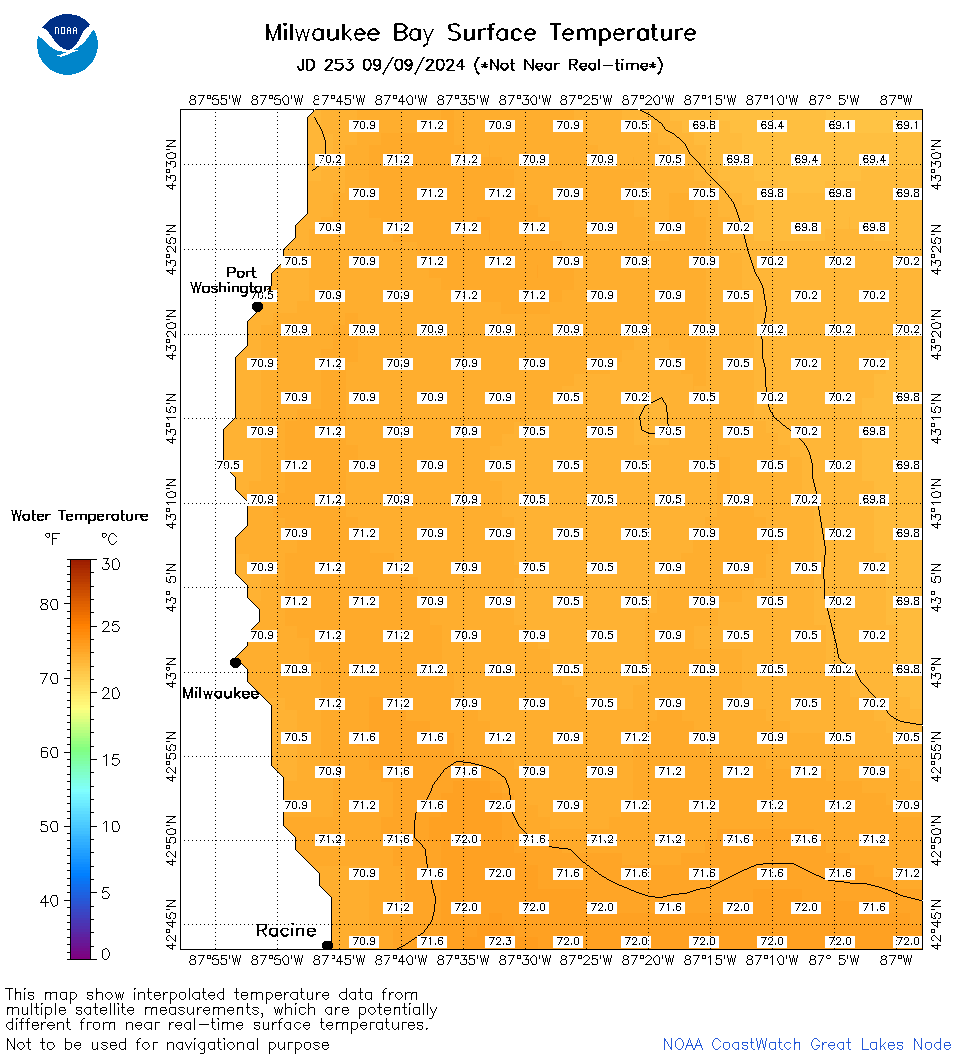 | m65_2024_253.png | 10-Sep-2024 09:26 | 37135 | |