
Easier access to scientific data

Brought to you by NOAA CoastWatch Great Lakes Node
|
ERDDAP
Easier access to scientific data |
|
Brought to you by NOAA CoastWatch Great Lakes Node |
| Dataset Title: | Lake Michigan Southern Region Surface Temperature Contour Map (2022-present)


|
| Institution: | CoastWatch Great Lakes Node (Dataset ID: LM_NRT_TC_m5) |
| Information: | Summary
| License
| Metadata
| Background | Subset
| Data Access Form
| Make a graph
| Subset
| Data Access Form
| Make a graph
|
![[ICO]](https://apps.glerl.noaa.gov/erddap/images/fileIcons/blank.gif) | Name | Last modified | Size | Description |
|---|---|---|---|---|
![[DIR]](https://apps.glerl.noaa.gov/erddap/images/fileIcons/back.gif) | Parent Directory | - | - | |
![[IMG]](https://apps.glerl.noaa.gov/erddap/images/fileIcons/image2.gif)  | m5_2024_09_30_0550.png | 30-Sep-2024 16:30 | 23369 | |
 | m5_2024_09_30_0640.png | 30-Sep-2024 16:31 | 23384 | |
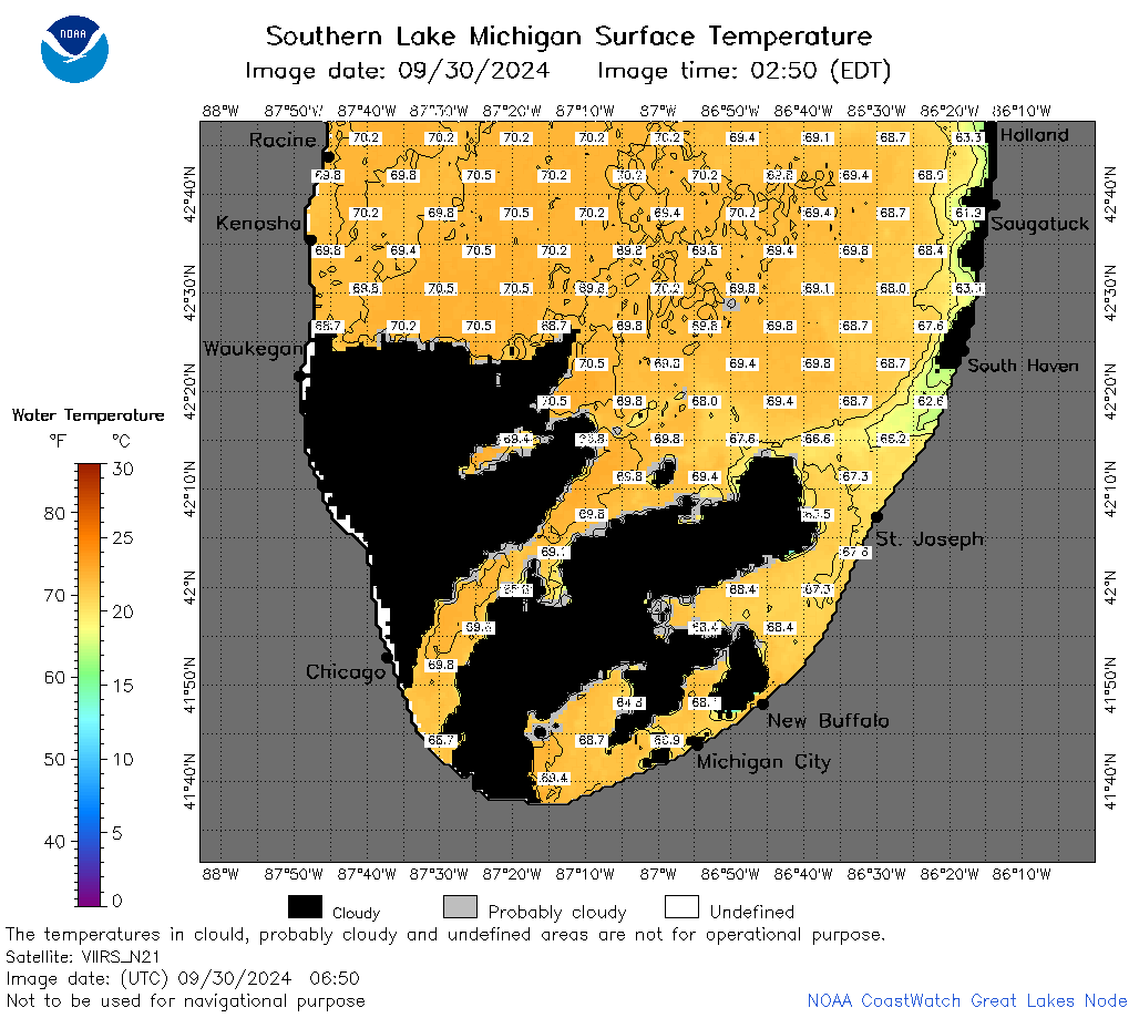 | m5_2024_09_30_0650.png | 30-Sep-2024 16:32 | 59120 | |
 | m5_2024_09_30_0710.png | 30-Sep-2024 16:33 | 58426 | |
 | m5_2024_09_30_0730.png | 30-Sep-2024 16:34 | 43194 | |
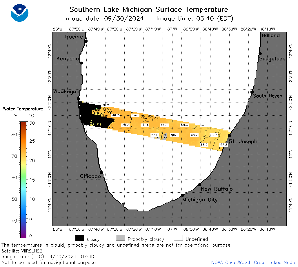 | m5_2024_09_30_0740.png | 30-Sep-2024 16:35 | 29939 | |
 | m5_2024_09_30_0830.png | 30-Sep-2024 16:36 | 58678 | |
 | m5_2024_274.png | 01-Oct-2024 09:10 | 34699 | |