
Easier access to scientific data

Brought to you by NOAA CoastWatch Great Lakes Node
|
ERDDAP
Easier access to scientific data |
|
Brought to you by NOAA CoastWatch Great Lakes Node |
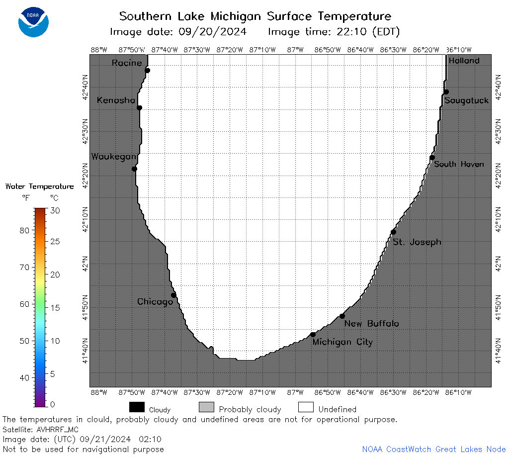
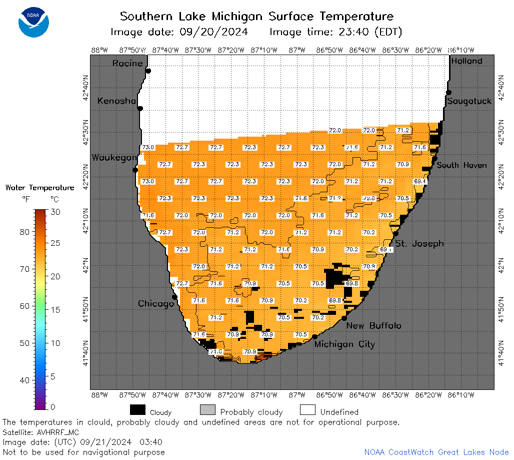
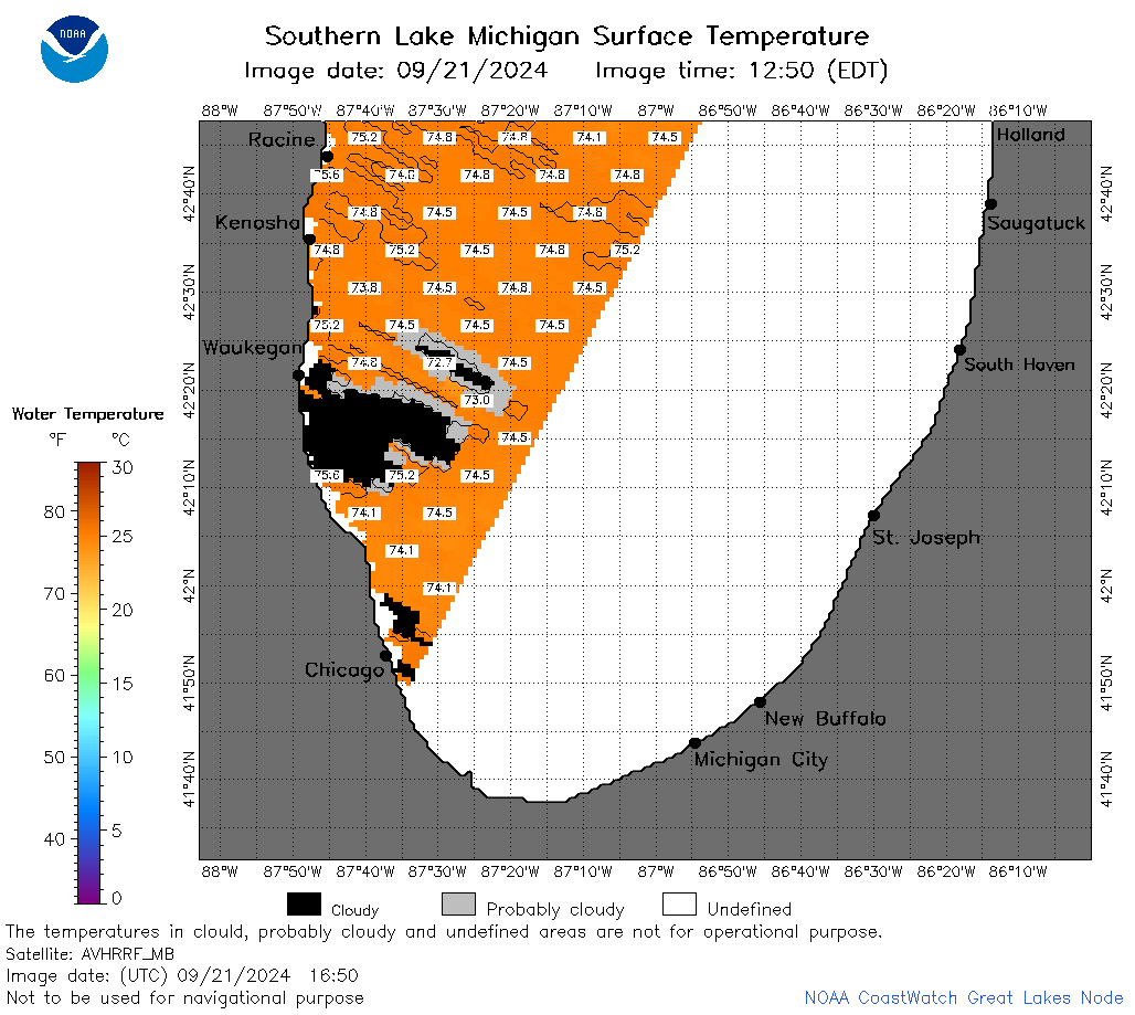
| Dataset Title: | Lake Michigan Southern Region Surface Temperature Contour Map (2022-present)


|
| Institution: | CoastWatch Great Lakes Node (Dataset ID: LM_NRT_TC_m5) |
| Information: | Summary
| License
| Metadata
| Background | Subset
| Data Access Form
| Make a graph
| Subset
| Data Access Form
| Make a graph
|
![[ICO]](https://apps.glerl.noaa.gov/erddap/images/fileIcons/blank.gif) | Name | Last modified | Size | Description |
|---|---|---|---|---|
![[DIR]](https://apps.glerl.noaa.gov/erddap/images/fileIcons/back.gif) | Parent Directory | - | - | |
![[IMG]](https://apps.glerl.noaa.gov/erddap/images/fileIcons/image2.gif)  | m5_2024_09_21_0110.png | 21-Sep-2024 11:30 | 26277 | |
 | m5_2024_09_21_0200.png | 21-Sep-2024 13:30 | 49650 | |
 | m5_2024_09_21_0210.png | 21-Sep-2024 13:31 | 25008 | |
 | m5_2024_09_21_0250.png | 21-Sep-2024 16:30 | 55107 | |
 | m5_2024_09_21_0340.png | 21-Sep-2024 16:31 | 38799 | |
 | m5_2024_09_21_0350.png | 21-Sep-2024 16:32 | 30188 | |
 | m5_2024_09_21_1420.png | 22-Sep-2024 00:30 | 26287 | |
 | m5_2024_09_21_1510.png | 22-Sep-2024 00:31 | 44722 | |
 | m5_2024_09_21_1600.png | 22-Sep-2024 02:30 | 25016 | |
 | m5_2024_09_21_1650.png | 22-Sep-2024 02:31 | 35200 | |
 | m5_2024_265.png | 22-Sep-2024 09:10 | 31352 | |