
Easier access to scientific data

Brought to you by NOAA CoastWatch Great Lakes Node
|
ERDDAP
Easier access to scientific data |
|
Brought to you by NOAA CoastWatch Great Lakes Node |
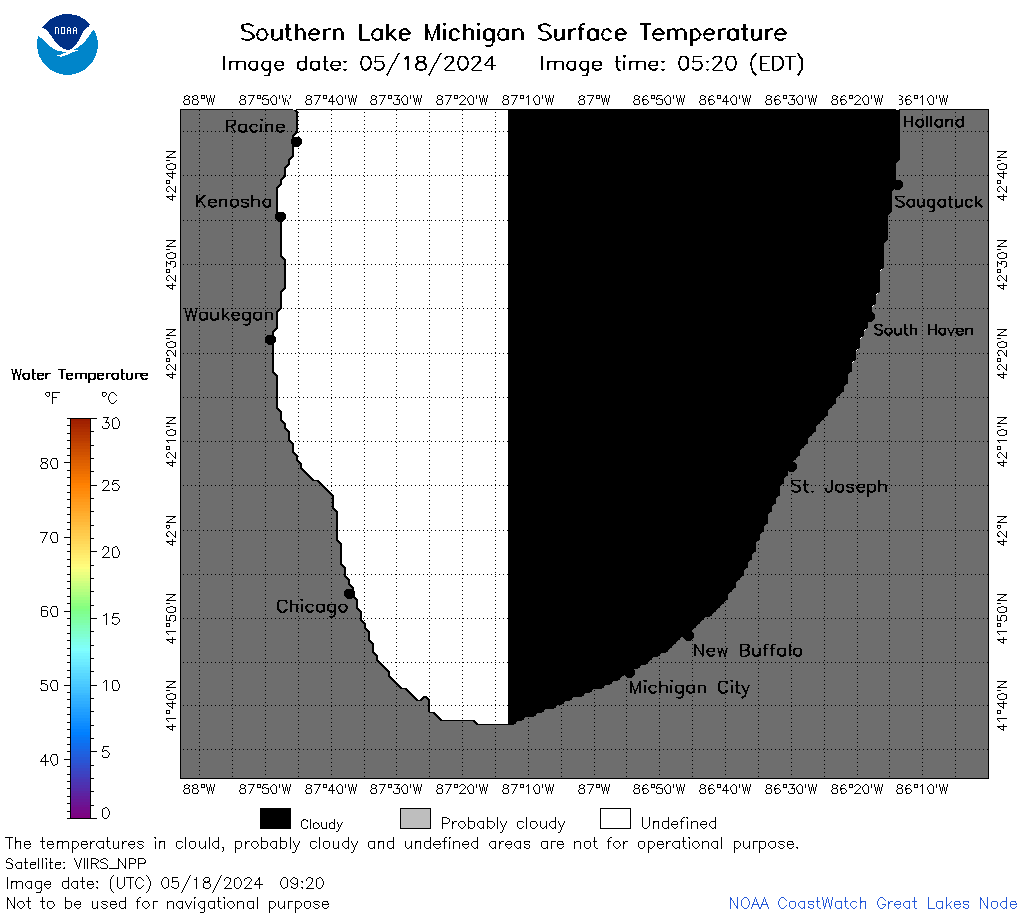
| Dataset Title: | Lake Michigan Southern Region Surface Temperature Contour Map (2022-present)


|
| Institution: | CoastWatch Great Lakes Node (Dataset ID: LM_NRT_TC_m5) |
| Information: | Summary
| License
| Metadata
| Background | Subset
| Data Access Form
| Make a graph
| Subset
| Data Access Form
| Make a graph
|
![[ICO]](https://apps.glerl.noaa.gov/erddap/images/fileIcons/blank.gif) | Name | Last modified | Size | Description |
|---|---|---|---|---|
![[DIR]](https://apps.glerl.noaa.gov/erddap/images/fileIcons/back.gif) | Parent Directory | - | - | |
![[IMG]](https://apps.glerl.noaa.gov/erddap/images/fileIcons/image2.gif)  | m5_2024_05_18_0120.png | 18-May-2024 05:24 | 26639 | |
 | m5_2024_05_18_0210.png | 18-May-2024 05:25 | 23674 | |
 | m5_2024_05_18_0300.png | 18-May-2024 05:26 | 23786 | |
 | m5_2024_05_18_0350.png | 18-May-2024 09:24 | 25578 | |
 | m5_2024_05_18_0600.png | 18-May-2024 09:25 | 23357 | |
 | m5_2024_05_18_0630.png | 18-May-2024 09:26 | 35865 | |
 | m5_2024_05_18_0740.png | 18-May-2024 12:24 | 49407 | |
 | m5_2024_05_18_0810.png | 18-May-2024 11:24 | 35339 | |
 | m5_2024_05_18_0920.png | 18-May-2024 16:24 | 25328 | |
 | m5_2024_05_18_1420.png | 18-May-2024 18:24 | 23346 | |
 | m5_2024_05_18_1430.png | 18-May-2024 18:25 | 26272 | |
 | m5_2024_05_18_1510.png | 18-May-2024 18:26 | 23738 | |
 | m5_2024_05_18_1600.png | 18-May-2024 20:24 | 23358 | |
 | m5_2024_05_18_1610.png | 18-May-2024 20:25 | 24151 | |
 | m5_2024_05_18_1650.png | 18-May-2024 20:26 | 25737 | |
 | m5_2024_05_18_1730.png | 18-May-2024 20:27 | 24113 | |
 | m5_2024_05_18_1750.png | 18-May-2024 20:28 | 24949 | |