
Easier access to scientific data

Brought to you by NOAA CoastWatch Great Lakes Node
|
ERDDAP
Easier access to scientific data |
|
Brought to you by NOAA CoastWatch Great Lakes Node |
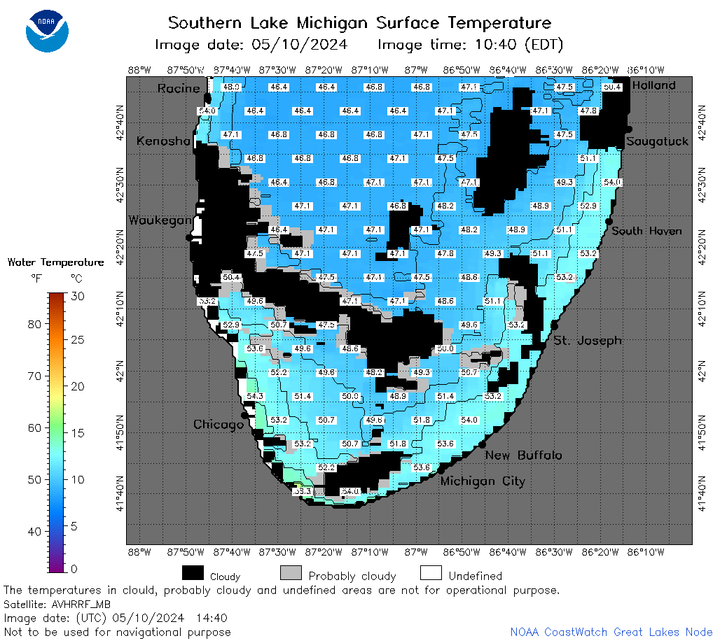
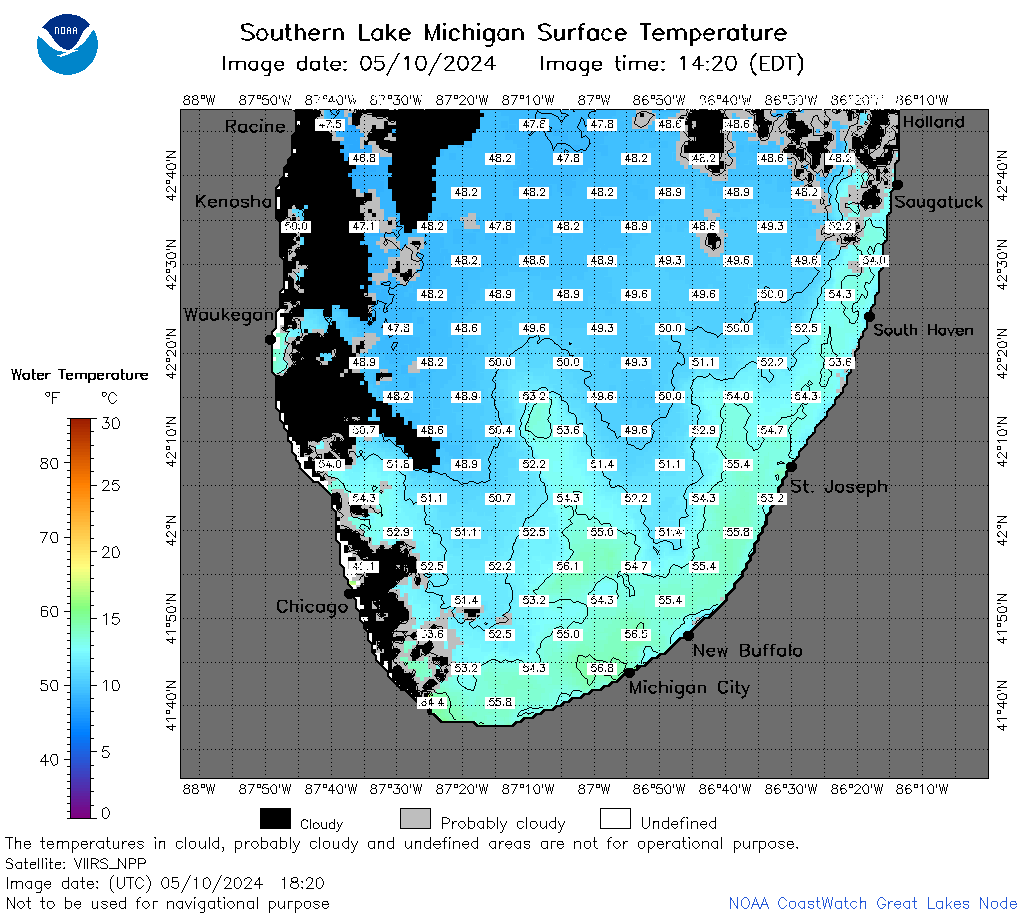
| Dataset Title: | Lake Michigan Southern Region Surface Temperature Contour Map (2022-present)


|
| Institution: | CoastWatch Great Lakes Node (Dataset ID: LM_NRT_TC_m5) |
| Information: | Summary
| License
| Metadata
| Background | Subset
| Data Access Form
| Make a graph
| Subset
| Data Access Form
| Make a graph
|
![[ICO]](https://apps.glerl.noaa.gov/erddap/images/fileIcons/blank.gif) | Name | Last modified | Size | Description |
|---|---|---|---|---|
![[DIR]](https://apps.glerl.noaa.gov/erddap/images/fileIcons/back.gif) | Parent Directory | - | - | |
![[IMG]](https://apps.glerl.noaa.gov/erddap/images/fileIcons/image2.gif)  | m5_2024_05_10_0130.png | 10-May-2024 05:24 | 26292 | |
 | m5_2024_05_10_0140.png | 10-May-2024 05:25 | 34057 | |
 | m5_2024_05_10_0220.png | 10-May-2024 05:26 | 33553 | |
 | m5_2024_05_10_0230.png | 10-May-2024 05:27 | 23379 | |
 | m5_2024_05_10_0320.png | 10-May-2024 06:24 | 36465 | |
 | m5_2024_05_10_0650.png | 10-May-2024 13:24 | 31328 | |
 | m5_2024_05_10_0720.png | 10-May-2024 13:25 | 38934 | |
 | m5_2024_05_10_0830.png | 10-May-2024 13:26 | 58656 | |
 | m5_2024_05_10_0900.png | 10-May-2024 13:27 | 38494 | |
 | m5_2024_05_10_1440.png | 10-May-2024 18:24 | 47341 | |
 | m5_2024_05_10_1530.png | 10-May-2024 19:24 | 57779 | |
 | m5_2024_05_10_1620.png | 10-May-2024 20:24 | 59957 | |
 | m5_2024_05_10_1700.png | 10-May-2024 19:25 | 26266 | |
 | m5_2024_05_10_1710.png | 10-May-2024 21:24 | 25335 | |
 | m5_2024_05_10_1820.png | 10-May-2024 22:24 | 57939 | |
 | m5_2024_05_10_1840.png | 10-May-2024 21:25 | 55704 | |
 | m5_2024_131.png | 11-May-2024 09:10 | 41587 | |