
Easier access to scientific data

Brought to you by NOAA CoastWatch Great Lakes Node
|
ERDDAP
Easier access to scientific data |
|
Brought to you by NOAA CoastWatch Great Lakes Node |
| Dataset Title: | Lake Michigan Southern Region Surface Temperature Contour Map (2022-present)


|
| Institution: | CoastWatch Great Lakes Node (Dataset ID: LM_NRT_TC_m5) |
| Information: | Summary
| License
| Metadata
| Background | Subset
| Data Access Form
| Make a graph
| Subset
| Data Access Form
| Make a graph
|
![[ICO]](https://apps.glerl.noaa.gov/erddap/images/fileIcons/blank.gif) | Name | Last modified | Size | Description |
|---|---|---|---|---|
![[DIR]](https://apps.glerl.noaa.gov/erddap/images/fileIcons/back.gif) | Parent Directory | - | - | |
![[IMG]](https://apps.glerl.noaa.gov/erddap/images/fileIcons/image2.gif)  | m5_2024_04_25_0100.png | 25-Apr-2024 06:24 | 23368 | |
 | m5_2024_04_25_0140.png | 25-Apr-2024 06:25 | 23390 | |
 | m5_2024_04_25_0150.png | 25-Apr-2024 06:26 | 57249 | |
 | m5_2024_04_25_0230.png | 25-Apr-2024 06:27 | 77635 | |
 | m5_2024_04_25_0240.png | 25-Apr-2024 06:28 | 23395 | |
 | m5_2024_04_25_0330.png | 25-Apr-2024 06:29 | 58248 | |
 | m5_2024_04_25_0630.png | 25-Apr-2024 10:24 | 67695 | |
 | m5_2024_04_25_0700.png | 25-Apr-2024 10:25 | 63189 | |
 | m5_2024_04_25_0810.png | 25-Apr-2024 12:24 | 47172 | |
 | m5_2024_04_25_0820.png | 25-Apr-2024 12:25 | 41878 | |
 | m5_2024_04_25_0840.png | 25-Apr-2024 12:26 | 47518 | |
 | m5_2024_04_25_1400.png | 25-Apr-2024 19:24 | 23353 | |
 | m5_2024_04_25_1450.png | 25-Apr-2024 21:24 | 52516 | |
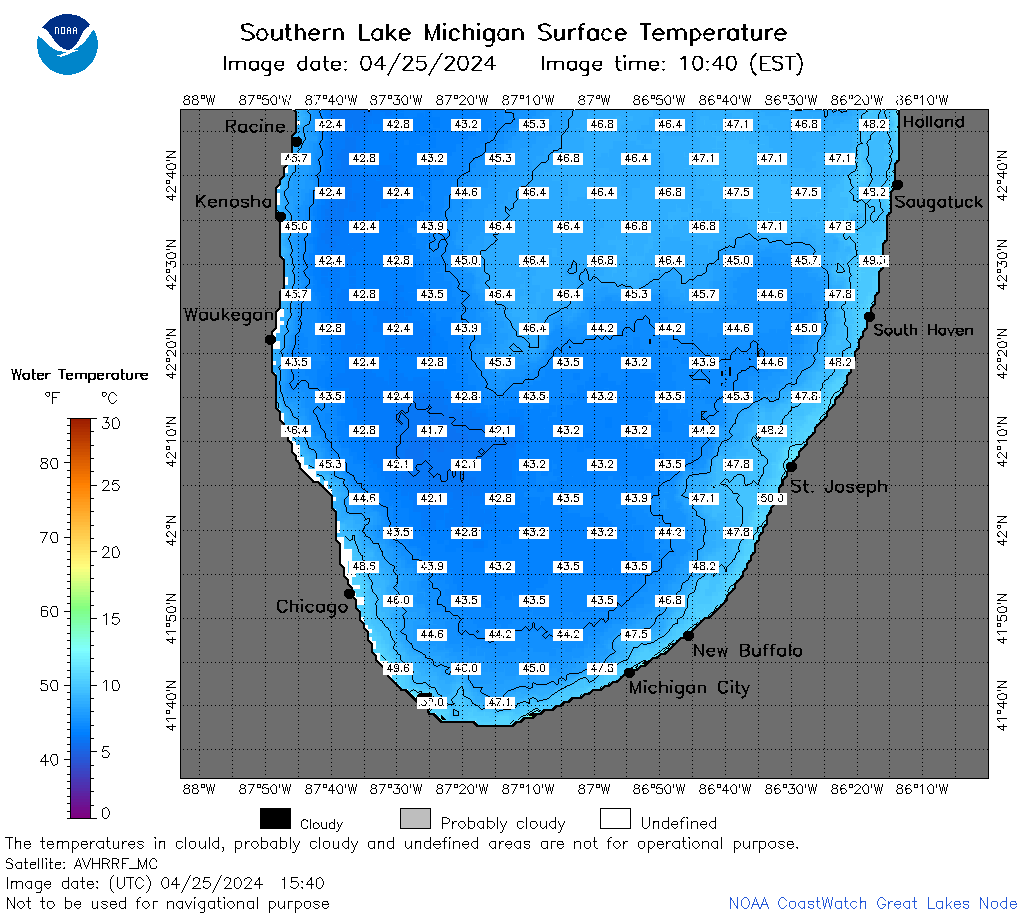 | m5_2024_04_25_1540.png | 25-Apr-2024 19:25 | 55765 | |
 | m5_2024_04_25_1630.png | 25-Apr-2024 19:26 | 57936 | |