
Easier access to scientific data

Brought to you by NOAA CoastWatch Great Lakes Node
|
ERDDAP
Easier access to scientific data |
|
Brought to you by NOAA CoastWatch Great Lakes Node |
| Dataset Title: | Lake Michigan Central Southern Region Surface Temperature Contour Map (2022- present) 

|
| Institution: | CoastWatch Great Lakes Node (Dataset ID: LM_NRT_TC_m4) |
| Information: | Summary
| License
| Metadata
| Background | Subset
| Data Access Form
| Make a graph
| Subset
| Data Access Form
| Make a graph
|
![[ICO]](https://apps.glerl.noaa.gov/erddap/images/fileIcons/blank.gif) | Name | Last modified | Size | Description |
|---|---|---|---|---|
![[DIR]](https://apps.glerl.noaa.gov/erddap/images/fileIcons/back.gif) | Parent Directory | - | - | |
![[IMG]](https://apps.glerl.noaa.gov/erddap/images/fileIcons/image2.gif)  | m4_2024_08_10_0130.png | 10-Aug-2024 12:30 | 50653 | |
 | m4_2024_08_10_0220.png | 10-Aug-2024 13:30 | 54632 | |
 | m4_2024_08_10_0310.png | 10-Aug-2024 16:30 | 47838 | |
 | m4_2024_08_10_0320.png | 10-Aug-2024 16:31 | 21978 | |
 | m4_2024_08_10_0400.png | 10-Aug-2024 16:32 | 24067 | |
 | m4_2024_08_10_0600.png | 10-Aug-2024 16:33 | 21966 | |
 | m4_2024_08_10_0630.png | 10-Aug-2024 16:34 | 53040 | |
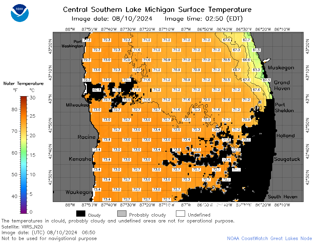 | m4_2024_08_10_0650.png | 10-Aug-2024 16:35 | 57395 | |
 | m4_2024_08_10_0920.png | 10-Aug-2024 16:36 | 21957 | |
 | m4_2024_08_10_1350.png | 10-Aug-2024 23:30 | 21980 | |
 | m4_2024_08_10_1430.png | 11-Aug-2024 00:30 | 21983 | |
 | m4_2024_08_10_1440.png | 11-Aug-2024 00:31 | 46685 | |
 | m4_2024_08_10_1530.png | 11-Aug-2024 01:30 | 52874 | |
 | m4_2024_08_10_1610.png | 11-Aug-2024 02:30 | 21962 | |
 | m4_2024_08_10_1620.png | 11-Aug-2024 02:31 | 50779 | |
 | m4_2024_08_10_1710.png | 11-Aug-2024 03:30 | 24037 | |
 | m4_2024_223.png | 11-Aug-2024 09:10 | 37925 | |