
Easier access to scientific data

Brought to you by NOAA CoastWatch Great Lakes Node
|
ERDDAP
Easier access to scientific data |
|
Brought to you by NOAA CoastWatch Great Lakes Node |
| Dataset Title: | Lake Michigan Central Southern Region Surface Temperature Contour Map (2022- present) 

|
| Institution: | CoastWatch Great Lakes Node (Dataset ID: LM_NRT_TC_m4) |
| Information: | Summary
| License
| Metadata
| Background | Subset
| Data Access Form
| Make a graph
| Subset
| Data Access Form
| Make a graph
|
![[ICO]](https://apps.glerl.noaa.gov/erddap/images/fileIcons/blank.gif) | Name | Last modified | Size | Description |
|---|---|---|---|---|
![[DIR]](https://apps.glerl.noaa.gov/erddap/images/fileIcons/back.gif) | Parent Directory | - | - | |
![[IMG]](https://apps.glerl.noaa.gov/erddap/images/fileIcons/image2.gif)  | m4_2024_05_02_0100.png | 02-May-2024 06:24 | 21979 | |
 | m4_2024_05_02_0150.png | 02-May-2024 06:25 | 30930 | |
 | m4_2024_05_02_0240.png | 02-May-2024 06:26 | 34973 | |
 | m4_2024_05_02_0330.png | 02-May-2024 06:27 | 31392 | |
 | m4_2024_05_02_0600.png | 02-May-2024 20:24 | 21944 | |
 | m4_2024_05_02_0630.png | 02-May-2024 20:25 | 46355 | |
 | m4_2024_05_02_1400.png | 02-May-2024 18:24 | 21944 | |
 | m4_2024_05_02_1410.png | 02-May-2024 18:25 | 21944 | |
 | m4_2024_05_02_1500.png | 02-May-2024 19:24 | 26943 | |
 | m4_2024_05_02_1540.png | 02-May-2024 19:25 | 24953 | |
 | m4_2024_05_02_1550.png | 02-May-2024 19:26 | 27537 | |
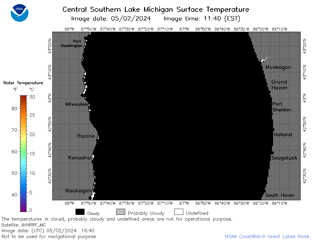 | m4_2024_05_02_1640.png | 02-May-2024 20:26 | 22295 | |
 | m4_2024_05_02_1720.png | 02-May-2024 20:27 | 21948 | |