
Easier access to scientific data

Brought to you by NOAA CoastWatch Great Lakes Node
|
ERDDAP
Easier access to scientific data |
|
Brought to you by NOAA CoastWatch Great Lakes Node |
| Dataset Title: | Lake Michigan Central Southern Region Surface Temperature Contour Map (2022- present) 

|
| Institution: | CoastWatch Great Lakes Node (Dataset ID: LM_NRT_TC_m4) |
| Information: | Summary
| License
| Metadata
| Background | Subset
| Data Access Form
| Make a graph
| Subset
| Data Access Form
| Make a graph
|
![[ICO]](https://apps.glerl.noaa.gov/erddap/images/fileIcons/blank.gif) | Name | Last modified | Size | Description |
|---|---|---|---|---|
![[DIR]](https://apps.glerl.noaa.gov/erddap/images/fileIcons/back.gif) | Parent Directory | - | - | |
![[IMG]](https://apps.glerl.noaa.gov/erddap/images/fileIcons/image2.gif)  | m4_2024_02_04_0120.png | 04-Feb-2024 06:26 | 24953 | |
 | m4_2024_02_04_0210.png | 04-Feb-2024 06:28 | 68633 | |
 | m4_2024_02_04_0300.png | 04-Feb-2024 06:30 | 65810 | |
 | m4_2024_02_04_0350.png | 04-Feb-2024 06:32 | 28659 | |
 | m4_2024_02_04_0650.png | 04-Feb-2024 11:26 | 61801 | |
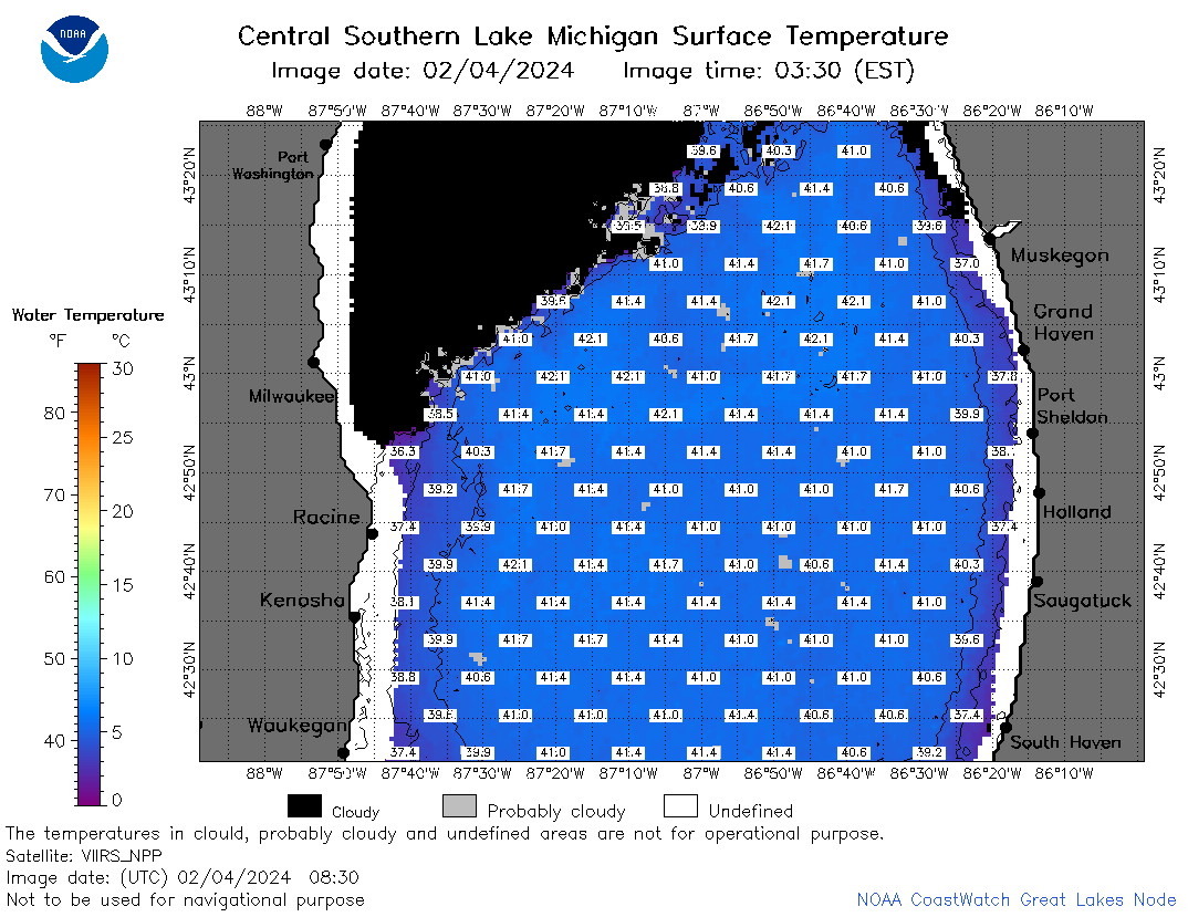 | m4_2024_02_04_0830.png | 04-Feb-2024 13:26 | 62743 | |
 | m4_2024_02_04_1420.png | 04-Feb-2024 19:26 | 24944 | |
 | m4_2024_02_04_1430.png | 04-Feb-2024 19:28 | 24945 | |
 | m4_2024_02_04_1520.png | 04-Feb-2024 19:30 | 48631 | |
 | m4_2024_02_04_1600.png | 04-Feb-2024 19:32 | 21972 | |
 | m4_2024_02_04_1610.png | 04-Feb-2024 19:35 | 52093 | |
 | m4_2024_02_04_1700.png | 04-Feb-2024 21:26 | 41288 | |
 | m4_2024_02_04_1820.png | 04-Feb-2024 21:28 | 49359 | |